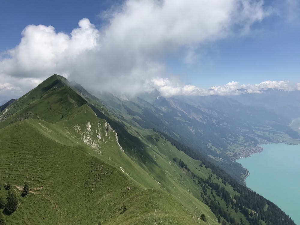
The Hardergrat
Sörenberg
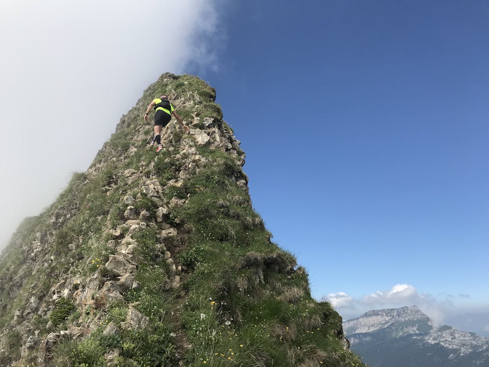
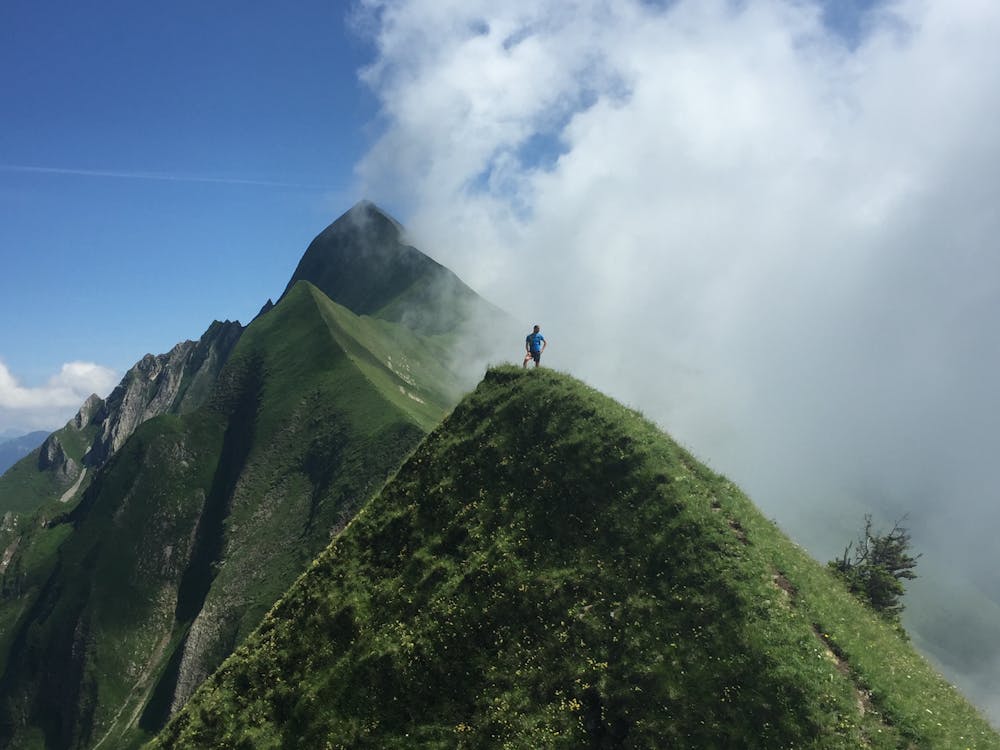
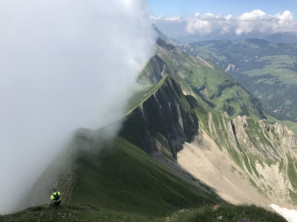
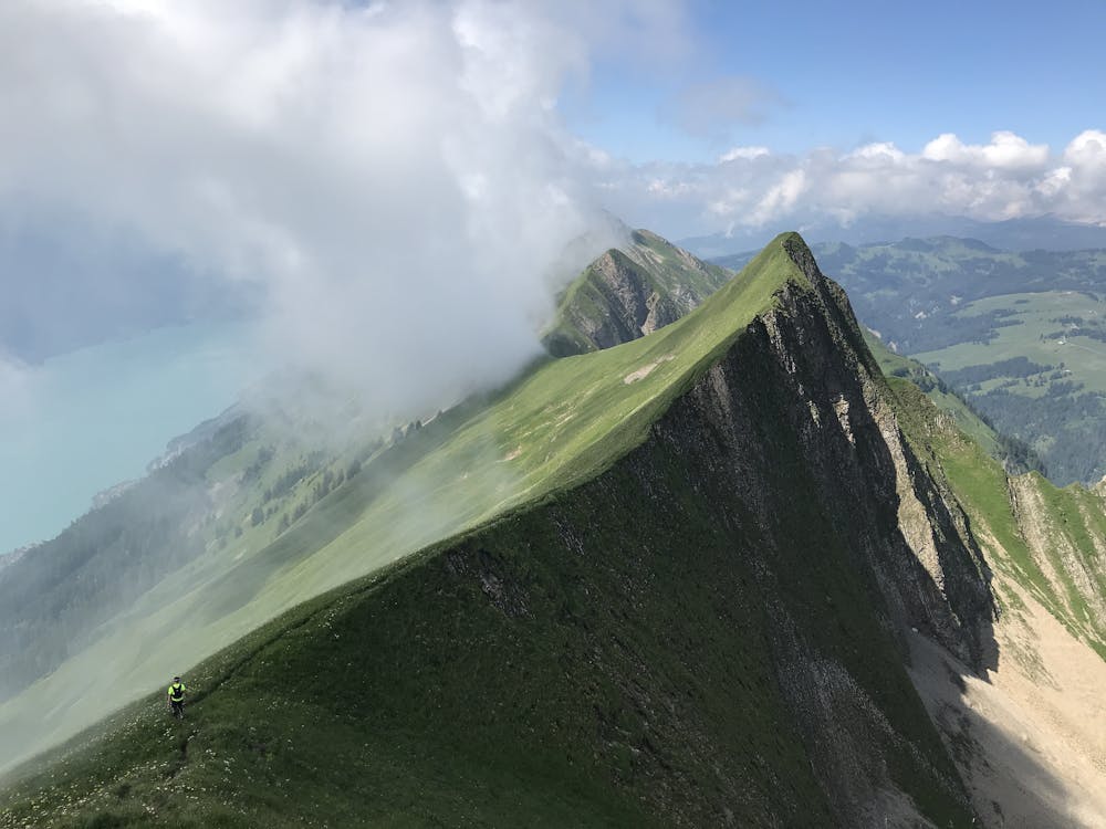
Stunning and very technical trail run along a beautiful and remarkably exposed ridge.
Trail Running Severe
- Distance
- 20 km
- Ascent
- 1.1 km
- Descent
- 2.1 km
- Duration
- 3-4 hrs
- Low Point
- 1.3 km
- High Point
- 2.3 km
- Gradient
- 18˚

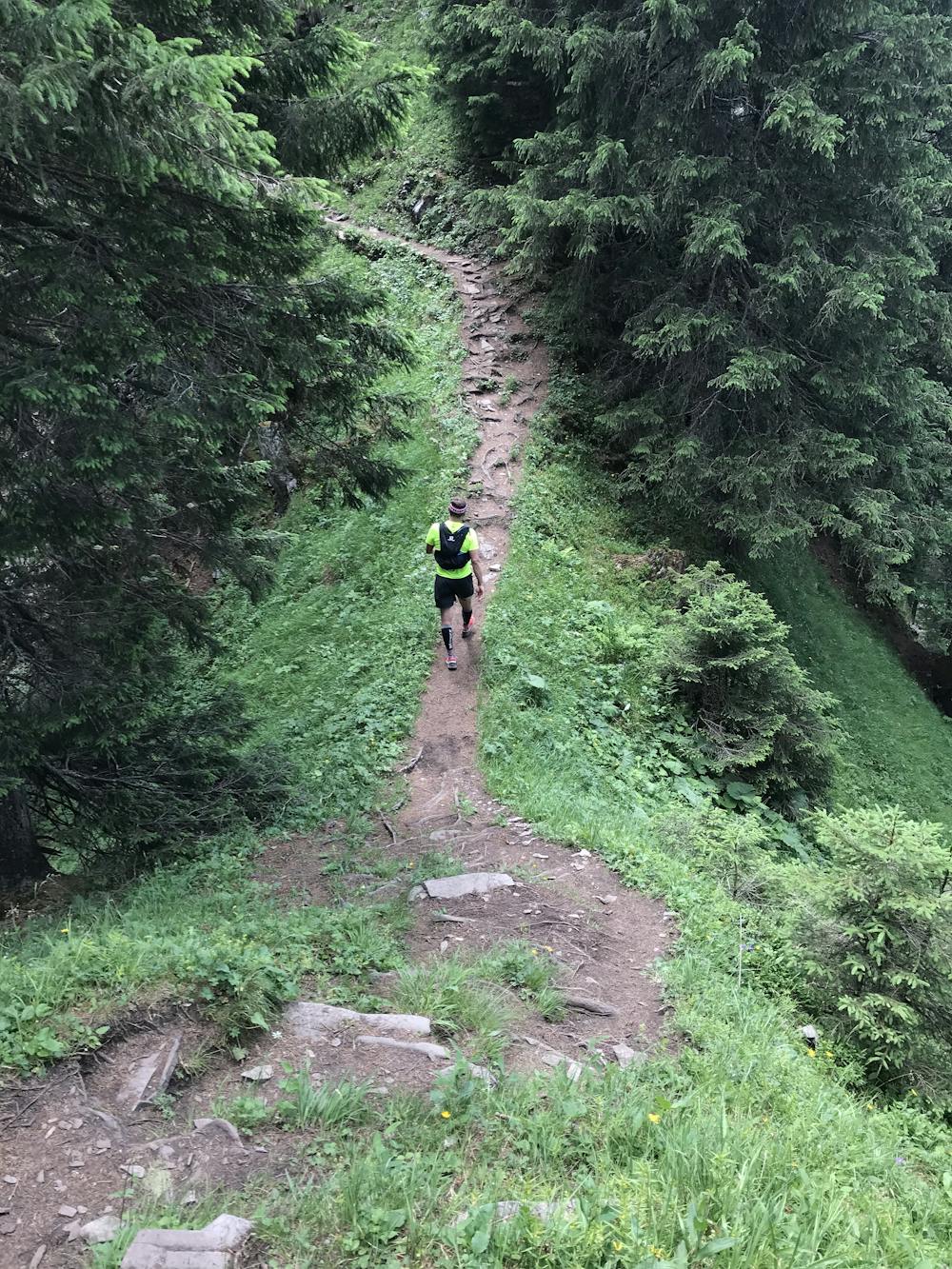
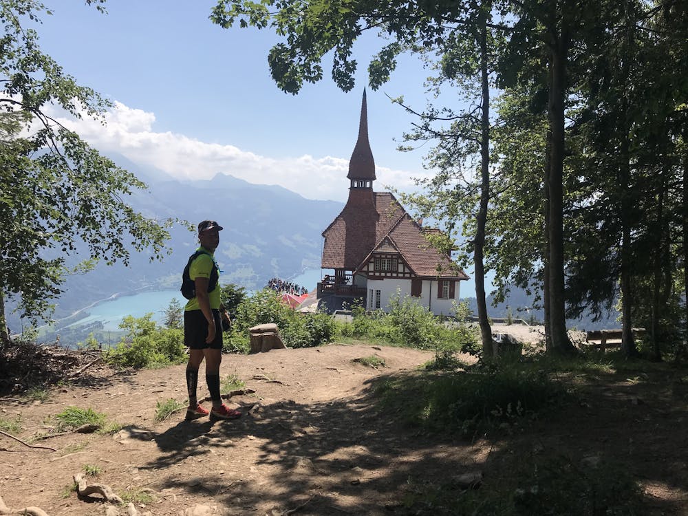
Take the first gondola up to Brienzer Rothorn, to get to the starting point of this amazingly scenic run, which follows the Hardergrat above Lake Brienz. The first half of the trail is less of a run and more of a fast hike. It's quite technical, involves a lot of steep climbs, and is in parts highly exposed. As you follow the ridge, you'll climb a fair amount of peaks, while being rewarded with stunning views of the Lake Brienz, the Bernese Alpes and the Hardergrat itself. In the last section, passing Gummhoren, the trail gets more moderate and the ridge wider, presenting you with gorgeous trail run sections, as you slowly dive into the forest, before reaching the famous Harder Kulm, just above Interlaken.
- •
- •
- •
- •
- •
- •
- •
Description
NOTE: Make sure you have enough water with you, there is no water available on the entire run!
Difficulty
Severe
Extreme Exposure

Some trail sections are extremely exposed where falling will almost certainly result in serious injury or death.
Remoteness

Away from help but easily accessed.