6 m away
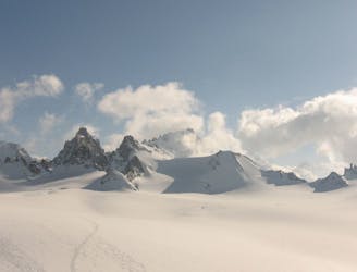
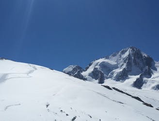
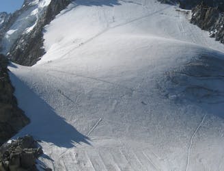
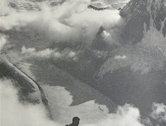
Haute Route Glacier Trek Day 2 - Albert Premier Hut to the Cabane d'Orny
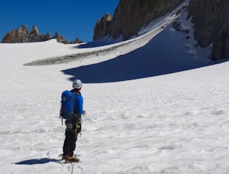
A gorgeous day across a wild glacier.
Moderate Alpine Climbing
- Distance
- 7.9 km
- Ascent
- 725 m
- Descent
- 610 m
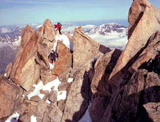
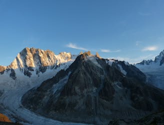
Ascent of Aiguille du Tour
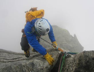
Alpine Climbing Difficult

Early start from Albert 1er Hut takes you towards Signal Reilly where crampons, ice axe and ropes come to action. Walking across Glacier du Tour, there is steeper section towards Col Supérieur du Tour. Flipping over to Switzerland, below Aiguille Purtscheller, across Col Purtscheller, you get below rocky ridge of Aiguille du Tour. Last few scrambling moves and you are at 3529m summit at sunrise. Beautiful day out in the alpine.
Difficult
The beginning of truly technical terrain which might involve pitched climbing on rock and/or ice, exposed terrain and complex route finding in ascent and descent. Equivalent to AD, AD+

The route features some exposed and/or difficult to protect sections.
Away from help but easily accessed.
6 m away
A gorgeous day across a wild glacier.
Moderate Alpine Climbing
12 m away
A short introductory North Face with a long approach and descent.
Difficult Alpine Climbing
12 m away
A classic introductory alpine peak, with stunning views from the summit.
Easy Alpine Climbing
20 m away
A classic easy peak which provides a wonderful journey through high and beautiful mountains.
Moderate Alpine Climbing
5.8 km away
Although short, this route packs in plenty of adventure and has a wonderful high mountain ambience.
Moderate Alpine Climbing
6.3 km away
A breathtaking viewpoint via an interesting (but never particularly hard) route.
Difficult Alpine Climbing
9 km away
A journey up the Vallée Blanche then ladders up to a remote hut in a wild and beautiful place
Easy Alpine Climbing
9.7 km away
One of the toughest classic 4000m peaks which enjoys some of the finest views in the range.
Difficult Alpine Climbing
9.7 km away
A classic route up a rocky peak with legendary views of the Mont Blanc Massif
Moderate Alpine Climbing
9.7 km away
A remote mountain, famed by the routes on its N Face, is a challenging climb from any side.
Difficult Alpine Climbing

12 routes · Alpine Climbing · Hiking

15 routes · Alpine Climbing · Hiking

6 routes · Alpine Climbing · Hiking

9 routes · Alpine Climbing · Hiking

9 routes · Alpine Climbing · Hiking