6.6 km away
Savoleyeres - Patier
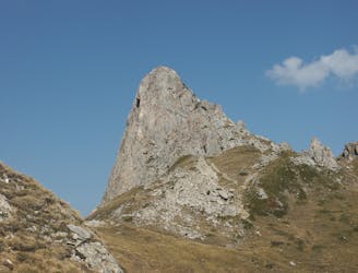
A medium to long walk via Pierre Avoi and Chute des Bisse across a fantastic ridge line that ends at a 360 view of Val de Bagnes and the Rhone Valley.
Difficult Hiking
- Distance
- 7.7 km
- Ascent
- 309 m
- Descent
- 1 km

This is a popular hiking route which is generally considered to be moderate. It's not remote, it features low exposure and is typically done between April and September. From a low point of 1.7 km to the maximum altitude of 2.2 km, the route covers 11 km, 547 vertical metres of ascent and 547 vertical metres of descent.
Cette randonnée est un incontournable à Nendaz ! Elle vous permet de découvrir le magnifique site naturel du Jardin Japonais, lové au pied des montagnes.
Moderate
Hiking along trails with some uneven terrain and small hills. Small rocks and roots may be present.

The path is on completely flat land and potential injury is limited to falling over.
Close to help in case of emergency.
6.6 km away
A medium to long walk via Pierre Avoi and Chute des Bisse across a fantastic ridge line that ends at a 360 view of Val de Bagnes and the Rhone Valley.
Difficult Hiking
7 km away
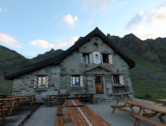
A short walk Around La Chaux including Cabane Mont Fort.
Moderate Hiking
7 km away
A gentle walk along a mostly flat route with the sound of running water alongside you for the entirety.
Easy Hiking
5 routes · Hiking