15 routes · Hiking
The toughest day on the Pennine Way, and one of the absolute best.
Hiking Difficult

Make no mistake about it - today is a toughie! On this hike there's a lot of distance to cover, over 1000 vertical metres of ascent to be made, and the highest peak on the entire Pennine Way to be crossed - so be ready for a challenge! The navigation isn't always straightforward either, and you're exposed to whatever the weather might throw at you, so trying to time it to do this day in good conditions is strongly recommended. If you pull into Dufton and there's a bad weather day forecast, taking a day off and waiting for better conditions is a good idea if your schedule allows for it.
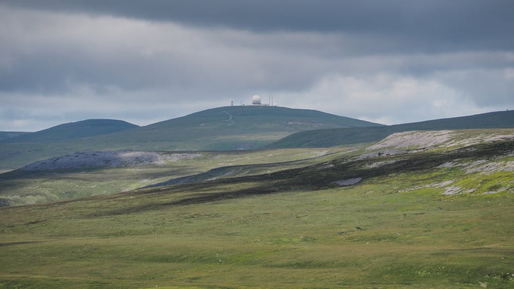
If the weather is good then heading up moorland to Knock Fell is the official route, but simply following the road up to Great Dun Fell is an option too. Great Dun Fell is home to a radar station which is operated by National Air Traffic Services, and this otherworldly contraption rather adds to the "out there" ambience of the fell. The whole stretch up to and over Great Dun Fell is one of the most beautiful and spectacular on the whole Pennine Way so if you get a good day you're in for a memorable trip.
Head across another section of gorgeous moorland and then climb up to Cross Fell - the highest point on the Pennine Way! Even if the sun is shining the navigation isn't easy around Cross Fell so pay attention throughout!
The final section of the day is something of a grind down a miners track which leads easily (navigationally at least) to Garrigill. From there, all that's left is a triumphant stroll into Alston. Barring injury or terrible conditions, completing the Pennine Way is within reach!
Difficult
Hiking trails where obstacles such as rocks or roots are prevalent. Some obstacles can require care to step over or around. At times, the trail can be worn and eroded. The grade of the trail is generally quite steep, and can often lead to strenuous hiking.

Some trail sections have exposed ledges or steep ascents/descents where falling could cause serious injury.
Little chance of being seen or helped in case of an accident.
15 routes · Hiking