273 m away
Ingleton Waterfalls Trail
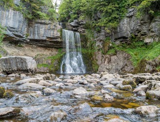
One of Yorkshire's finest easy hikes past some of its most beautiful water features
Moderate Hiking
- Distance
- 6.8 km
- Ascent
- 210 m
- Descent
- 210 m
An alternative take on a classic Three Peak climb
Hiking Moderate

Take a different slant on a classic!
Most people visiting the three peaks of the Yorkshire Dales trudge up the trade routes. Yes, they are spectacular and offer so much - but take a walk off the beaten track and you can find so much more.
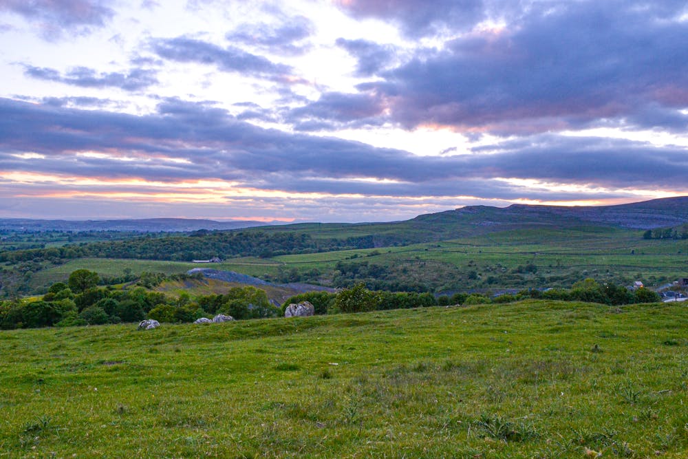
Starting from Ingleton, this route takes you up Fell Lane and towards the pastures of Crina Bottom before rising steeply to the 723m summit of Ingleborough and its Iron Age fort remains.
It's a relatively person free route, despite it climbing out of such a busy village, but offers a good challenge climb and the opportunity to see down the valley to the Lancashire coast.
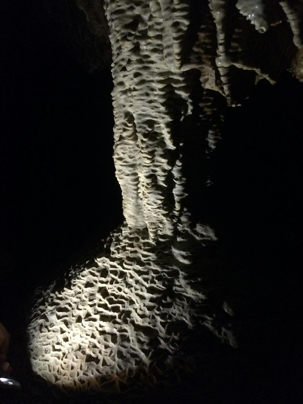
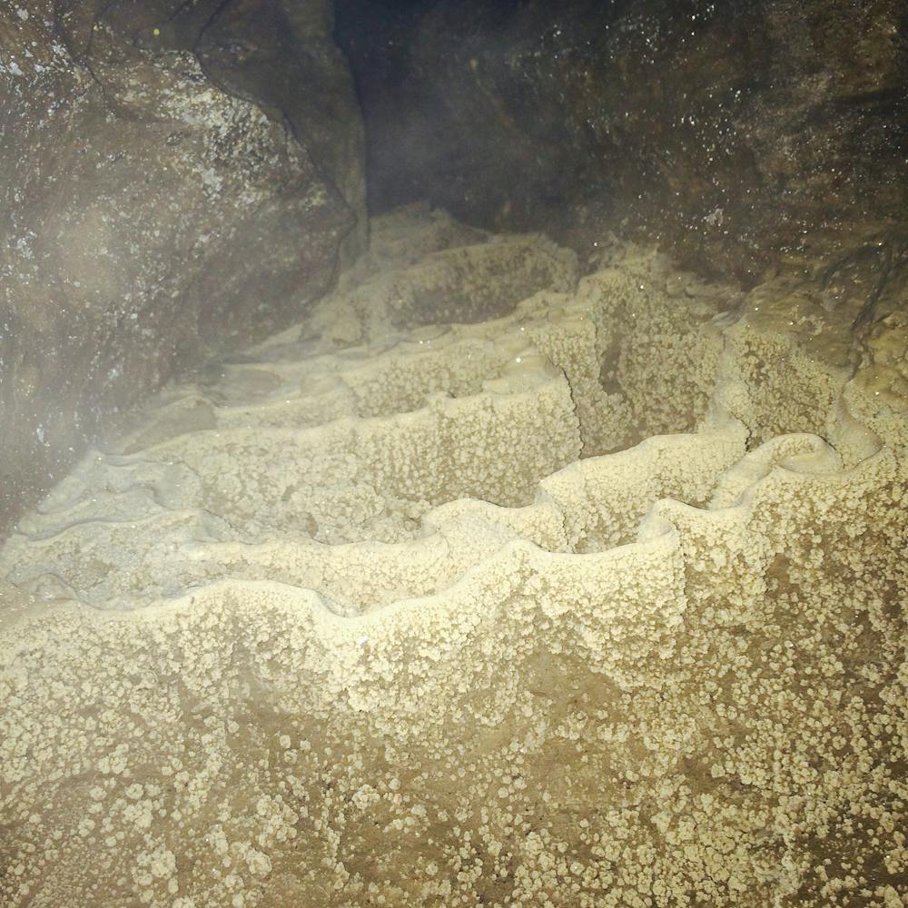
The route back follows roughly the same path, until you take a right to climb down to Ingleton Quarry. Before this, there's the chance to visit a former showcave - Skirwith. There's a succession of old board walks inside and although you'll get wet feet, it's worth taking a torch to see some of the formations. Be careful though and don't go beyond your limits.
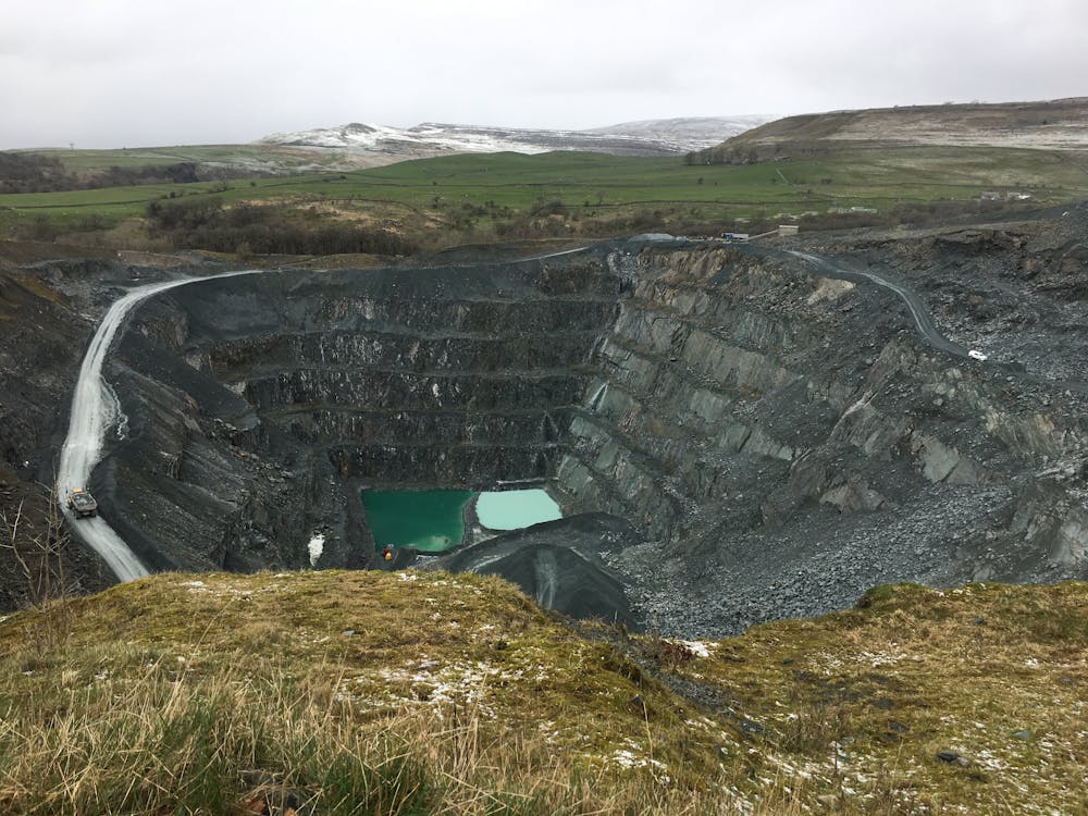
Back on the surface, you can see the vast chasm of Ingleton Quarry from the viewpoint, before making your way back to the village via Meabank Quarry and the welcoming brew stops in Ingleton.
A great introduction to the iconic Ingleborough!
Moderate
Hiking along trails with some uneven terrain and small hills. Small rocks and roots may be present.

The trail contains some obstacles such as outcroppings and rock which could cause injury.
Away from help but easily accessed.
273 m away
One of Yorkshire's finest easy hikes past some of its most beautiful water features
Moderate Hiking
9 km away
Hike to the highest peak in the Yorkshire Dales and pass a legendary landmark on the way!
Difficult Hiking