6.1 km away
Portage Pass Trail
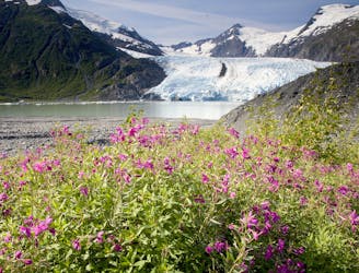
A super scenic hike that earns a view of Portage Glacier, and perhaps an icy dip in the lake.
Moderate Hiking
- Distance
- 7 km
- Ascent
- 448 m
- Descent
- 447 m
Walk to see a glacier and snow caves in a steep-sided, boulder-filled valley.
Hiking Easy

Byron Glacier Trail is a casual hike to see ice formations and watch ecological succession in action, in the wake of a receding glacier. Byron glacier extended much farther down the valley just decades ago, but its retreat has left barren ground for plants to reclaim. On the trail you’ll walk through a maturing forest of cottonwood and alder, then into more recently vegetated terrain where shrubs and wildflowers are gradually advancing on the rocky plain. The glacier itself is visible ahead, though it’s now confined to the uppermost slopes of the valley. You can see other ice formations, however, in the mounds of snow leftover from winter avalanches. As meltwater streams beneath the compressed snow, caves are hollowed out. These are dangerous to enter but fascinating to view from outside.
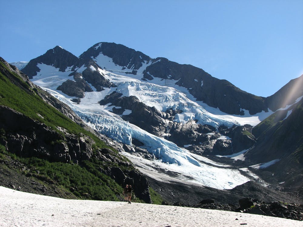
The trail is well defined and easy to walk, except for some muddy and possibly snowy sections. More challenge can be had by venturing into the rocks and getting closer to the toe of the glacier. Families will appreciate the easy stroll with rock-hopping and a stream for kids to enjoy. Rock climbers may come for the bouldering opportunities that surround. To find the climbing, look for side trails that lead to larger clusters of boulders. he broad appeal of this valley makes Byron Glacier a very popular trail, but parking is limited so try to arrive early. Also be aware that avalanche danger is high in the winter, and even through the spring in some years. You might consult the staff at Begich Boggs Visitor Center about conditions before you go.
Sources: https://www.alaska.org/detail/byron-glacier-trail https://www.fs.usda.gov/recarea/chugach/recreation/hiking/recarea/?recid=6606&actid=50
Easy
Walking along a well-kept trail that’s mostly flat. No obstacles are present.

Away from help but easily accessed.
6.1 km away
A super scenic hike that earns a view of Portage Glacier, and perhaps an icy dip in the lake.
Moderate Hiking
10 routes · Gravel Biking · Hiking · Road Biking