
5 routes · Hiking
Hike to a beautiful backcountry cabin in the Alaskan Wilderness.
Hiking Difficult

The 3.5-mile hike up the Caribou Creek Trail winds slowly along the banks of the creek before entering a stunning alpine valley. After ascending the valley for around a mile and a half and enjoying stunning views all around, you'll arrive at the Caribou Creek Cabin.
The route to the cabin crosses the creek many times, forcing you to get wet feet as you negotiate the icy cold waters. Early in the year, the creek can become a torrent and can prove dangerous--exercise caution.
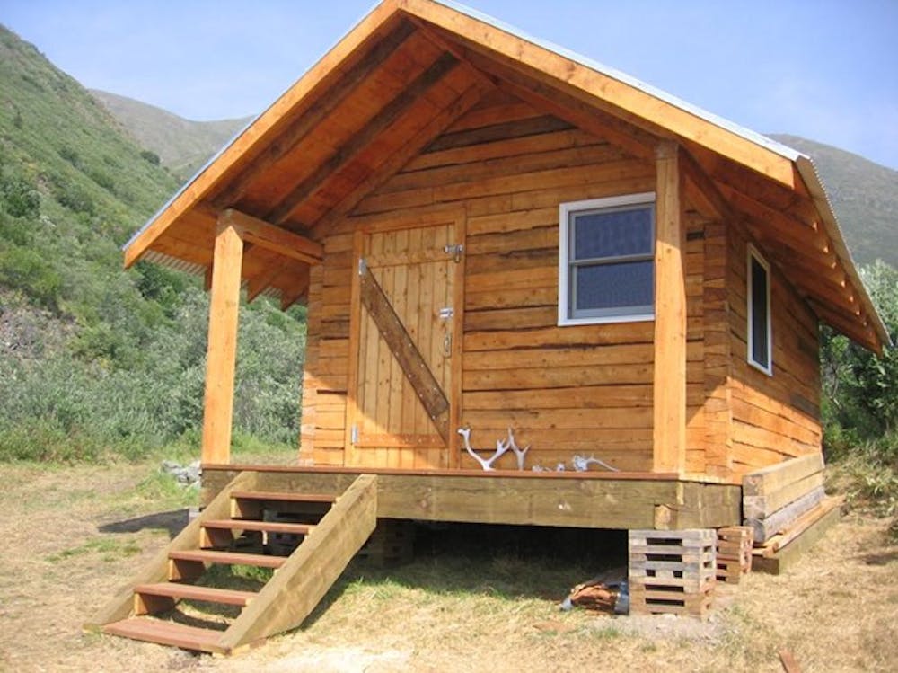
This backcountry cabin "sits nestled between ridges with breathtaking views of the valley south towards Mount Sanford, Mount Wrangell, and the Tanada peaks," according to the NPS. While "there is no running water or plumbing," the cabin does provide two twin sized beds, a wood stove, a table, a porch, and a rustic pit toilet (but no toilet paper). The cabin can be reserved year-round, and reservations can be made up to six months in advance.
While the hike mapped here terminates at the cabin, that doesn't mean your adventure is over. From the cabin, there are even more opportunities to hike and explore the ridges and surrounding mountain peaks!
Difficult
Hiking trails where obstacles such as rocks or roots are prevalent. Some obstacles can require care to step over or around. At times, the trail can be worn and eroded. The grade of the trail is generally quite steep, and can often lead to strenuous hiking.

The path is on completely flat land and potential injury is limited to falling over.

In the high mountains or remote conditions, all individuals must be completely autonomous in every situation.
5 routes · Hiking