2 m away
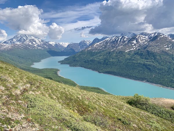
McHugh Creek to Rabbit Lake
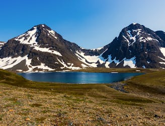
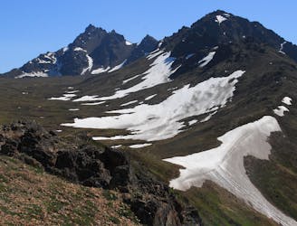
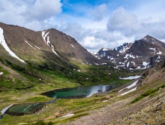
Hike all the way up from the sea to one of the prettiest alpine lakes in the Chugach, by way of a stunning glacial valley with nearly nonstop views.
Difficult Hiking
- Distance
- 21 km
- Ascent
- 1.2 km
- Descent
- 1.2 km
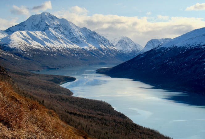
A prominent peak above Anchorage, overlooking the city plus most of Turnagain Arm and the length of the Cook Inlet.
Hiking Severe

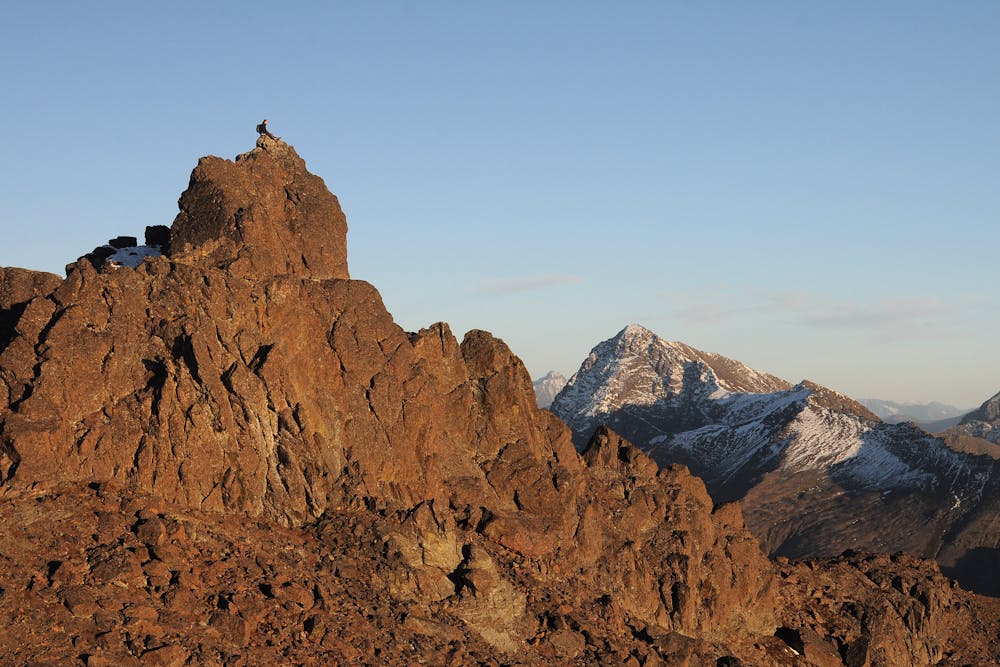
McHugh Peak is not as high as some other Front Range summits, but nonetheless it proudly stakes its claim on the skyline over Anchorage. A bulky massif set apart from the rest, it's first in the line of the mountains marching along Turnagain Arm. This unique position at the nexus of the city, the sea, and the summits make McHugh a proud point to stand on indeed. And it's really an achievement if you start this 4300-footer by standing at sea level.
There are multiple approaches to McHugh, and what's mapped here is the one with the most vertical gain. Only your attitude determines whether that's a pro or a con! Other advantages to this route are variety of scenery on the way up, and easy access within Chugach State Park. The other popular route is the north ridge, but it begins outside the park at a spot with very limited parking.
To tackle this south flank route, park at the McHugh Creek trailhead on Seward Highway. You'll start on the regular trail to McHugh Lake, which goes first through leafy coastal forest then through a swath of skeleton trees from a 2016 wildfire. Be aware that bears may frequent this area, especially during the spring and fall.
Pay attention to the upslope on your left to find the climbers trail that branches off. It comes at the base of a broad bowl in the mountainside, then punches straight up the center, through dry tundra and talus to gain the ridgeline.
Once on the ridge, you'll find the view off the other side of the mountain to Anchorage. The summit is still about a mile and a half away, but it's a mellow ridge walk to get there. The biggest difficulty may be the high winds that frequently blast from the ocean.
Rock outcrops can easily be bypassed moving left or right along the ridge, but the mountain's true summit is a finger-like crag that must be scrambled. The moves aren't too difficult, but there is a real fall hazard. Proceed with caution if you're determined to make the top.
Sources: https://www.summitpost.org/mchugh-peak/668907 https://www.alaska.org/detail/mchugh-peak https://winterbear.com/guidebook/alaska/chugach-state-park/mchugh-peak/
Severe
Hiking challenging trails where simple scrambling, with the occasional use of the hands, is a distinct possibility. The trails are often filled with all manner of obstacles both small and large, and the hills are very steep. Obstacles and challenges are often unexpected and can be unpredictable.

Some trail sections have exposed ledges or steep ascents/descents where falling could cause serious injury.
Little chance of being seen or helped in case of an accident.
2 m away
Hike all the way up from the sea to one of the prettiest alpine lakes in the Chugach, by way of a stunning glacial valley with nearly nonstop views.
Difficult Hiking
9.8 km away
The most impressive peak rising from Anchorage, with a route to the top that's actually easier than it looks.
Severe Hiking
9.8 km away

The classic hike and scramble to Alaska's #1 summit!
Difficult Hiking
9.9 km away
Find a variety of Chugach scenery on this long day hike or overnight trip, which begins from a popular trailhead but soon leaves the crowds behind.
Moderate Hiking
7 routes · Hiking
10 routes · Gravel Biking · Hiking · Road Biking