0 m away
Tanalian Falls
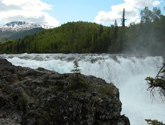
A classic Lake Clark day hike to a breathtaking waterfall crashing 30' over hardened lava rock.
Moderate Hiking
- Distance
- 6.8 km
- Ascent
- 287 m
- Descent
- 287 m
A rigorous climb up Tanalian Mountain with spectacular 360-degree views reaching for miles in every direction.
Hiking Difficult

Sharing a trailhead with Tanalian Falls, climbing the Tanalian Mountain Trail is one of the other classic day hikes from Port Alsworth in Lake Clark National Park. The trail meanders uphill through vibrant spruce and birch forests, then emerges onto exposed tundra lined with beautiful summer wildflowers. Dall Sheep can often be seen roaming mountainside, and a USGS benchmark greets you just below the summit. Just over 4 miles one-way, the Tanalian awards stunning panoramic views stretching for miles in every direction.
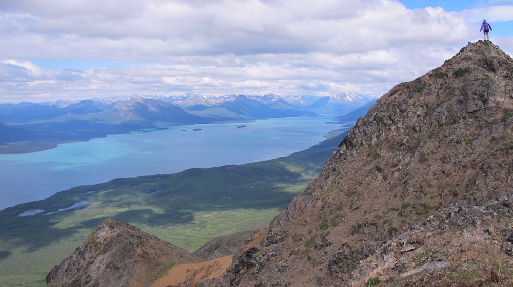
With the sun taking longer to set at these latitudes, watching the sunset from the 3,900' peak is absolutely mesmerizing—just remember beforehand to pack your headlamp for the return trip down. Also, remember to bring plenty of water and sunscreen for those warmer days, and to layer appropriately for the unpredictable late-spring and early-fall weather. May through October offers the best chance for favorable weather.
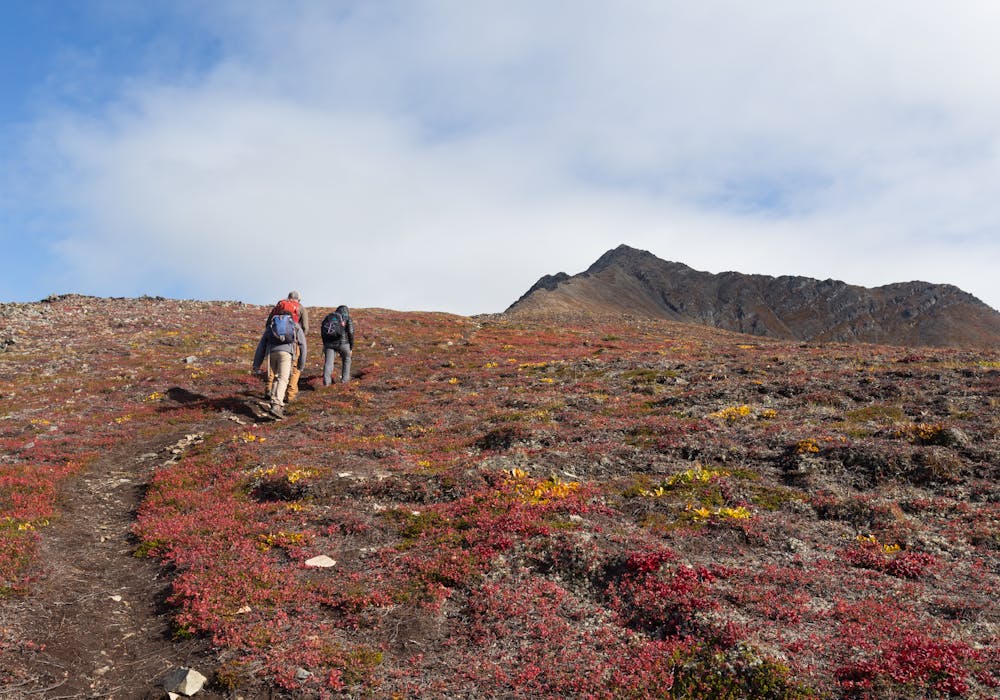
Though the route begins with a gentle climb to Beaver Lake, it climbs steeply after. The park suggests eight hours to complete the entire 8.5-mile round-trip trek, though a bench overlooking Beaver Pond could be the destination for a shorter out-and-back hike.
The trail is officially listed as dog-friendly, but the park highly recommends leaving your four-legged friends at home for this adventure. More information about visiting Port Alsworth, including their pet policy, travel information, and a detailed map can be found here.
Sources: https://www.nps.gov/lacl/planyourvisit/ https://59in59.com/the-blog/2015/11/2/mount-tanalian https://www.alaska.org/detail/tanalian-mountain-trail
Difficult
Hiking trails where obstacles such as rocks or roots are prevalent. Some obstacles can require care to step over or around. At times, the trail can be worn and eroded. The grade of the trail is generally quite steep, and can often lead to strenuous hiking.

Some trail sections have exposed ledges or steep ascents/descents where falling could cause serious injury.
Little chance of being seen or helped in case of an accident.
0 m away
A classic Lake Clark day hike to a breathtaking waterfall crashing 30' over hardened lava rock.
Moderate Hiking
3 routes · Hiking

63 routes · Alpine Climbing · Hiking