794 m away
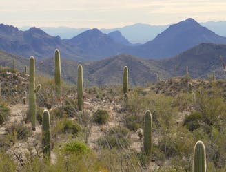
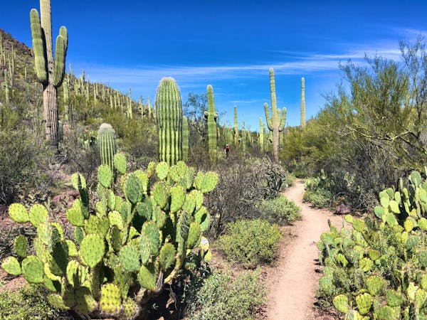
Valley View Overlook
A quick hike through colorful cactus forest, to a panoramic overlook on a hill.
Moderate Hiking
- Distance
- 1.3 km
- Ascent
- 19 m
- Descent
- 19 m
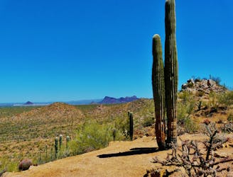
The most scenic route to the top of Wasson Peak, and perhaps in all of Saguaro West.
Hiking Difficult

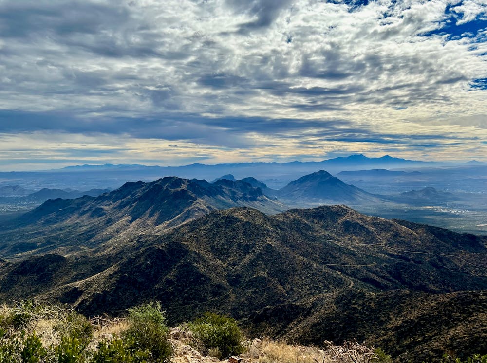
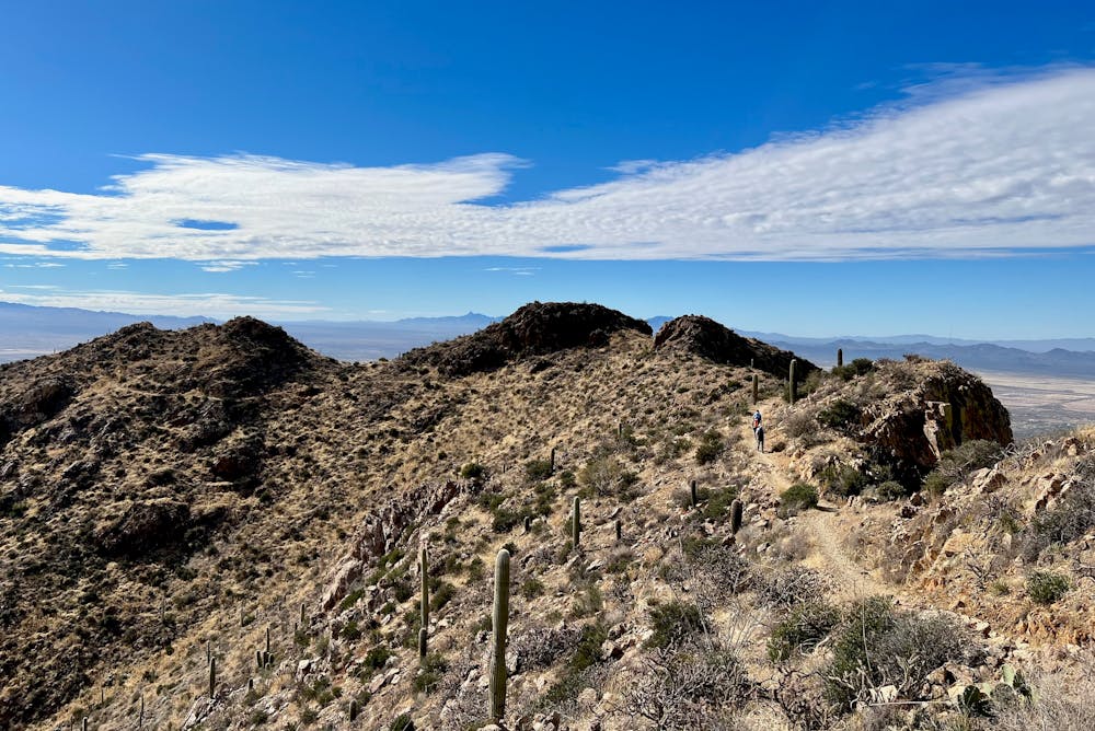
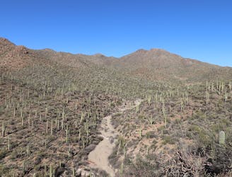
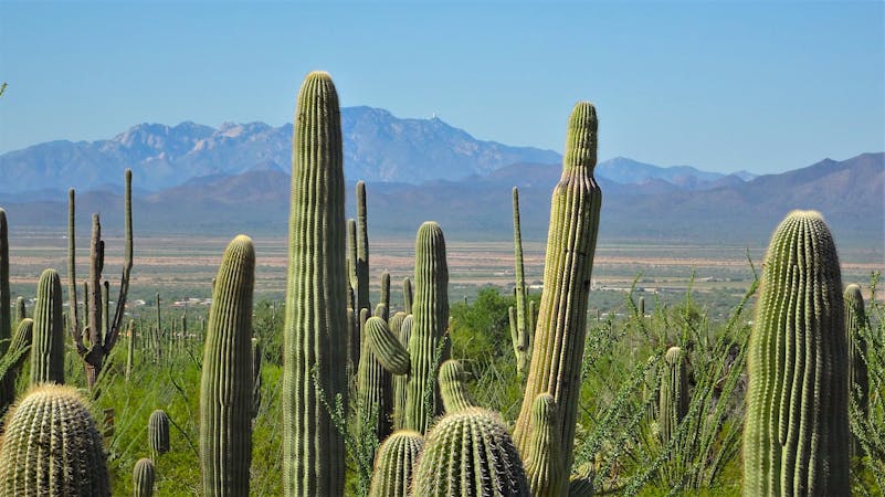
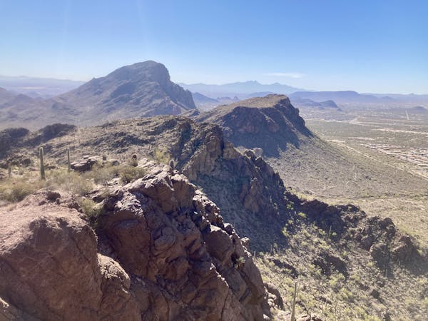
Wasson Peak is the highest point in Saguaro National Park West, and of the handful of trails that reach its summit, Hugh Norris is the longest and most gradual. It’s arguably the most scenic route as well, because it follows a long, undulating ridgeline with panoramic views and photogenic rock formations.
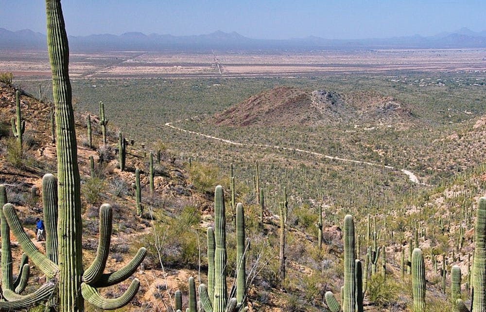
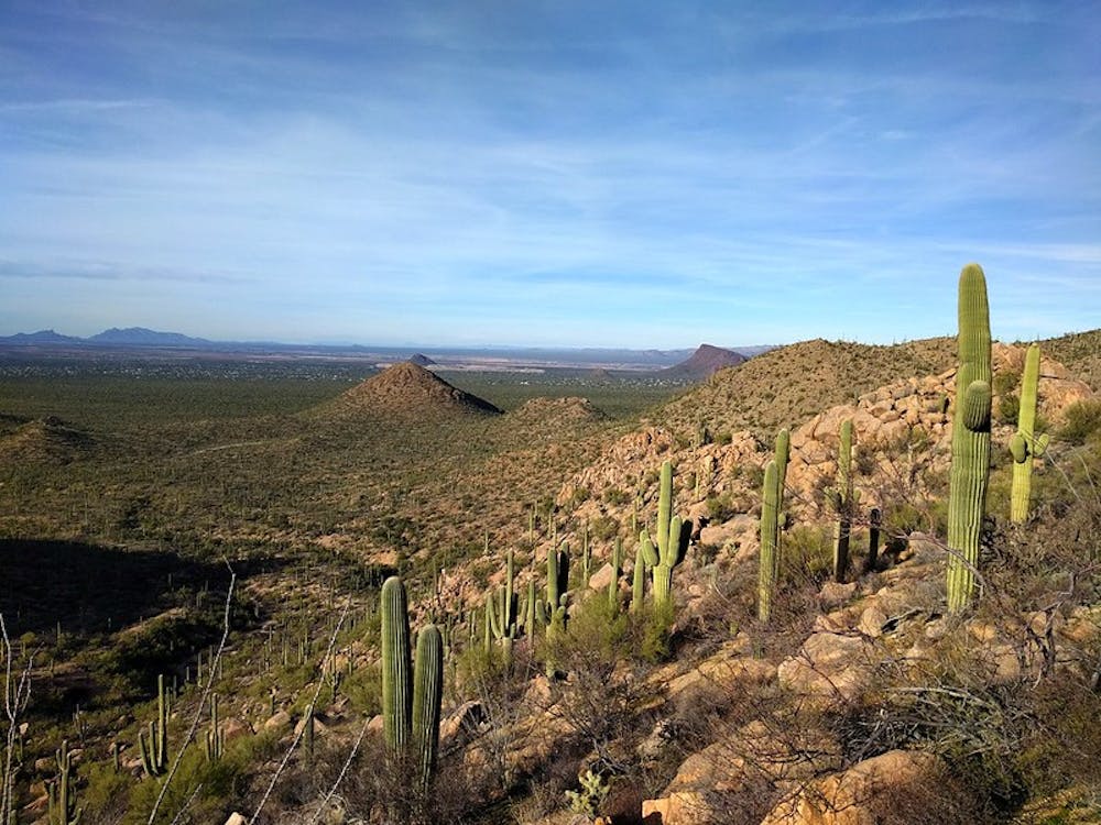
Hiking all the way to Wasson Peak is not necessary to appreciate the beauty of Hugh Norris Trail, however. In fact, most people go only a few miles out and back, rather than the full 10-mile roundtrip to the summit. The trail gains the ridgeline only 1 mile from the start, and anywhere beyond there makes a rewarding turnaround point.
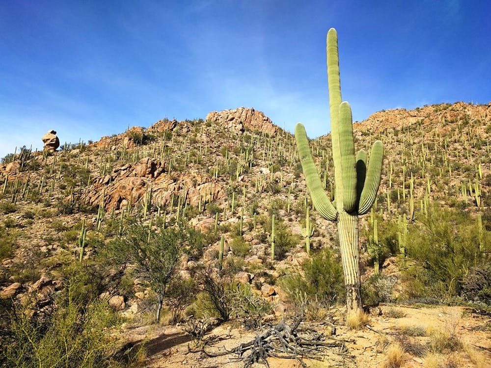
The trailhead is a small parking area on the Bajada Loop Drive, and the path goes uphill right away. It’s gradual at first, but then ascends a ravine on tight switchbacks. The gradient does not remain so steep, however; it mellows after this first intense mile, and the entire trail is well constructed with stone steps to aid the persistent uphill.
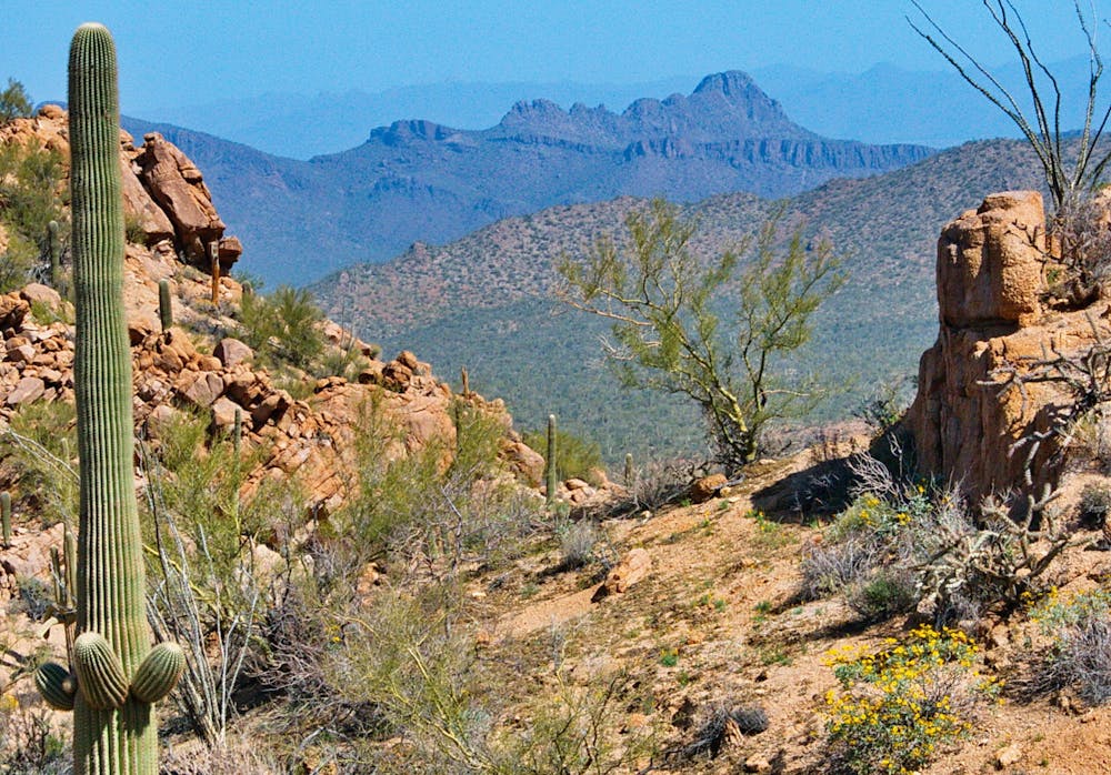
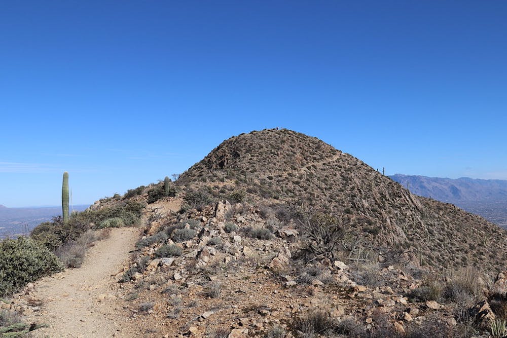
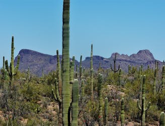
The ridgeline is home to all the same cacti as the cactus forest below, but with subtle differences that come with elevation gain. The major scenery change is in the terrain, which is steep and rock-strewn. The path winds among granite boulders and towers crowning the ridgeline. In several places, the trail traverses craggy sub-peaks of the ridge to avoid climbing over them.
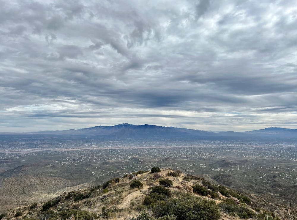
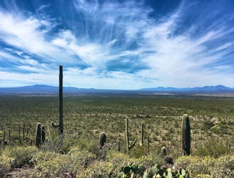
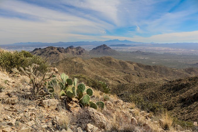
Just over 2 miles into the hike, the ridge trends downhill for a while, toward a broad saddle where Sendero Esperanza Trail crosses Hugh Norris Trail. It then turns upward again, and soon breaks above 4,000 feet elevation. The pitch remains gradual until mile 4.25, where an imposing shoulder of the mountain necessitates another set of switchbacks. Atop those, however, the remaining ridgeline is relatively easy, and soon reaches the 4,687-foot summit of Wasson Peak.
Sources: https://www.americansouthwest.net/arizona/saguaro/hugh-norris-trail.html https://www.nps.gov/sagu/planyourvisit/upload/Trails%20in%20the%20Tucson%20Mountain%20District.pdf
Difficult
Hiking trails where obstacles such as rocks or roots are prevalent. Some obstacles can require care to step over or around. At times, the trail can be worn and eroded. The grade of the trail is generally quite steep, and can often lead to strenuous hiking.

The trail contains some obstacles such as outcroppings and rock which could cause injury.
Away from help but easily accessed.
794 m away
A quick hike through colorful cactus forest, to a panoramic overlook on a hill.
Moderate Hiking
794 m away
Mellow hike among desert flora and low hills within the Bajada Scenic Loop.
Easy Hiking
2.1 km away
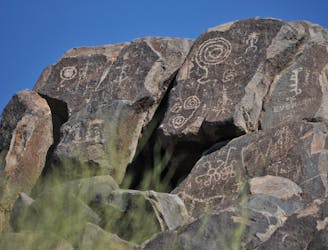
Not much of a hike, but a quick walk to the site of well-preserved Native American rock art.
Easy Hiking
3.7 km away
A mellow walk through open desert, then a steep but short climb to a panoramic ridgeline.
Moderate Hiking
4.3 km away
A full-value loop to the highest point in the Tucson Mountains District of Saguaro National Park.
Difficult Hiking
4.3 km away
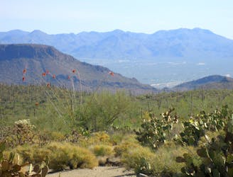
Mountainside cactus forest and an old copper mine, plus a backcountry picnic area with a view.
Moderate Hiking
7.6 km away
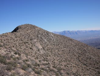
Hike along a gorgeous ridge with stupendous views of the Tucson Mountains and Saguaro National Park.
Difficult Hiking
7.9 km away
Climb to the highest peak in the Tucson Mountain.
Difficult Hiking
10 routes · Hiking
5 routes · Hiking
9 routes · Hiking
6 routes · Hiking
7 routes · Hiking

32 routes · Mountain Biking · Hiking · Road Biking

63 routes · Alpine Climbing · Hiking

10 routes · Alpine Climbing · Canyoning · Hiking