6.6 km away
West Clear Creek Trail from Bull Pen Ranch
A maintained trail into the wilderness area, with access to backcountry camping, swimming, and fishing.
Moderate Hiking
- Distance
- 21 km
- Ascent
- 405 m
- Descent
- 405 m
A rugged hike and rock hop through the creek, to a waterfall and swimming holes among desert red rocks.
Hiking Severe

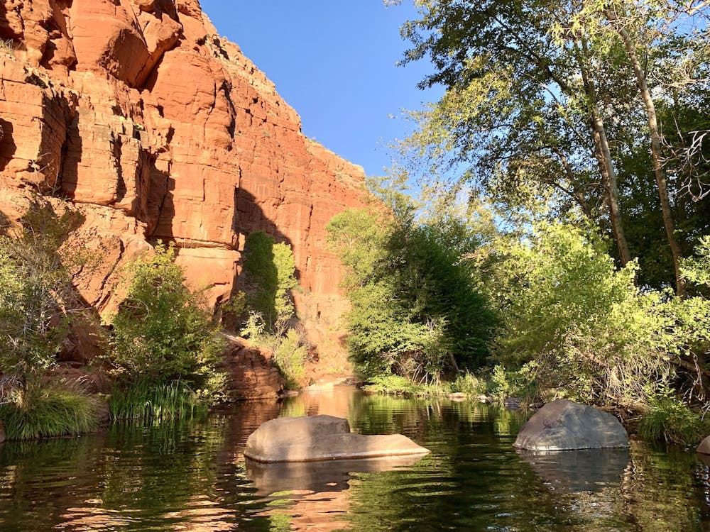
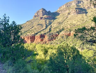
Among the many miles which West Clear Creek carves through its canyon of brilliant sandstone, one spot stands out from the rest. Indian Maiden Falls, or Maiden Falls for short, is the best-known destination in the lower gorge, within the western extent of the West Clear Creek Wilderness. Getting there is not easy, however. It requires a rugged trail hike and then a few miles of difficult travel in the creek itself––rock-hopping and wading, and even swimming long pools between rock walls.
The journey starts on the West Clear Creek Trail, which has two trailheads near the western bound of the wilderness. Described here is the shorter way to Maiden Falls, starting from the trailhead on Bald Hill Road. It’s doable as a day hike, but perhaps better as a backpacking trip, allowing time to sufficiently explore and to enjoy the falls at the warmest time of day. Note that the road to this trailhead is quite rugged, and best done with 4-wheel drive.
The trail starts out rather flat, among juniper trees on a sun-baked hilltop. It soon tips downward into an arm of the canyon, and looses elevation quickly. Expect rocky and loose footing in places, with some intimidating drop-offs to the side. Upon reaching the bottom of the canyon, this official trail crosses the creek and turns westward, eventually ending at Bull Pen Ranch. The way to Maiden Falls, however, is to leave this trail and turn upstream, following the water’s course through the gorge.
This becomes a bit of a route-finding adventure the rest of the way to the falls. You’ll need to constantly choose between wading/swimming in the water or rock hopping/bushwhacking along the bank. It’s a tedious two miles to Maiden Falls, but it’s decorated with geology, flora, and fauna every step of the way. The water slides between red stone walls and polished black boulders. Gold-colored trout fill the clear pools, and a surprising diversity of foliage drapes the banks.
If you do this as a backpacking trip, you’ll need to choose your place to camp along the way. There are no designated sites, only scattered clearings in the woods, which are sometimes hard to see from the creek. Suitable spots can be found throughout the stretch from the trail to the waterfall, however, if you look carefully.
You’ll know when you are at the falls. At one point after turning a corner, you’ll encounter a long pool bound by vertical walls. Though there may be a feasible bypass, the best option is to swim across it. The water is cold and deep, but the reward is close at hand. You’ll next have to scramble some rock ledges and swim another pool, but then you’ll be there.
Maiden Falls is a sheet of water falling 15 feet into a rectangular pool, among beveled blocks of bright red sandstone. There are spots for cliff jumping and lounging on the rocks, but don’t expect much sun in this alcove. You may continue as far as you like upstream, but the waterfall makes the turnaround point for most. Remember that you’ll want to time your hike based on the weather and time of day. It’s generally chilly along the creek, but hot and exposed on the steep uphill back to the trailhead.
Whether camping or day hiking, remember that this is designated wilderness and a rare aquatic habitat in Arizona. Please be sure to Leave No Trace and adhere to the wilderness regulations that apply.
Severe
Hiking challenging trails where simple scrambling, with the occasional use of the hands, is a distinct possibility. The trails are often filled with all manner of obstacles both small and large, and the hills are very steep. Obstacles and challenges are often unexpected and can be unpredictable.

Some trail sections have exposed ledges or steep ascents/descents where falling could cause serious injury.

In the high mountains or remote conditions, all individuals must be completely autonomous in every situation.
6.6 km away
A maintained trail into the wilderness area, with access to backcountry camping, swimming, and fishing.
Moderate Hiking