
10 routes · Alpine Climbing · Canyoning · Hiking
A sketchy, exposed climb leads to an incredible view from the top of Picacho Peak.
Hiking Extreme

From the bottom, Picacho Peak doesn't look like that intimidating of a mountain. Sure, it has some dramatic rock sides, but it's really not all that tall. Rising to a height of 3,374 feet above sea level, the peak is just 1,374 vertical feet above the rest of the state park in the flat desert below.
But exactly how much vertical gain is required to climb the mountain is tricky to determine.
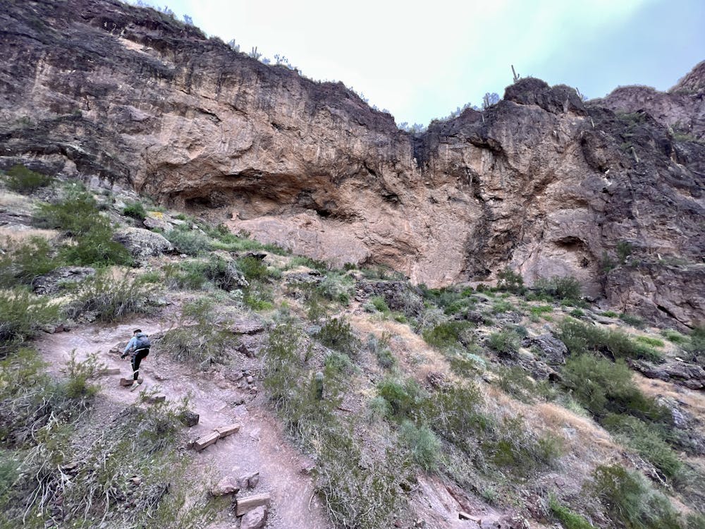
The trail begins by ascending via a series of steep, rocky switchbacks before gaining a saddle. Many neophyte hikers think the saddle is the destination, but that steep climb is only the beginning. From here, the trail gets dramatically more technical and much steeper, and it descends back down the opposite side of the mountain before turning around and making for the summit. Since the terrain is nearly-vertical, the cliff faces play havoc on GPS devices and maps.
SoCalHiker.net lists the elevation gain for this hike as 1,986 feet, although to me, that seems like it might be the one-way elevation gain. Round-trip, this hike still probably gains more. Regardless, this short ~3-mile hike is a steep, technical affair.
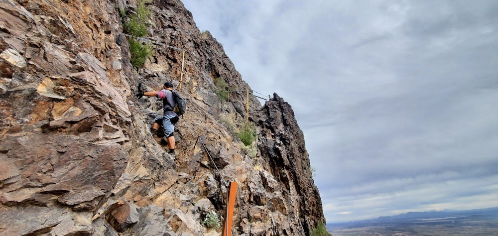
But it's not just the elevation gain that makes this hike so challenging: it's the technicality of the climb. After passing the saddle, the website for Picacho Peak State Park notes that "the route becomes difficult, steep and twisting, with steel cables (gloves are recommended) anchored into the rock in places where the surface is bare."
This statement is accurate, but it belies the truly rugged nature of this steep climb.
From the saddle, pull on your gloves as you begin a controlled slide down a slick slab of rock and a series of rock ledges, holding onto the cables to keep your speed in control. After bottoming out, the climb begins again in earnest.
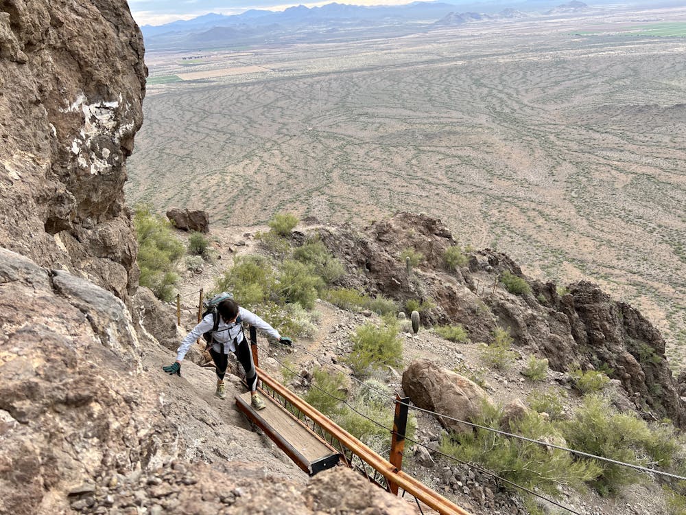
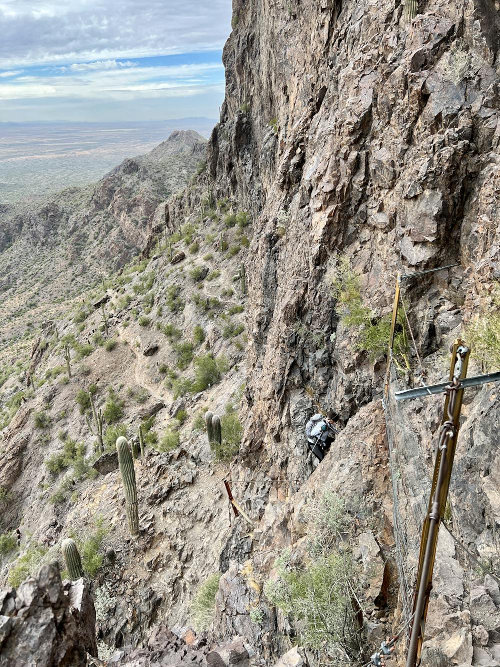
From here, you'll have to scale vertical rock faces with fifth-class moves that were protected by said "cables anchored in rock..." if by "anchored," you mean thin wires connected by wiggling, creaking brackets drilled into the rock face with woefully-small bolts. In places, chicken wire fencing strung along the top of a sheer cliff face is the only form of protection.
While some sections of the cables and fencing have been reinforced in recent years, most of the protection was originally erected in 1932 so that maintenance workers could reach a light beacon on the summit. It's highly unlikely that the original Civilian Conservation Corps trail builders thought that the metal cables they were erecting would still be in service over 80 years later... but here you are, putting your life on the line with thin metal bands as your sole protection.
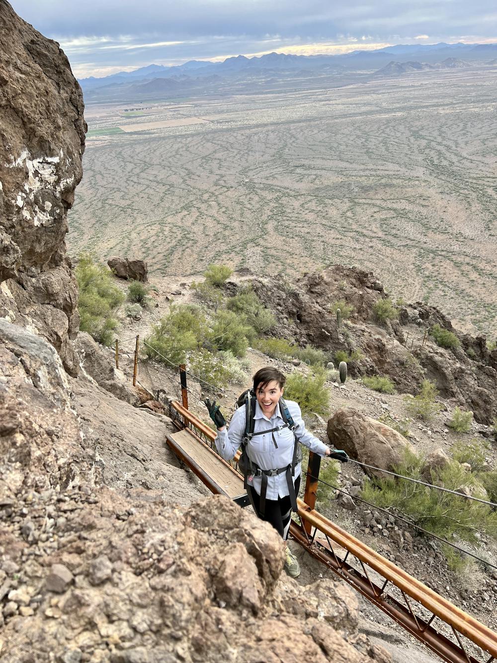
Tight corners, more cliffs to scale, and finally, a section of elevated boardwalk between two rock ledges culminate in your arrival at the top of Picacho Peak.
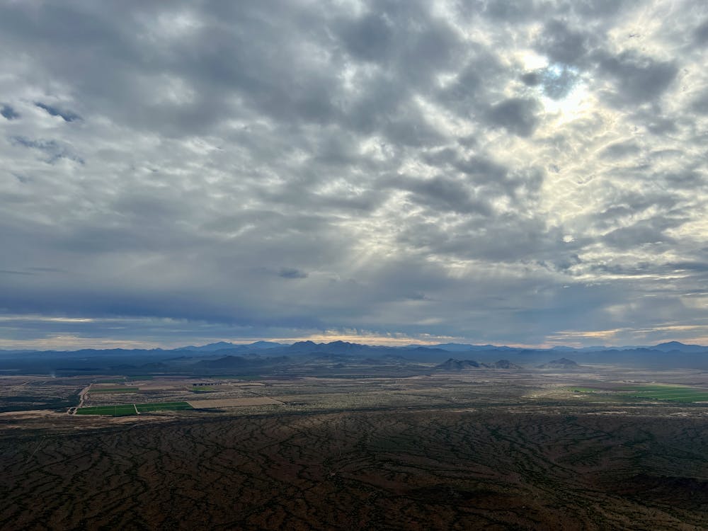
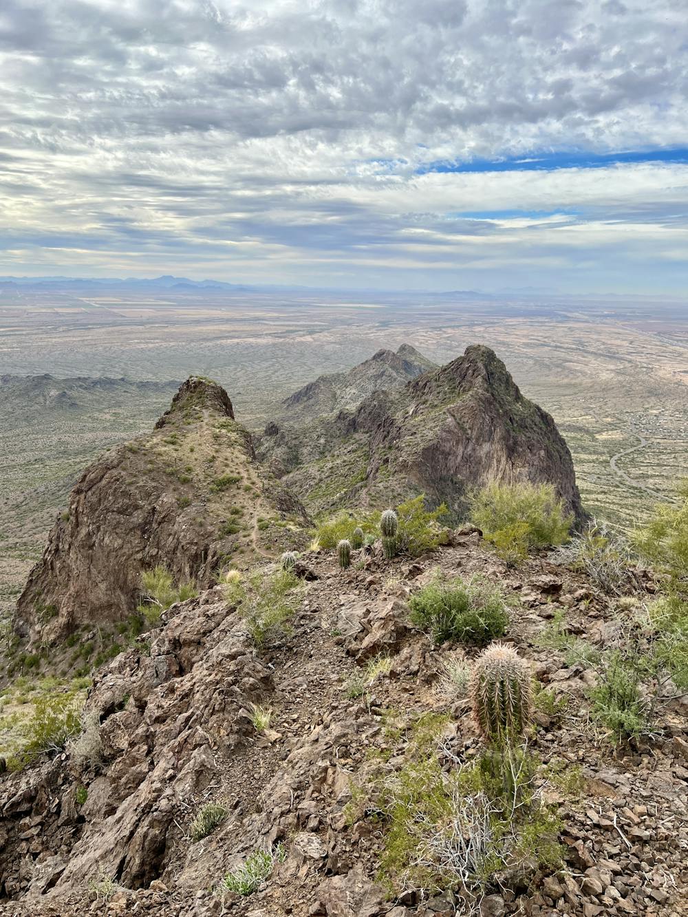
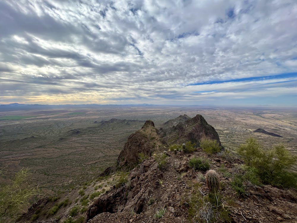
From the top, the desert spreads out below you, with the flat basins punctuated by rugged mountain ranges in the distance. Take some time to enjoy this incredible vista... and to gather yourself. The descent is at least as challenging as the climb was!
Extreme
Scrambling up mountains and along technical trails with moderate fall exposure. Handholds are necessary to navigate the trail in its entirety, although they are not necessary at all times. Some obstacles can be very large and difficult to navigate, and the grades can often be near-vertical. The challenge of the trail and the steepness of the grade results in very strenuous hiking. Hikes of this difficulty blur the lines between "hiking" and "climbing".

Some trail sections are extremely exposed where falling will almost certainly result in serious injury or death.

Away from help but easily accessed.
10 routes · Alpine Climbing · Canyoning · Hiking