1 m away
Freedom Trail

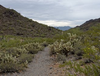
A short hike around the base of Piestewa Peak.
Moderate Hiking
- Distance
- 6.1 km
- Ascent
- 353 m
- Descent
- 353 m
A classic hike with 360-degree views atop Piestewa Peak.
Hiking Difficult

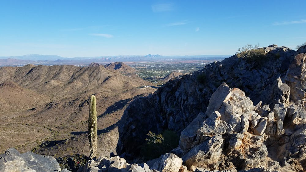
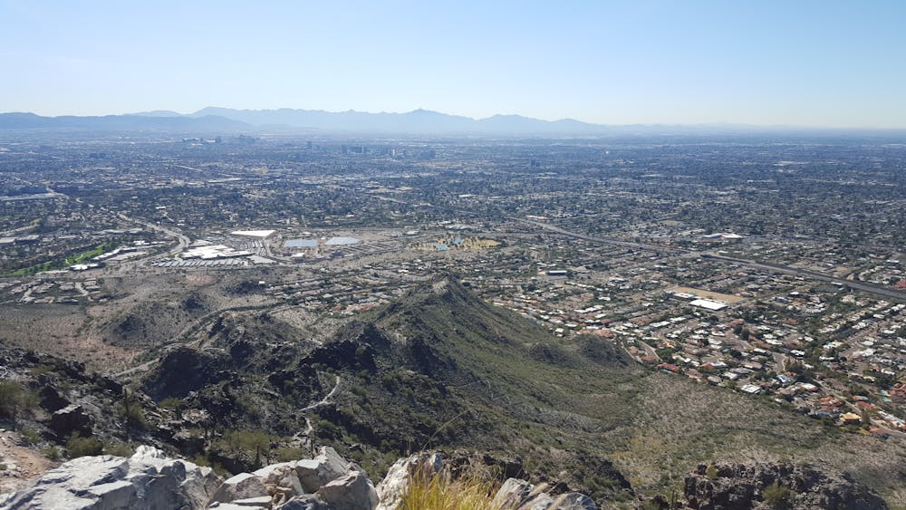
Short in length, this is a hike that cannot be underestimated. In just 1.2 miles, this trail climbs 1,200' to the summit of the Piestewa Peak, where you're welcomed with incredible 360-degree views of the valley below. Phoenix.gov even states that "This summit trail has been a Phoenix favorite for several decades and is internationally recognized among hiking communities".
This hike begins at the 302 Trailhead along Squaw Peak Drive. At the trailhead you will find drinking water, restrooms, and plenty of parking. Since this is one of the most popular hikes in the valley, get an early start to avoid the crowds.
Following several switchbacks and stairs, the trail ascends quickly to the first saddle - this is roughly the halfway point. Take a few moment to catch your breath before attempting the second half.
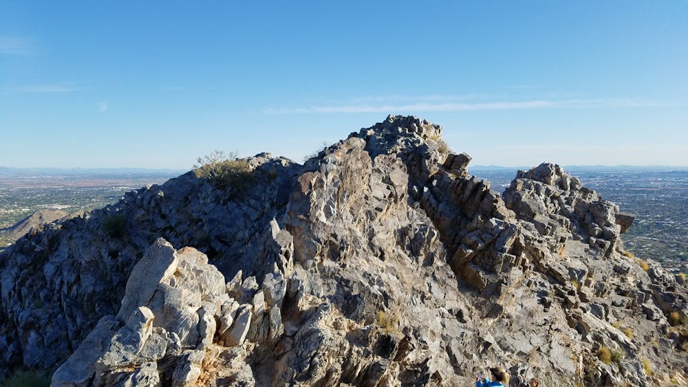
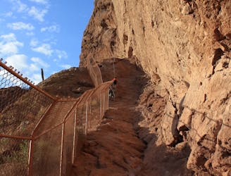
Keeping right at the fork, the path continues to the summit. As you continue climbing, the trail narrows and intensifies as it approaches Piestewa Peak (formerly named Squaw Peak). The loose rocks and sharp shale you'll encounter should be navigated with caution.
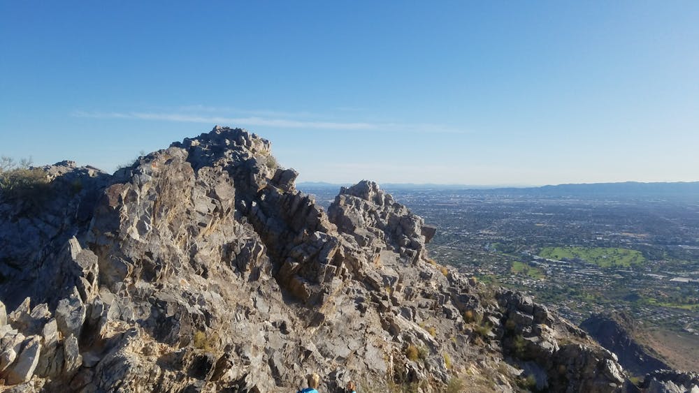
At the top, you will find several different viewpoints to enjoy the reward for your effort. To the southeast, you can snag views the iconic Camelback Mountain - to the northwest, you can view North Mountain. On a clear day, the Four Peaks are distinguishable to the east.
Sources: https://www.phoenix.gov/parks/trails/locations/piestewa-peak/hiking-trail-map
Difficult
Hiking trails where obstacles such as rocks or roots are prevalent. Some obstacles can require care to step over or around. At times, the trail can be worn and eroded. The grade of the trail is generally quite steep, and can often lead to strenuous hiking.

Some trail sections have exposed ledges or steep ascents/descents where falling could cause serious injury.

Close to help in case of emergency.
1 m away
A short hike around the base of Piestewa Peak.
Moderate Hiking
2.8 km away
An intermediate hike beginning at Dreamy Draw Recreation Area.
Moderate Hiking
5 km away
The more adventurous of two trails leading to the best view over Phoenix and Scottsdale
Difficult Hiking

16 routes · Hiking