9.9 km away
Boulder Canyon Out-and-Back
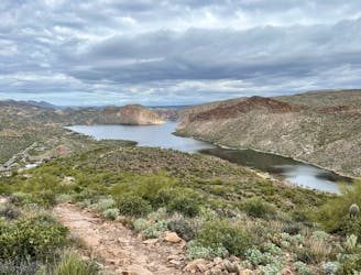
A steep, rocky hike to an incredible view into the Superstition Wilderness.
Difficult Hiking
- Distance
- 7 km
- Ascent
- 345 m
- Descent
- 345 m
Climb to one of the best views in the Superstitions, up a steep canyon with rock scrambling required.
Hiking Severe

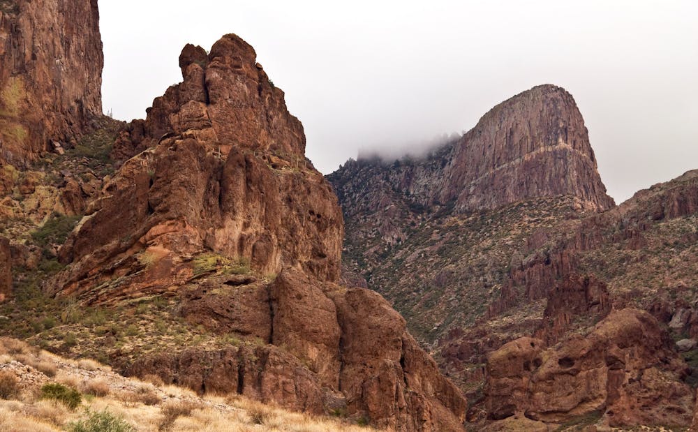
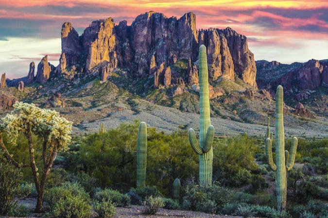
The Flatiron is an iconic summit of the Superstition Mountains, located at the western bound of the range. It’s one of the craggy formations so prominent above Lost Dutchman State Park. From a distance the vertical cliffs seem impassable, but one weakness allows passage. That is Siphon Draw, a steep canyon of water-worn rock in the mountain’s west side.
Siphon Draw Trail begins in Lost Dutchman State Park. The first two miles are somewhat steep and rocky, climbing through open desert to a basin at the foot of the mountain, with the Flatiron looming overhead. A sign marks the entrance to the Superstition Wilderness and the end of the maintained trail. This is where the real climb begins.
If you feel tired or overheated at this point, or are low on water, turn around. The views from the basin are a reward all their own, and the rigorous canyon above is not worth putting yourself in danger. Only if you feel fit and prepared, proceed on the unmaintained trail up into Siphon Draw.
What follows is nearly 2,000 vertical feet of steep hiking and rock scrambling, practically straight up the narrow drainage to the top of the mountain. At times the surface is solid-rock bowls and gullies carved smoothly by water. In other places it’s loose rock or large boulders. Eventually you’ll exit the canyon and emerge at a saddle surrounded by rocky pinnacles, with the prow of the flatiron now at eye level. Continue across it’s flat summit to reach the proud overlook, and enjoy your hard-earned panorama over all of the Phoenix Valley.
The best way to tackle Siphon Draw is to camp in Lost Dutchman State Park. Beginning in the campground makes the hike a bit shorter, and makes it easier to start early and beat the heat. On all but the coolest winter days, it’s best to be safely returned from this sunny hike before midday. No water and very little shade can be found along the trail.
Sources: https://www.fs.usda.gov/recarea/tonto/null/recarea?recid=35451&actid=50 https://d2umhuunwbec1r.cloudfront.net/gallery/0004/0024/BDAB3BF6CA6B4814BA32AE0F967598F2/LODUParkMapFall2018B&WFINAL01.pdf
Severe
Hiking challenging trails where simple scrambling, with the occasional use of the hands, is a distinct possibility. The trails are often filled with all manner of obstacles both small and large, and the hills are very steep. Obstacles and challenges are often unexpected and can be unpredictable.

Some trail sections have exposed ledges or steep ascents/descents where falling could cause serious injury.
Little chance of being seen or helped in case of an accident.
9.9 km away
A steep, rocky hike to an incredible view into the Superstition Wilderness.
Difficult Hiking
16 routes · Hiking