7.3 km away
Gateway Loop
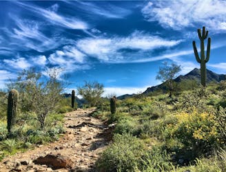
The Gateway Loop is the gateway to the incredible hiking in the McDowell Sonoran Preserve.
Moderate Hiking
- Distance
- 7.2 km
- Ascent
- 218 m
- Descent
- 219 m
This popular hike leads to a unique rock formation at the summit.
Hiking Difficult

Tom's Thumb is one of the most famous hikes in the greater Phoenix area. Located in the McDowell Mountain Range above Scottsdale, this unique formation looks like a thumbs-up sign on top of the mountain.


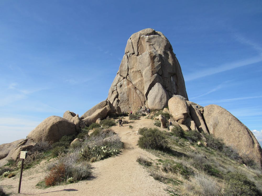
The hike to the top is regarded as a difficult climb due to its steep 1,250 feet of climbing in just 2 miles. While parts of the climb can be rocky and chunky, this hike still doesn't require any scrambling or technical climbing skills, thus only earning it a FATMAP "Difficult" technicality rating.
That said, some of the rock formations on the mountainside are popular with rock climbers, so it's not unusual to see climbers ascending the trail, heavily loaded down with their climbing gear.
Sources: https://modernhiker.com/hike/toms-thumb/ https://www.travelbybrit.com/toms-thumb-hiking-trail/
Difficult
Hiking trails where obstacles such as rocks or roots are prevalent. Some obstacles can require care to step over or around. At times, the trail can be worn and eroded. The grade of the trail is generally quite steep, and can often lead to strenuous hiking.

The trail contains some obstacles such as outcroppings and rock which could cause injury.
Away from help but easily accessed.
7.3 km away
The Gateway Loop is the gateway to the incredible hiking in the McDowell Sonoran Preserve.
Moderate Hiking

16 routes · Hiking