626 m away
Telephone Trail

This short, steep route is a rare Sedona hike providing solitude.
Severe Hiking
- Distance
- 3.7 km
- Ascent
- 332 m
- Descent
- 332 m

The West Fork Trail of Oak Creek is well-removed from the city center of Sedona, yet many people still regard it as one of the best hikes and trail runs in the region!

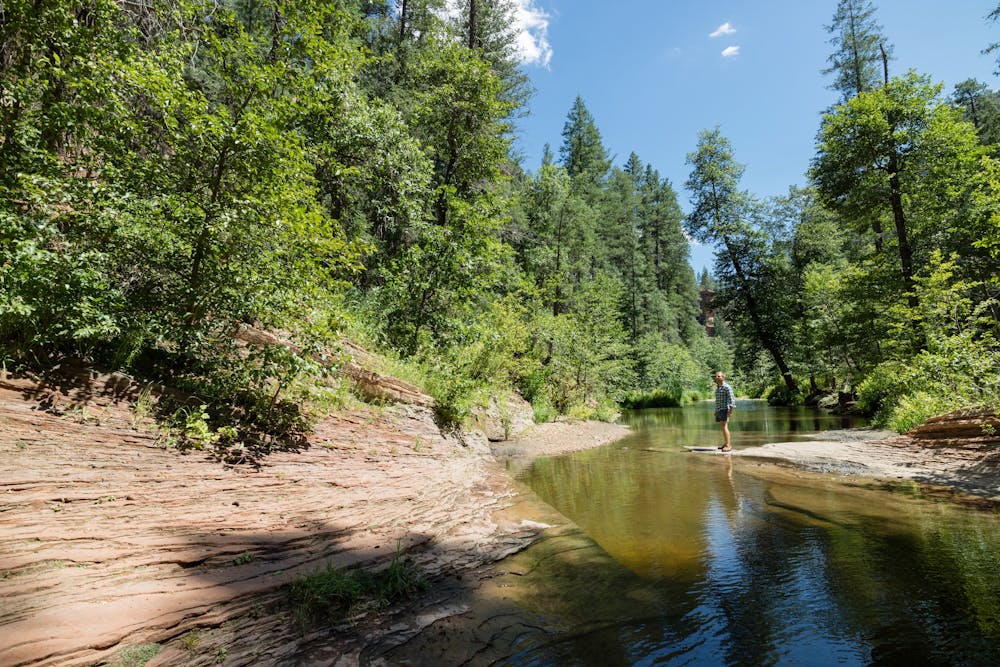
This route follows the path of the creek, which "flows through a deep, forested canyon, quite narrow in places, with many pretty eroded rock formations and plentiful wildlife," according to AmerianSouthwest.net. The trail crosses the shallow stream numerous times over this 9-mile round trip, guaranteeing you'll get wet feet. Consequently, this hike is best done in warm weather.
One highlight of the route is a short slot canyon section, requiring you to wade through the water to reach the other side.
Sources: https://www.americansouthwest.net/arizona/sedona/westoakcreek.html https://wherearethosemorgans.com/west-fork-trail-sedona-az/
Moderate
Hiking along trails with some uneven terrain and small hills. Small rocks and roots may be present.

The path is on completely flat land and potential injury is limited to falling over.

Little chance of being seen or helped in case of an accident.
626 m away
This short, steep route is a rare Sedona hike providing solitude.
Severe Hiking
6 km away

A lightly-populated Sedona route that's a must-do hike in the fall.
Severe Hiking
7.3 km away

A view-heavy hike to the highest point in the Sedona area
Difficult Hiking

14 routes · Hiking