5.1 km away
Flagstaff Loop
An ever-evolving and ultimate circuit of Flagstaff via trails, roads, and urban pathways.
Moderate Trail Running
- Distance
- 72 km
- Ascent
- 1.1 km
- Descent
- 1.1 km
A long run linking Elden and Little Elden just minutes from town.
Trail Running Difficult

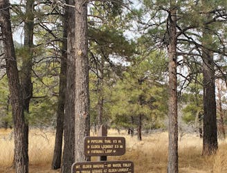
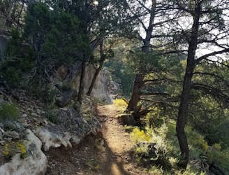
This circuit links Elden Mountain and Little Elden Mountain for an epic and rewarding adventure run that's just under 13 miles. From the summit of Mount Elden, you'll enjoy 360-degree views beneath a series of transmission towers and an inactive fire tower, and less than 200-feet below, Little Elden offers equally impressive views. While the trails near the trailhead can tend to be busy due to their popularity, chances are you will have most of this run to yourself.
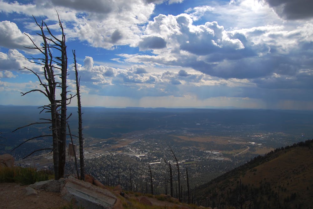
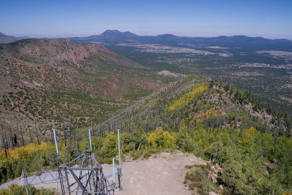
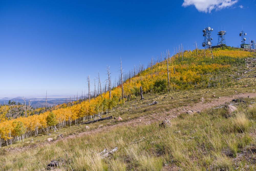
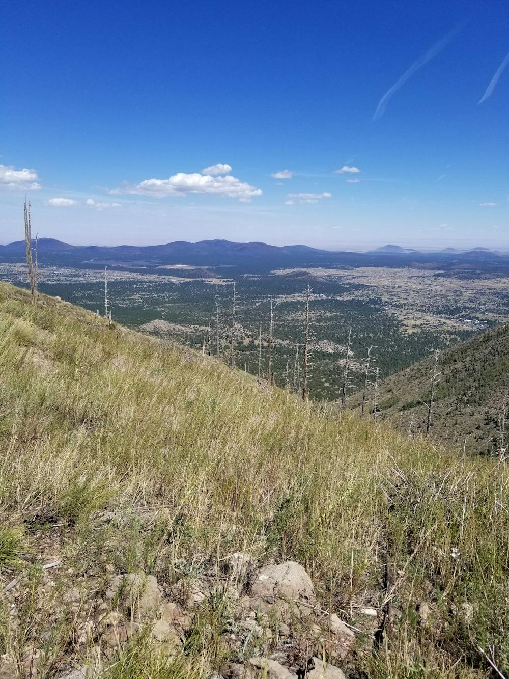
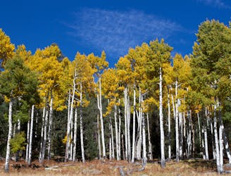
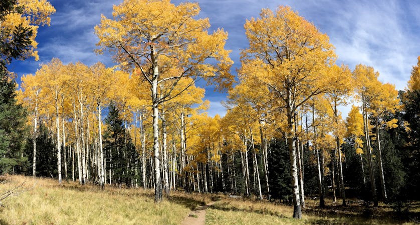
Best enjoyed clockwise, you'll experience a variety of flora and fauna such as juniper, pinyon, and ponderosa at the lower elevations, plus cactus that seems a bit out of place in the cooler high-mountain climates. Higher elevations can yield aspen and pine, and remnants of historic fires can still be witnessed along portions of the trail. While challenging overall, the views between the two summits along the Sunset Trail are spectacular if you can plan your run around dusk or dawn.
According to this source, the peak was named in honor of John Elden, "an early settler who arrived in the area in 1875," just prior to the founding of Flagstaff. "In 1887, his son was shot and killed, apparently as part of a dispute over the use of water at a nearby spring," of whom Elden Spring was then named after. His son's gravesite is not far from the spring, though the family ultimately relocated to California following the incident.
As this area can be popular during the warmer months, it's best to get an early start to avoid the crowds hiking the trails along the base of the mountain. The trailhead is located off of Highway 89 across from the mall and next to the Ranger Station but there are no restrooms or drinking water. There are plenty of opportunities nearby to get either, however.
Sources: https://www.grandcanyontrust.org/hikes/elden-lookout-trail https://www.fs.usda.gov/recarea/coconino/recarea/?recid=55140 https://hikearizona.com/decoder.php?ZTN=217
Difficult

Some trail sections have exposed ledges or steep ascents/descents where falling could cause serious injury.
Little chance of being seen or helped in case of an accident.
5.1 km away
An ever-evolving and ultimate circuit of Flagstaff via trails, roads, and urban pathways.
Moderate Trail Running
7 km away
A long trail run with multiple viewpoints looking into the beautiful Walnut Canyon.
Moderate Trail Running
7.6 km away
A long and wild trail run alongside some of Arizona's highest peaks.
Difficult Trail Running
10 routes · Trail Running