66 m away
Pima East & West Loops
A short trail run originating from the Pima Canyon Trailhead.
Moderate Trail Running
- Distance
- 4.3 km
- Ascent
- 82 m
- Descent
- 82 m
A comprehensive trail running route on the eastern portion of South Mountain.
Trail Running Difficult

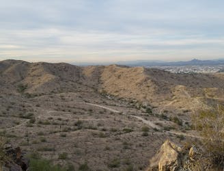
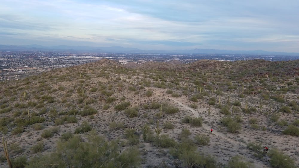
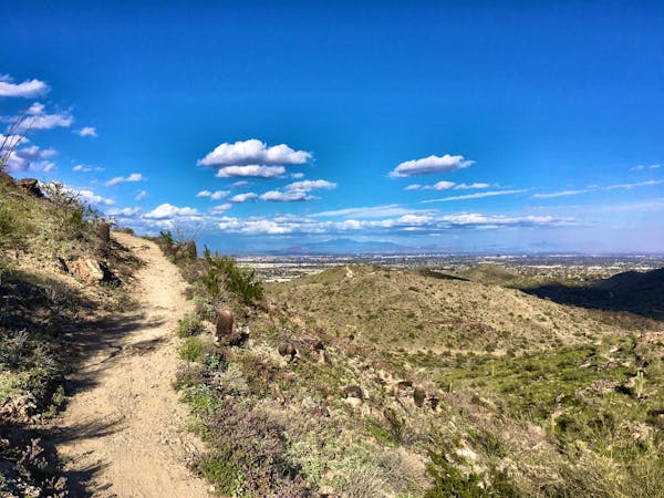
South Mountain Park holds the title of largest municipal park in United States, and this is the perfect route to explore its eastern half. Countless intersections and connecting trails make this trail network hard to follow, so stick close to this route to experience some of the best singletrack Phoenix has to offer.

We suggest running this loop clockwise from the Pima Trailhead, where a newer pavilion provides drinking water, restrooms, and a large parking area to accommodate the busy weekends.
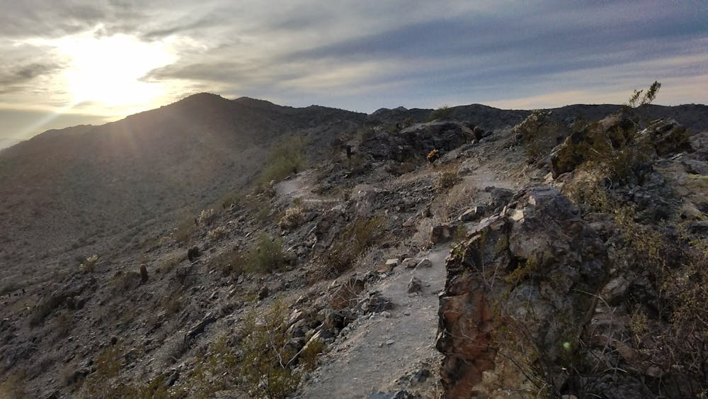
The route begins with a grueling climb up Marcos de Niza Trail. Three high points provide fantastic views, which are even better at dusk or dawn - should you be able to plan your run around that. For an easier warm-up, stick to the doubletrack that leads into the canyon.
The next portion of the route follows what many refer to as the Mormon/National Loop. Extremely popular among mountain bikers, this section includes some intense climbing as the trail leads up to the crest of the ridge.
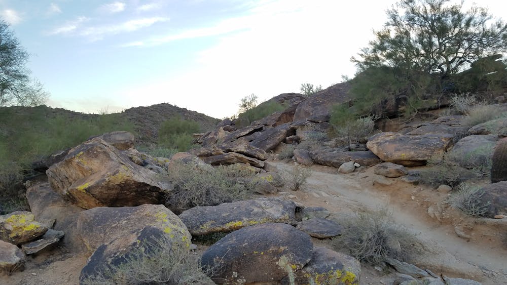
Though it can be bypassed with ease, a trip to Hidden Valley is a must. Included in this route, you get to pass through a natural rock tunnel atop the ridge. Fat Man's Pass lies ahead, a memorable and picturesque passage through a field of massive boulders.
The return trip follows Mormon Trail to Javelina Trail, a steady, mostly downhill route to the northeast corner of the range. Beverly Canyon, paired with the Pima West Loop, connect back to the trailhead to finish. Several connecting trails pass through here, but do not be afraid to explore. At the most, you're within one mile of the trailhead.
Sources: https://en.wikipedia.org/wiki/SouthMountainPark http://www.arizonahikersguide.com/all-hikes/hike-hidden-valley-trail-south-mountain
Difficult

Some trail sections have exposed ledges or steep ascents/descents where falling could cause serious injury.

Away from help but easily accessed.
66 m away
A short trail run originating from the Pima Canyon Trailhead.
Moderate Trail Running
9 routes · Trail Running