Ouachita National Recreation Trail
An epic point-to-point trail in the Ouachita Mountains.
Also in Oklahoma, United States of America
Hiking Difficult
- Distance
- 317 km
- Ascent
- 7 km
- Descent
- 7.3 km
- Duration
- 1 day +
- Low Point
- 86 m
- High Point
- 799 m
- Gradient
- 4˚

The Ouachita National Recreation Trail “is the longest trail in the Ouachita National Forest spanning 192 miles across its entire length,” according to the USFS. An additional ~32 miles of trail on private land brings the entire trail length up to about 223 miles in total. While most of the trail is in Arkansas, 46 miles of the trail extends over the border into Oklahoma.
Description
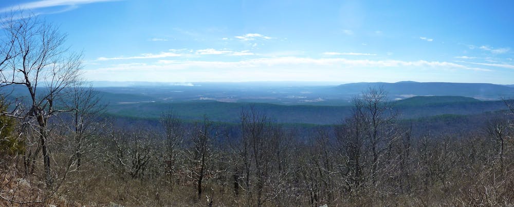
This epic backpacking route is extremely remote and little-traveled. You could easily spend hours, if not days, hiking the Ouachita NRT without seeing another human being! "In a ranking of U.S. long-distance trails on a number of criteria by Backpacker Magazine, the trail ranked third for solitude3 and fourth for signage," says Wikipedia.
This solitude is largely due to backpackers choosing to head to more famous trails, such as the Appalachian Trail, for their epic multi-day. Oklahoma and Arkansas? Not such a hot backpacking destination.
"While the heartland of America is usually dismissed as coffee-table flat, rather than coffee-table-book pretty, the Ouachita Mountains, which form the spine of this east-west trail and undulate from 600 to 2,600 feet in elevation, deny the stereotype," write Taryn Jory and Andy Dappen for Backpacker Magazine. "The rolling mountains and valleys, smothered with oak, hickory, maple, and pine, are carved by cobbled creeks and capped with the occasional sandstone rooster comb. This is a place that will win you over with its subtle beauty, not with its grandeur."
Difficulty
Difficult
Hiking trails where obstacles such as rocks or roots are prevalent. Some obstacles can require care to step over or around. At times, the trail can be worn and eroded. The grade of the trail is generally quite steep, and can often lead to strenuous hiking.
Low Exposure

The path is on completely flat land and potential injury is limited to falling over.
Remoteness

In the high mountains or remote conditions, all individuals must be completely autonomous in every situation.
Best time to visit
Features
- Forestry or heavy vegetation