9.6 km away
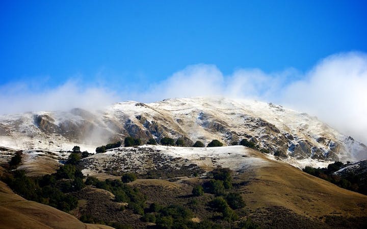
Cataract Falls from Alpine Lake
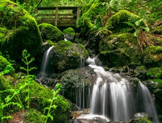
A bounty of waterfalls and a peaceful picnic area on Cataract Creek.
Difficult Hiking
- Distance
- 4.5 km
- Ascent
- 340 m
- Descent
- 341 m
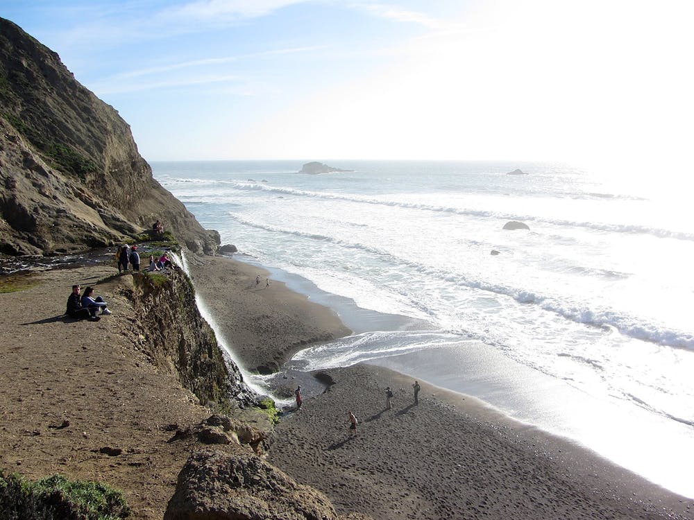
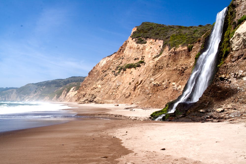
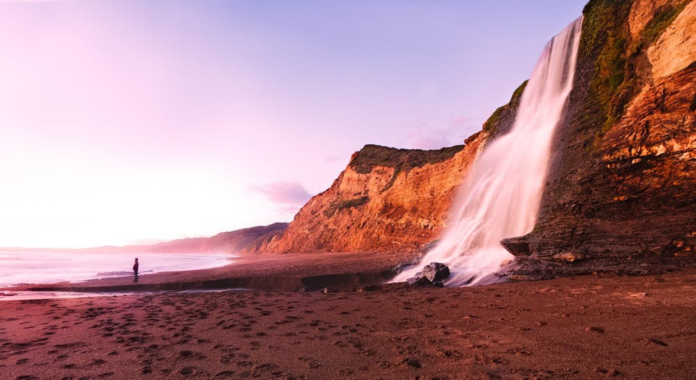
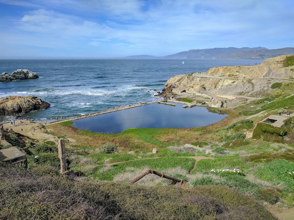
A waterfall dropping into the sea is the culmination of this wildly scenic, somewhat strenuous, and very popular hike.
Hiking Difficult

The Bay Area is rich in natural scenery, but waterfalls are not a common sight. Alamere Falls is one of the few, and it shatters all expectations. To call it the most spectacular in the Bay Area would be an understatement, because It’s one of the best waterfalls you’ll see anywhere. It’s a 40-footer that plummets over sea cliffs to a sandy beach and meets the ocean—one of only a few waterfalls in California that fall into the sea.
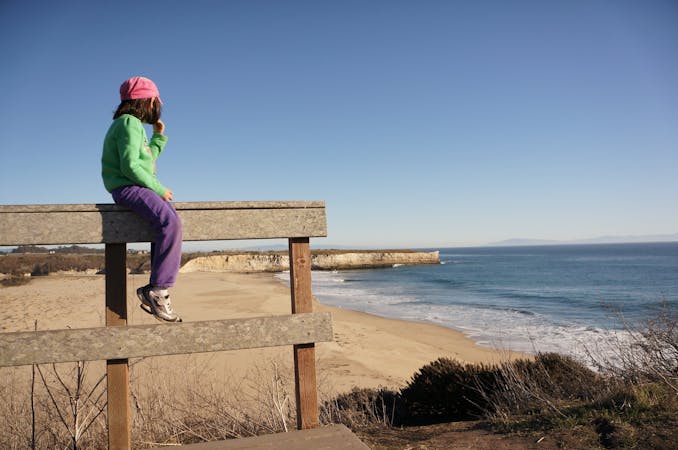
Alamere is remote and there’s no easy way to get there, yet it remains popular because of it’s fame and relative proximity to Bay Area cities. It is usually very crowded. If you can, visit on a weekday or get a very early start. Multiple trails in Point Reyes National Seashore lead to the falls, but the easiest and most scenic is from Palomarin Trailhead, which is the hike described here. Most of the road to get to Palomarin is paved. The last mile is bumpy dirt, but is passable for most cars in dry weather. The trailhead has toilets, but no water or other services. From there begins the dramatic hike to Alamere Falls.
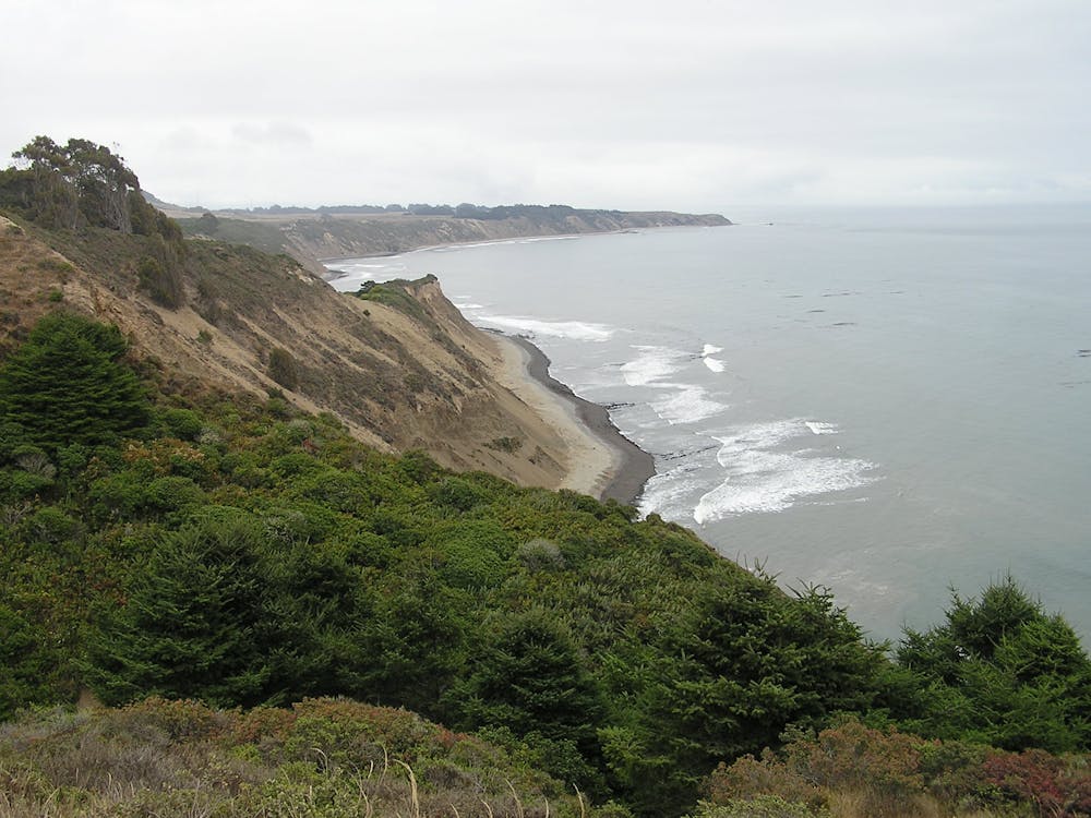
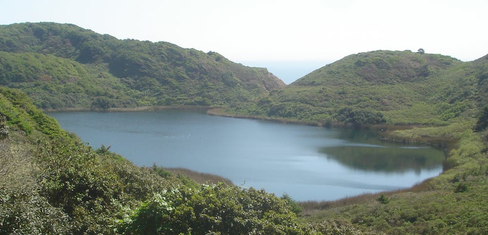
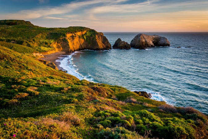
Take Palomarin Trail to Coast Trail, winding through lush coastal heather, wildflowers, and occasionally dense groves of pine—all atop tall bluffs that tumble to the ocean below. The trail then turns inland and enters a forested valley, passing a few small ponds before arriving at Bass Lake, which is the first of a few freshwater lakes you’ll find perched in these hills.
Next comes Pelican Lake where, from the right vantage point on a clear day, you can actually see the blue ocean horizon beyond green hills hemming the lake, all in one view. From there, the trail continues to meander along hillsides and through valleys. There are thick groves, carpets of ferns, open meadows, trickling creeks, and wide vistas to keep your eyes interested the whole way.
At Wildcat Camp is where you’ll meet the beach. You’ll also find a toilet and drinking water. Campsites can be reserved with a backcountry permit, so you can make this an overnight trip if you wish. From there begins the beautiful beachwalk between cliffs and surf to reach the falls. This part of the hike is only safe during low tide, however, because high tide can reach the base of the bluffs and completely inundate the beach. You need to check the tides beforehand and be sure you can go one mile along the beach to Alamere Falls, and back, before high tide.
If the tides will not cooperate, there is another option. There’s a shortcut trail shortly after passing Pelican Lake, but it has its own risks. It’s an unofficial trail that cuts through highly eroded cliffs, and people often get injured attempting it. Only do it if you are comfortable with steep and loose rock scrambling, or if you get cut off by the tide at the falls and have no other choice.
The spectacle of Alamere Falls, and the nice beach surrounding it, are more than worth the trials to reach it. Keep in mind that the waterfall is only the halfway point, however. You’ll need to negotiate all the same terrain on the way back, and it won’t get any easier. The difficulty largely depends on conditions. On a warm, dry day with favorable tides, the hike is usually no problem, but if the weather turns quickly or if the tide is too high, it quickly becomes more serious. Even in nice weather, you may encounter mud, loose surfaces, and pools of water on the trail. Be sure to plan ahead and prepare properly. This hike is sure to be one you won’t forget.
Sources: https://www.nps.gov/pore/planyourvisit/alamerefalls.htm https://socalhiker.net/hiking-to-alamere-falls-in-point-reyes-national-seashore/
Difficult
Hiking trails where obstacles such as rocks or roots are prevalent. Some obstacles can require care to step over or around. At times, the trail can be worn and eroded. The grade of the trail is generally quite steep, and can often lead to strenuous hiking.

Some trail sections have exposed ledges or steep ascents/descents where falling could cause serious injury.

Away from help but easily accessed.
9.6 km away
A bounty of waterfalls and a peaceful picnic area on Cataract Creek.
Difficult Hiking
8 routes · Hiking
7 routes · Hiking
7 routes · Hiking

13 routes · Hiking · Trail Running
8 routes · Hiking · Road Biking