1.2 km away
Lower Doane Valley Loop
Pleasant stroll through diverse subalpine forest with a good chance of spotting wildlife.
Easy Hiking
- Distance
- 5.3 km
- Ascent
- 129 m
- Descent
- 129 m
Mountaintop views and colorful forest in a pleasantly cool, high-elevation corner of San Diego County.
Hiking Moderate
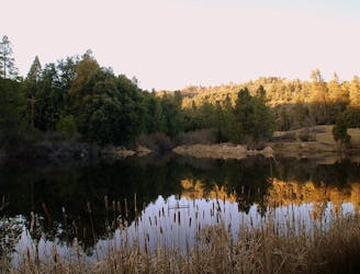
Palomar Mountain rises to more than 5,000 feet elevation in northern San Diego County, well above the parched deserts of the valley. The climate here is relatively wet and cool, even snowy in the winter. The mixed conifer forests and mountain meadows among Palomar’s high ridgelines enjoy a climate reminiscent of the Sierra Nevada, though much more accessible from San Diego.
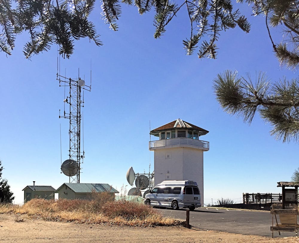
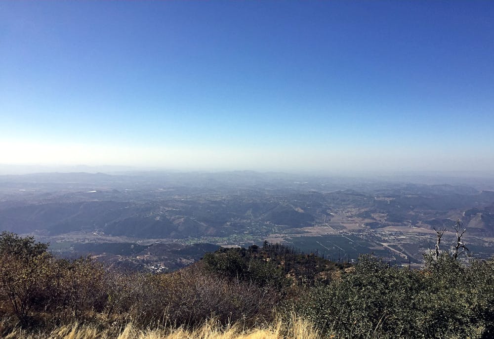
Boucher Hill is a summit on the mountain’s west side, and the tower on top is both a historic landmark and a functional lookout during fire season. Its interior is not normally open to the public, but views from its base are still impressive, extending over hills and valleys all the way to the ocean on a clear day.
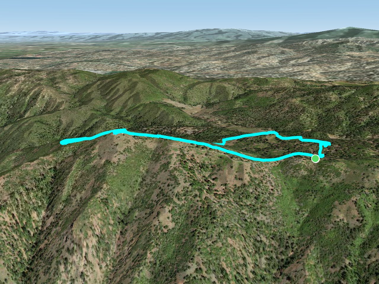
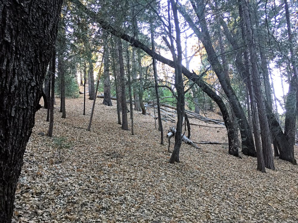
The hike described here is a loop within Palomar State Park that climbs to the lookout, descends through sunny forest into a fern-carpeted valley, then climbs a ridgeline past an old homestead site. The scenery changes with every season, though the park can sometimes close for snow in winter. Spring and summer are pleasant at this elevation, and the trail stays mostly under shady canopy. Bountiful deciduous trees like black oak and dogwood make a delightfully colorful fall hike. When they lose their leaves, you’ll get the best views of the year through clear, crisp air and bare branches. In any season you have a chance of spotting mule deer and other local wildlife.
The loop is good in either direction. As mapped it goes clockwise, climbing to the tower first. Begin from Silvercrest Picnic Area, walking a short distance west along the paved road to find the start of Boucher Lookout Trail. From the lookout, continue the loop by following the trail on the far side of the parking lot, which descends to Cedar Grove Campground. From there begins the climb up Thunder Ridge, which leads back to your car at Silvercrest.
Sources: https://www.parks.ca.gov/?pageid=637 http://www.parks.ca.gov/pages/637/files/palomarmountain.pdf https://modernhiker.com/hike/hiking-the-boucher-hill-loop-palomar-mountain-state-park/
Moderate
Hiking along trails with some uneven terrain and small hills. Small rocks and roots may be present.

The path is on completely flat land and potential injury is limited to falling over.

Away from help but easily accessed.
1.2 km away
Pleasant stroll through diverse subalpine forest with a good chance of spotting wildlife.
Easy Hiking
17 routes · Hiking