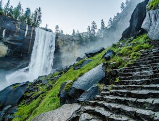
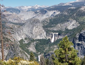
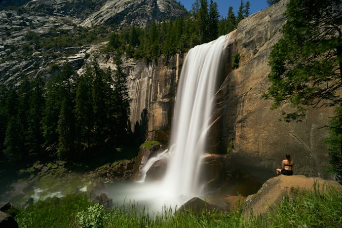
Vernal Fall and Nevada Fall Loop
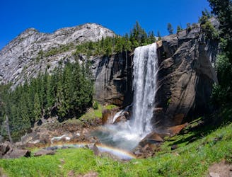
Connect two of Yosemite's great waterfalls in a concise but strenuous loop
Difficult Hiking
- Distance
- 11 km
- Ascent
- 740 m
- Descent
- 740 m
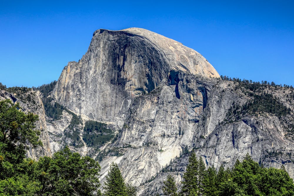
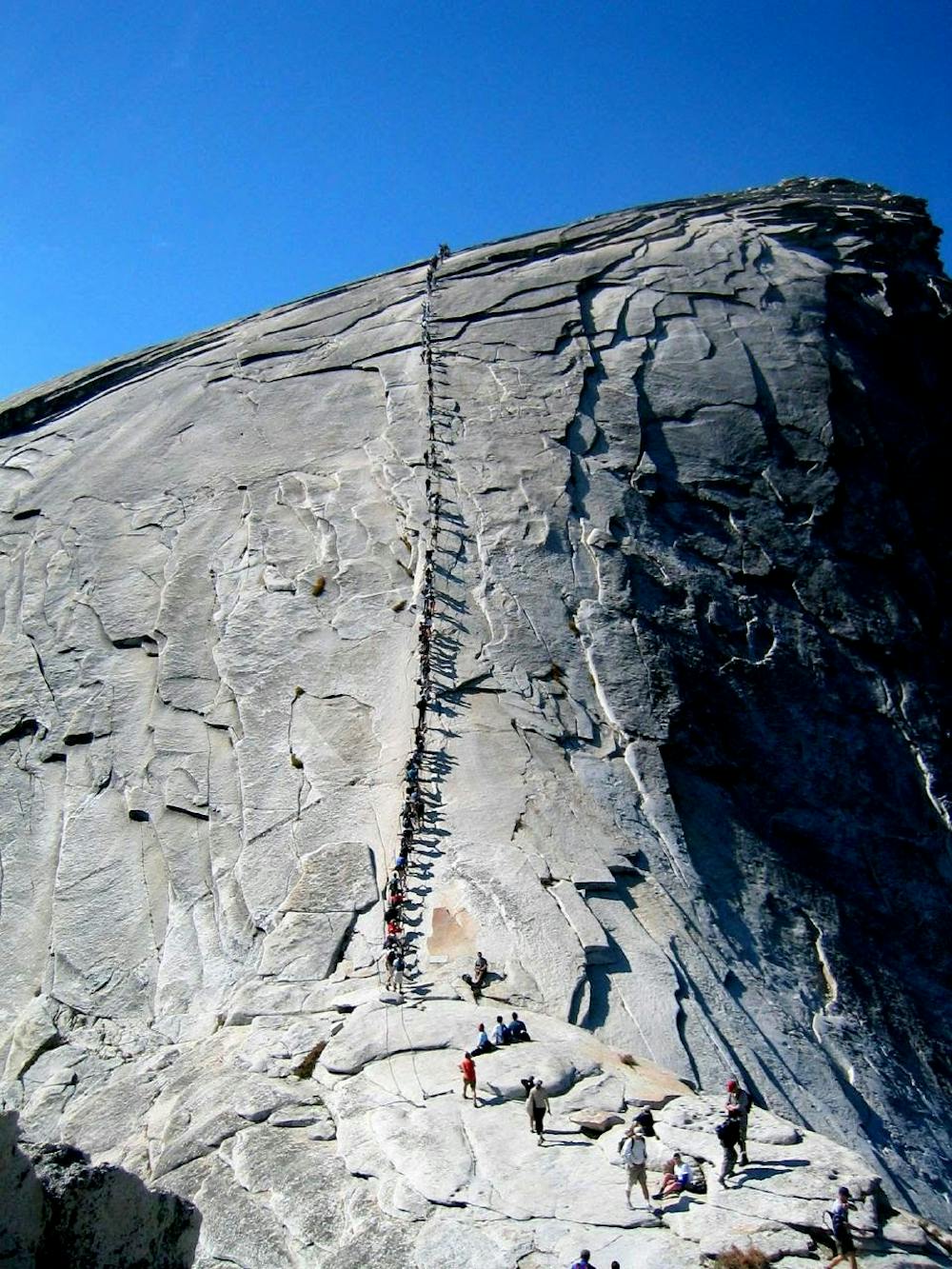
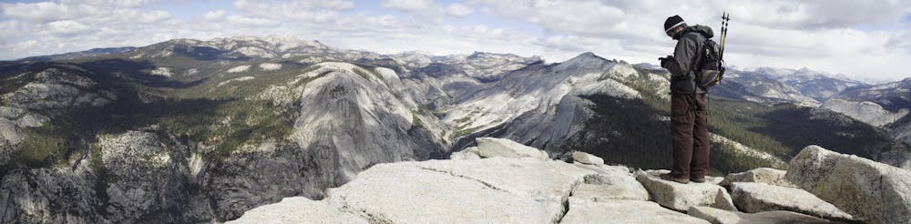
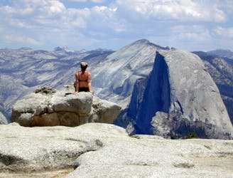
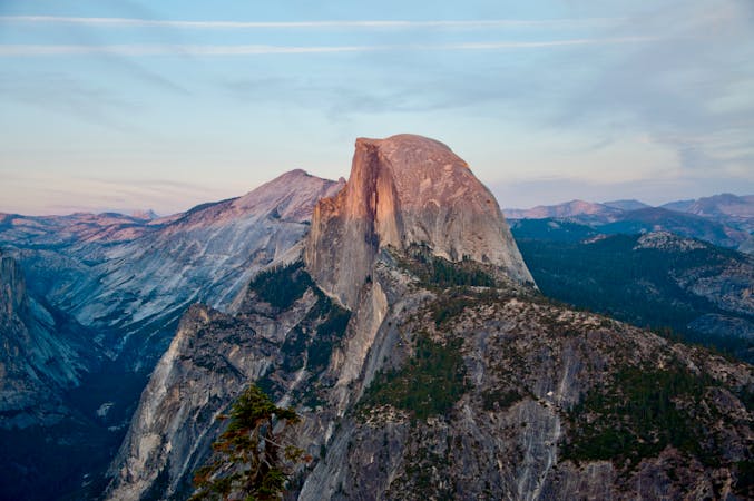
An exciting hike to the summit of one of North America's most iconic peaks.
Hiking Extreme

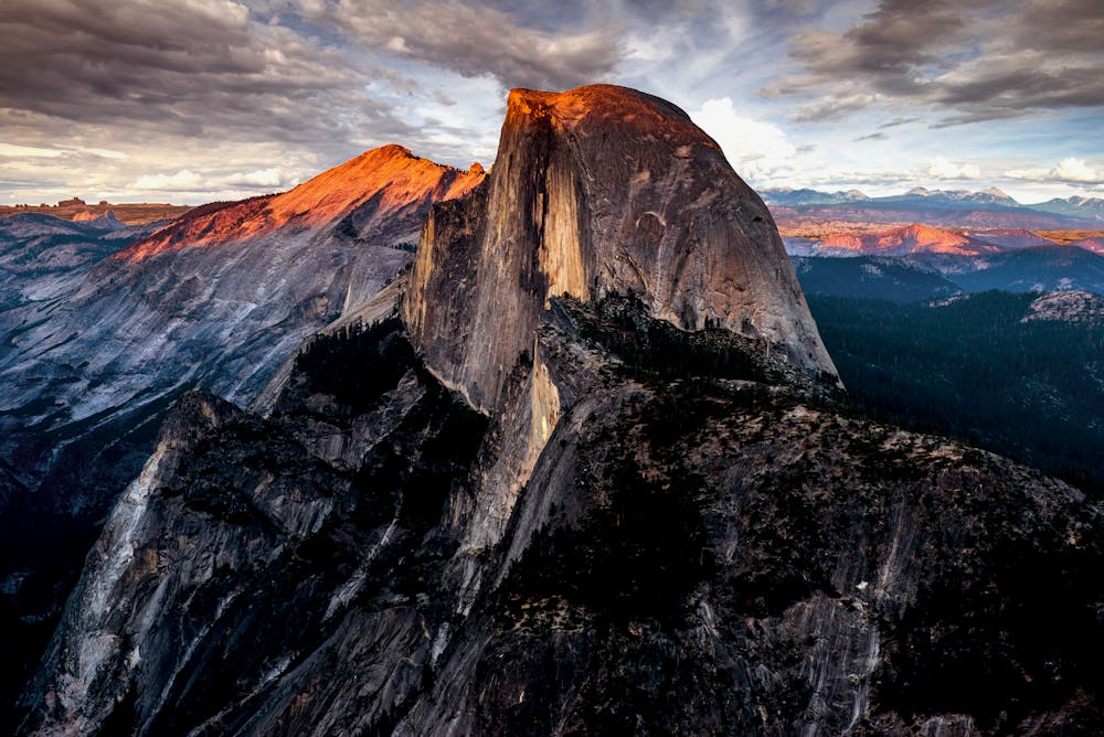
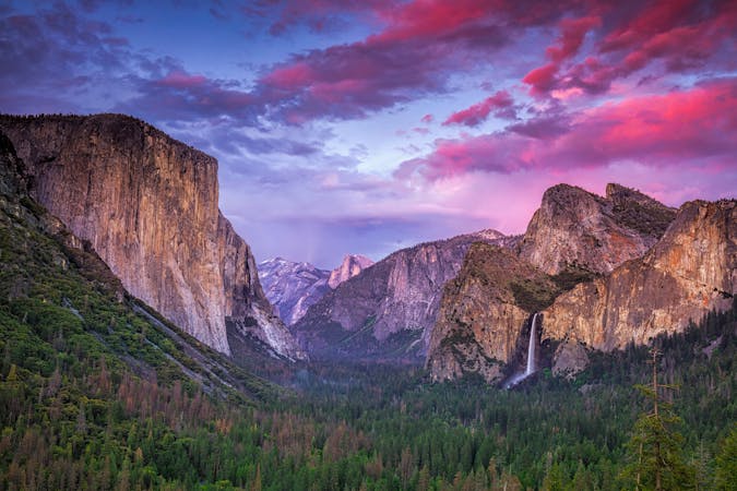
A truly spectacular peak, Half Dome is rightly revered as one Yosemite's great landmarks. It was first climbed in 1875 by George Anderson, despite being described in a report 10 years earlier as "perfectly inaccessible, being probably the only one of the prominent points about the Yosemite which never has been, and never will be, trodden by human foot". Nowadays it is an attainable (but still tough) hike with a famous section of cables close to the summit. The hike is 14-16 miles long (depending on exactly how you do it) and gains 4800 feet in that time. Most hikers take 10 - 12 hours to complete the roundtrip having started at sunrise. The hike up is clear and well marked but 400 feet below the summit a series of cables begin. You will need to haul yourself up these (although there is a wooden walkway underfoot to help you grip) to reach the very top. The cables are not very steep but concentration is still required if you are to stay safe while climbing them. Once at the top of the cables, take in the extraordinary panorama across one of the Country's best known and most dramatic valleys. There is also the option to crawl to the edge of the 2000 feet high north-west face and peer down it, but only if you have a head for heights! Descend back down the same route to the valley floor.


Extreme
Scrambling up mountains and along technical trails with moderate fall exposure. Handholds are necessary to navigate the trail in its entirety, although they are not necessary at all times. Some obstacles can be very large and difficult to navigate, and the grades can often be near-vertical. The challenge of the trail and the steepness of the grade results in very strenuous hiking. Hikes of this difficulty blur the lines between "hiking" and "climbing".

Some trail sections are extremely exposed where falling will almost certainly result in serious injury or death.

Away from help but easily accessed.
Connect two of Yosemite's great waterfalls in a concise but strenuous loop
Difficult Hiking
2 m away
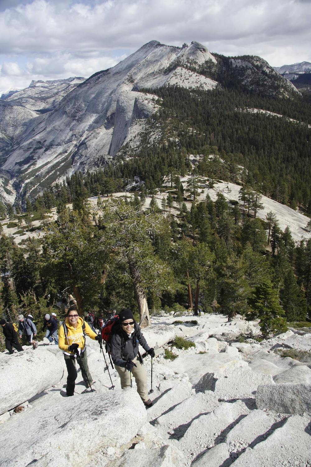
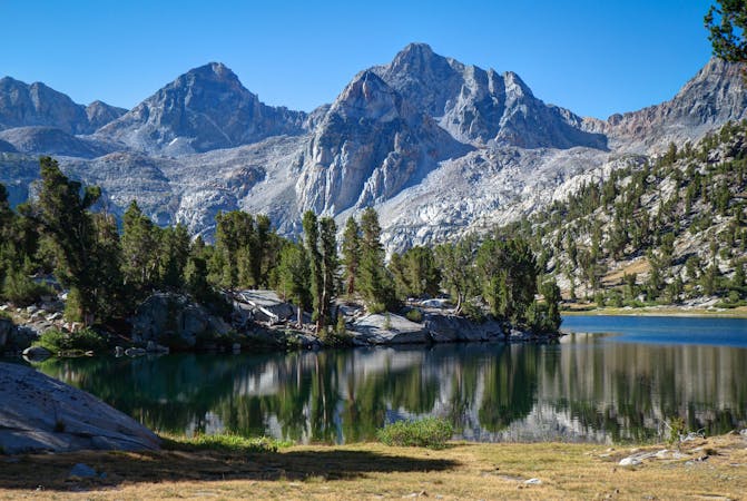
Thru hike of the California’s Sierra Nevada, linking the most impressive alpine scenery from Yosemite National Park to Mount Whitney.
Difficult Hiking
28 m away
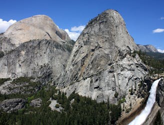
A stunning hike up steep climbs, passing close to Vernal and Nevada Falls.
Difficult Hiking
1.1 km away
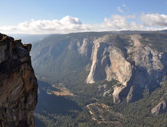
Hike at the brink of a huge waterfall and along the precipitous rim of Yosemite Valley.
Difficult Hiking
3.1 km away
A hike through the forest to a panoramic viewpoint over Yosemite Valley.
Easy Hiking
3.1 km away
Birds-eye view of the Valley atop one of Yosemite's higher granite domes.
Moderate Hiking
3.2 km away
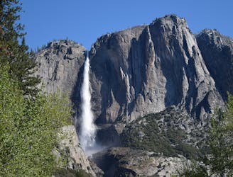
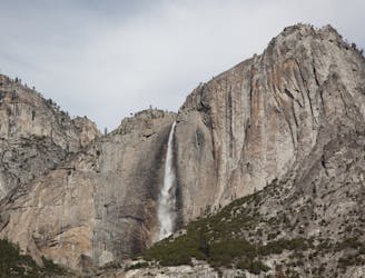
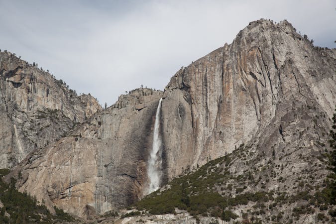
Steep hike to the top of North America's tallest waterfall.
Difficult Hiking
3.2 km away
Make the arduous climb to Upper Yosemite Falls, then go even farther to find the highest point on this side of Yosemite Valley.
Difficult Hiking
7.7 km away
Paved trail to the base of a 620-foot waterfall.
Easy Hiking
8.1 km away
Forest hike to the rim of Yosemite Valley at one of its greatest viewpoints
Moderate Hiking
13 routes · Hiking
6 routes · Hiking · Road Biking
7 routes · Hiking
9 routes · Hiking

25 routes · Alpine Climbing · Hiking

5 routes · Alpine Climbing · Hiking
7 routes · Hiking

63 routes · Alpine Climbing · Hiking