4.9 km away
Mount Woodson Trail to Potato Chip Rock
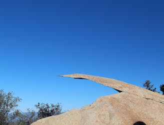
Photo-famous rock formation and expansive views atop Mount Woodson
Difficult Hiking
- Distance
- 11 km
- Ascent
- 605 m
- Descent
- 606 m
Popular hike to a great view on one of San Diego's favorite local mountains.
Hiking Moderate

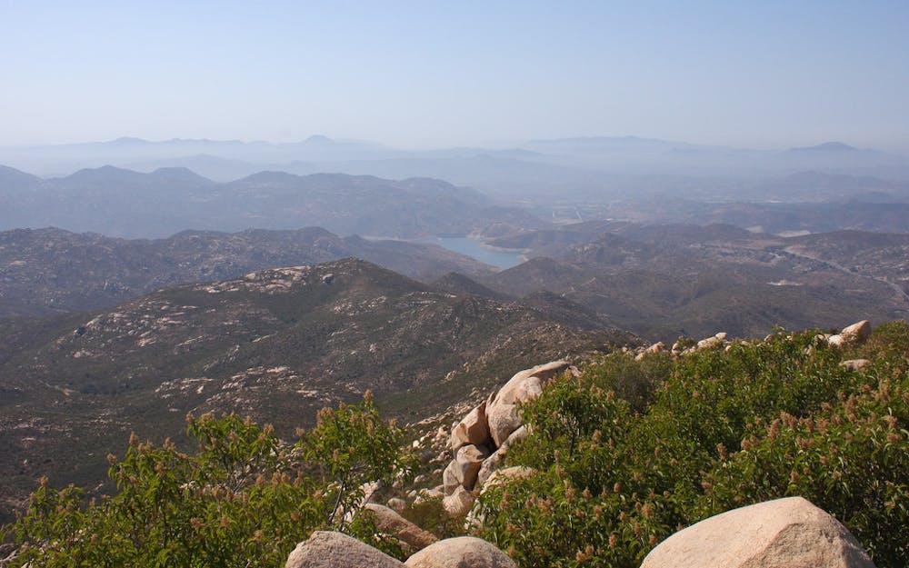
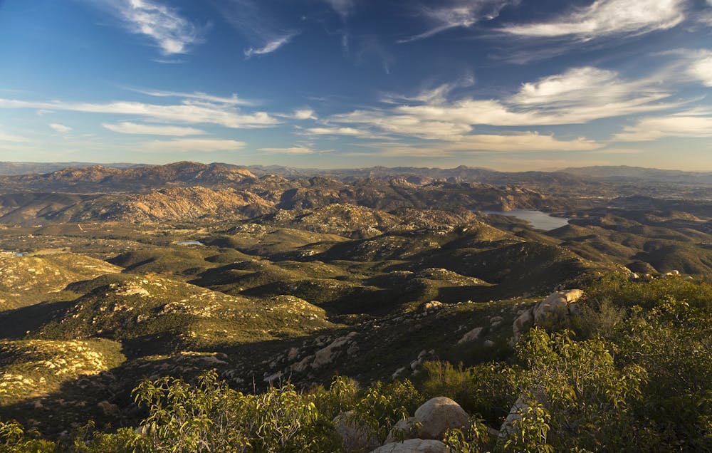
Iron Mountain is one of San Diego’s favorite local hikes. It’s an easy trip from the city and a moderately-challenging jaunt to the top of a panoramic peak. It’s a casual workout for some and a significant accomplishment for others, depending on fitness level.
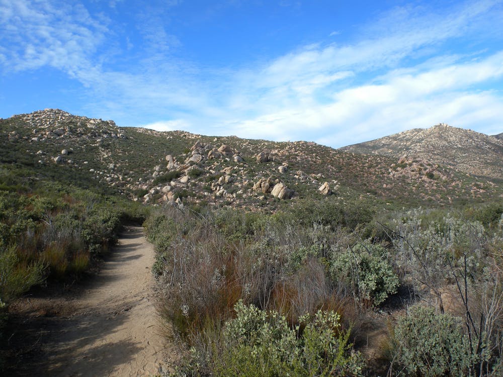
The trail gives a somewhat showy sendoff; it passes beneath a ranch-style archway that says “Iron Mountain,” then a tunnel of planted shade trees. From there it proceeds with no further fanfare, however, in a straight-cut path across open sagebrush meadows with the mountain in plain sight.
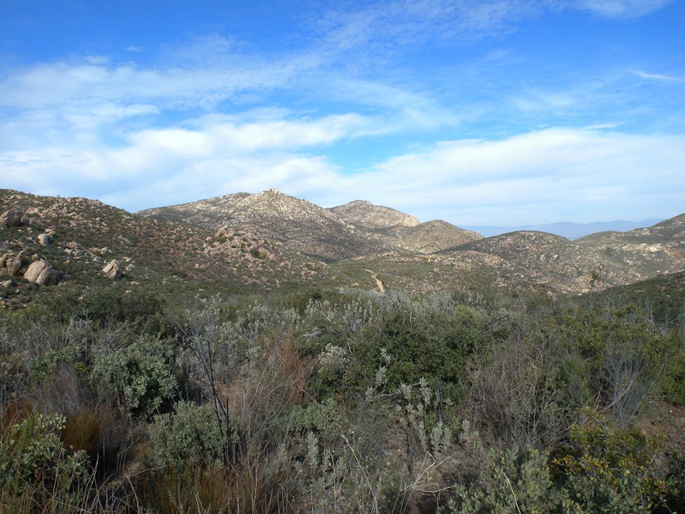
The incline is very gradual at first, but when the straightaway ends it suddenly becomes much rockier and steeper. For the rest of the ascent, the trail alternates between rougher and gentler sections as it switchbacks up the mountain. Views grow more expansive as you climb, and you’ll notice many picturesque formations in the granite boulders scattered around.
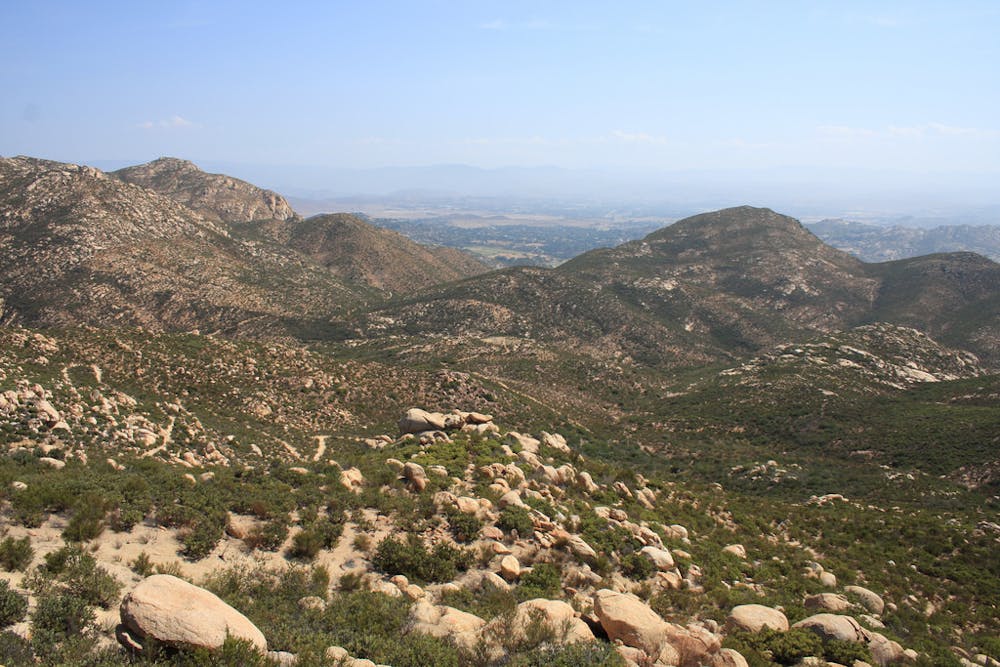
The summit grants views in all directions. To the north is Mt. Woodson, with its signal towers on top. To the south lies San Vicente Reservoir and El Cajon Mountain. In the east, you can see the Cuyamaca Mountains. To the west is Black Mountain, and on a clear day, you can see the Pacific beyond.
This hike is very popular, and though the parking lot is large, it tends to fill up on weekends. Try to get here early, to beat both the crowds and the heat. There is almost no shade on this hike.
Sources: http://hikingsdcounty.com/iron-mountain/ http://www.ihikesandiego.com/iron-mountain-hike/
Moderate
Hiking along trails with some uneven terrain and small hills. Small rocks and roots may be present.

The trail contains some obstacles such as outcroppings and rock which could cause injury.

Close to help in case of emergency.
4.9 km away
Photo-famous rock formation and expansive views atop Mount Woodson
Difficult Hiking
17 routes · Hiking