1.5 km away
Smith Lake

One of the quickest lake hikes in the Lakes Basin.
Moderate Hiking
- Distance
- 3.3 km
- Ascent
- 109 m
- Descent
- 109 m
Challenging hike in the Lakes Basin.
Hiking Severe

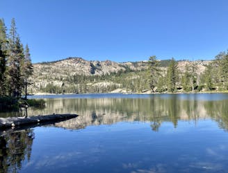
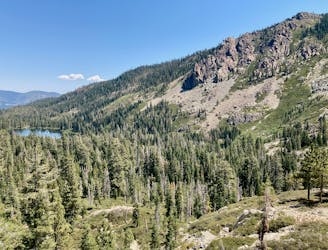
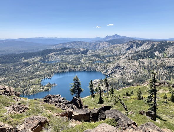
The Lakes Basin region offers an unexpected haven filled with beautiful recreation and views, deep in the Sierras. This basin is filled with crystal-clear alpine lakes flanked by towering walls of granite. The exposed rock walls rise up to form towering mountains, with the spine of the Sierras soaring high above the entire milieu.
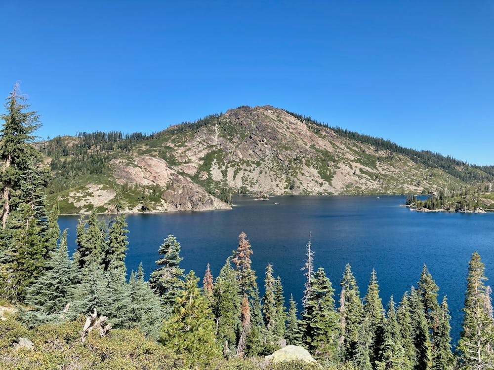
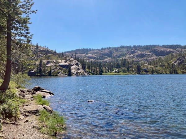
The lollipop loop mapped here circumnavigating Long Lake is one of the longer lake hike options in the Lakes Basin Area. While you can access Long Lake from a variety of trails, the route mapped here begins directly off of Gold Lake Highway.
The hike begins by descending through dry terrain into a lush, verdant valley. Then, you’ll slowly hike up the valley floor before turning right to work up the side of the valley, making for Long Lake.
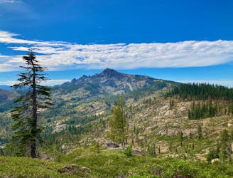
This route loops around the entirety of the lake, including portions of singletrack that skirt the flanks of Mt. Elwell. You’ll also swing by the shores of Silver Lake along this before returning to Long Lake. Once done with the circumnavigation, you'll retrace your steps back to your car.
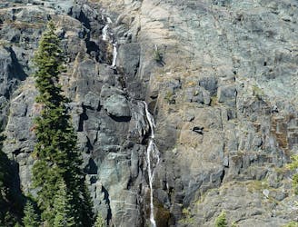
In addition to the almost 7 miles of hiking and over 1,800 feet of climbing, the trail tread itself makes this hike quite challenging. The trails in the Lakes Basin are generally very rocky and filled with boulders. While the path before you is always clear, the trail tread is filled with rock gardens, rock steps, boulders, roots, and all manner of roughness. While you won’t find any serious scrambling or mountaineering, you must be prepared to travel on a little-maintained backcountry trail. Of special note, the section of singletrack that ascends partway up the flanks of Mt. Elwell can be challenging and sometimes a little overgrown.
Severe
Hiking challenging trails where simple scrambling, with the occasional use of the hands, is a distinct possibility. The trails are often filled with all manner of obstacles both small and large, and the hills are very steep. Obstacles and challenges are often unexpected and can be unpredictable.

The trail contains some obstacles such as outcroppings and rock which could cause injury.

Little chance of being seen or helped in case of an accident.
1.5 km away
One of the quickest lake hikes in the Lakes Basin.
Moderate Hiking
1.5 km away
One of the most popular sights in the Lakes Basin.
Easy Hiking
2.2 km away
Dip your toes into Lakes Basin hiking!
Difficult Hiking
2.2 km away
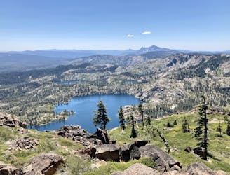
Gain stunning views above the Lakes Basin area from the summit of Mt. Elwell.
Difficult Hiking
4.7 km away
Hike to a pair of sublime alpine lakes in a rocky amphitheater.
Difficult Hiking
9.8 km away
A stunning hike on the Pacific Crest Trail and the spine of the Sierras.
Difficult Hiking

5 routes · Hiking
7 routes · Hiking
4 routes · Hiking · Stand Up Paddle