2 m away
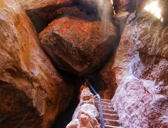
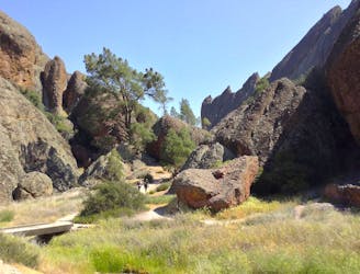
Bear Gulch Cave
One of the most popular hikes in Pinnacles National Park
Moderate Hiking
- Distance
- 2.3 km
- Ascent
- 112 m
- Descent
- 112 m
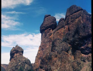
The highest peak in Pinnacles National Park, rising to a height of 3,306 feet above sea level.
Hiking Difficult

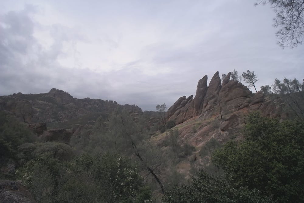
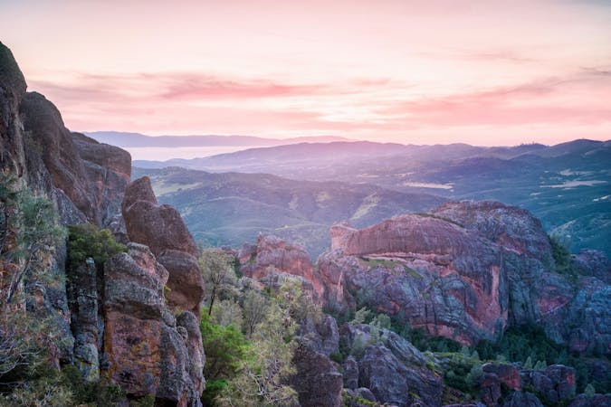
North Chalone Peak is the highest peak in Pinnacles National Park, rising to a height of 3,306 feet above sea level. You'll gain respectable views of the eponymous rock pinnacles even from this modest height. You can even see "the back of the Big Sur range and the range before you reach the Fresno Valley," according to SummitPost.org. On a clear day, you may even be able to spot Mount Diablo and even the Sierras.
As peak hikes go, this climb is relatively non-technical. The trail is well-maintained, and in places, the path has even been graveled for easy hiking. However, some sections can get quite steep, and at almost 8 miles round-trip, it's quite a respectable day hike.
The hike begins on the popular route to the Bear Gulch Cave. The cave is one of the highlights of this route, so be sure to bring a flashlight or headlamp! While "a few shafts of light slip through the boulder ceiling, other areas are pitch black," according to HikesPeak.com. Bear Gulch Creek also runs through the cave, "tumbling over rocks, and adding a rich sound to the dark passageway. Follow the trail up steps and across metal scaffolding to progress out of the talus cave and back into the daylight."
However, the NPS sometimes closes the cave to protect the bats that live there, so be sure to check with a ranger before heading into the cave. If the cave is closed, you can use the nearby Moses Spring Trail to bypass it and continue on toward the peak.
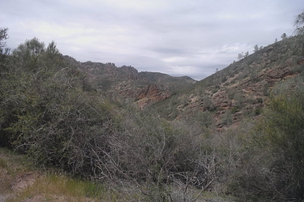
After you climb out of the canyon, you will crest a couple of ridges before reaching the major ridge that eventually leads to the summit. The rest of the hike will follow this main upper ridge, providing expansive views off the sides for the duration of your hike.
Once done at the top, the return to your car follows the same route that you climbed. Or, if you're feeling especially spry, you could add on some bonus miles by continuing on to tag the summit of South Chalone Peak as well. However, note that you'll have to return to North Chalone and descend the same route back to your car—there is no convenient loop option available.
Difficult
Hiking trails where obstacles such as rocks or roots are prevalent. Some obstacles can require care to step over or around. At times, the trail can be worn and eroded. The grade of the trail is generally quite steep, and can often lead to strenuous hiking.

The trail contains some obstacles such as outcroppings and rock which could cause injury.

Little chance of being seen or helped in case of an accident.
2 m away
One of the most popular hikes in Pinnacles National Park
Moderate Hiking
129 m away
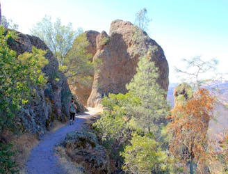
Exciting trail along the jagged backbone of the Pinnacles, with steep stairs and drop-offs protected by metal rails.
Difficult Hiking
2.8 km away
A main attraction of Pinnacles National Park is the Balconies Cave––a cool passageway beneath giant boulders jumbled in a deep canyon.
Moderate Hiking
2.8 km away
This lollipop loop provides a little-hiked and quite technical approach to the High Peaks in Pinnacles National Park.
Severe Hiking
5 routes · Hiking

63 routes · Alpine Climbing · Hiking