8.7 km away
Chocolate Peak and Lakes Loop
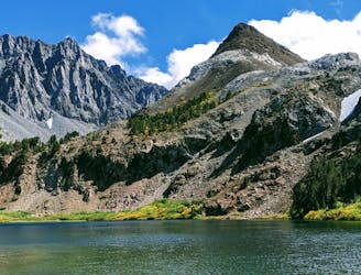
A linkup of lakes around a multicolored mountain, requiring mild scrambling and some route finding.
Moderate Hiking
- Distance
- 11 km
- Ascent
- 519 m
- Descent
- 519 m
Miles 831-857.7 of the northbound PCT: Climbing along lakes and falls to Muir Pass, rolling through sky-high meadows of Evolution Basin, then descending through yet another waterfall gorge of the central Sierra Nevada.
Hiking Difficult

On this segment of CA Section H, the PCT climbs over the fifth of nine major passes on the route of the John Muir Trail (JMT) northbound. This one is Muir Pass at 11,970 feet, poised at the head of LeConte Canyon on the Middle Fork Kings River. From the pass, the PCT proceeds into the famed landscape of Evolution Basin, then Evolution Valley, and finally the canyon of the South Fork San Joaquin River. These 27 spectacular miles of the PCT/JMT are invariably a highlight for thru hikers, and are also popular with section hikers who enter from North Lake or South Lake trailheads or elsewhere.
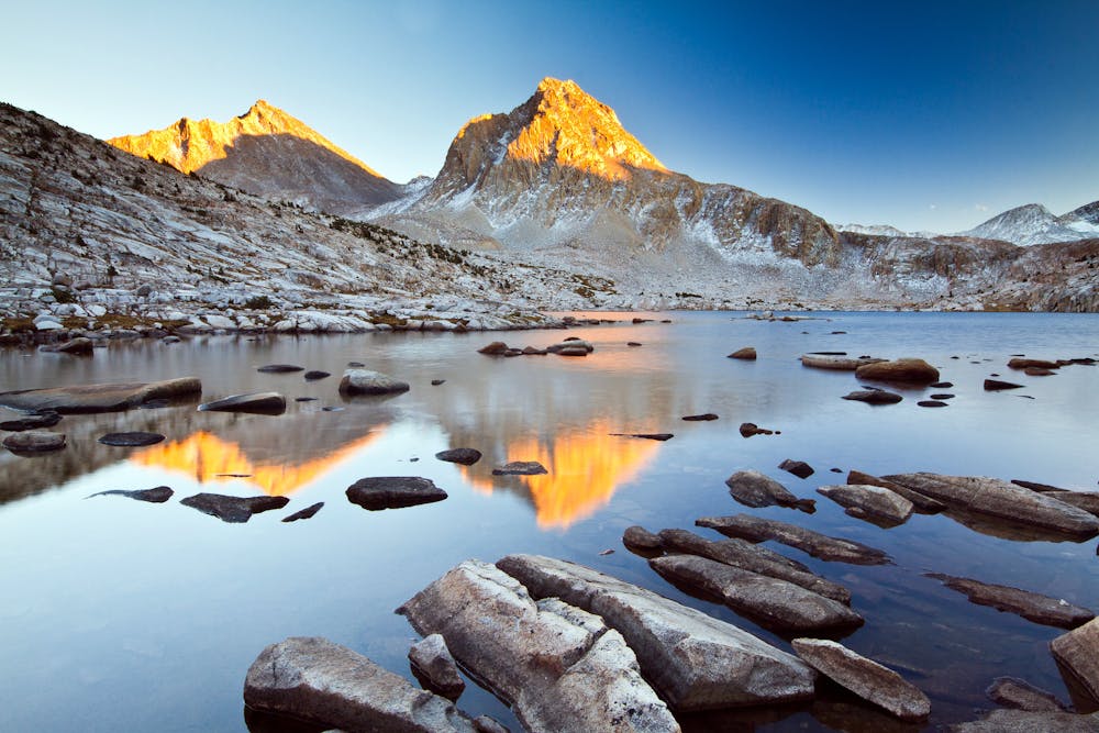
The segment mapped here goes northbound from the junction with Bishop Pass trail (NB mile 831) which leads to South Lake trailhead. Beyond this junction, the PCT continues to rise in elevation through some tougher sections as the canyon constricts and steepens. In the upper valley the trail climbs through a series of glacial benches, each with its own little lake and with plenty of good campsites. The last lake, called Helen Lake, is the largest and lies just beneath Muir Pass. The trail over the pass is straightforward if free of snow, and even with snow it should be no problem if you’ve made it over the passes to the south. Traction devices are recommended, nonetheless. Atop the pass is a historic stone hut (NB mile 838.6), which makes a novel spot to rest and get a photo. It could provide shelter in bad weather, though it’s probably best to get quickly to lower elevation as usual.
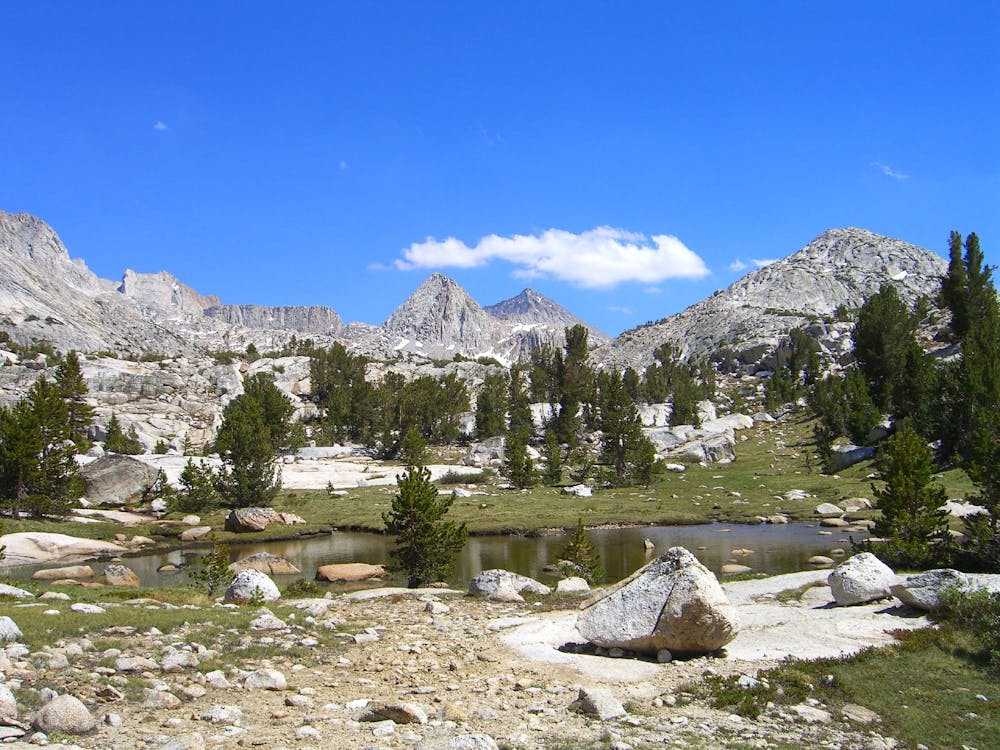
Just north of Muir Pass is Evolution Basin (NB mile 840)––renowned for High Sierra scenery at its finest, but sometimes also for mountain weather at its worst. Entirely above 11,000 feet, it’s a sloping plain void of trees, strewn with sparkling white boulders and flower-flecked grass, and dotted with shimmering pools. All of this can be covered by snow and ice, of course, in early season. In clear weather there are rows of peaks above, though clouds may shroud them and storms can arise violently. By contrast, sunny days can be intense as well, with high-altitude radiation on reflective rock. It’s best to walk on through the beauty of this exposed landscape and aim for camp at Evolution Lake or lower.
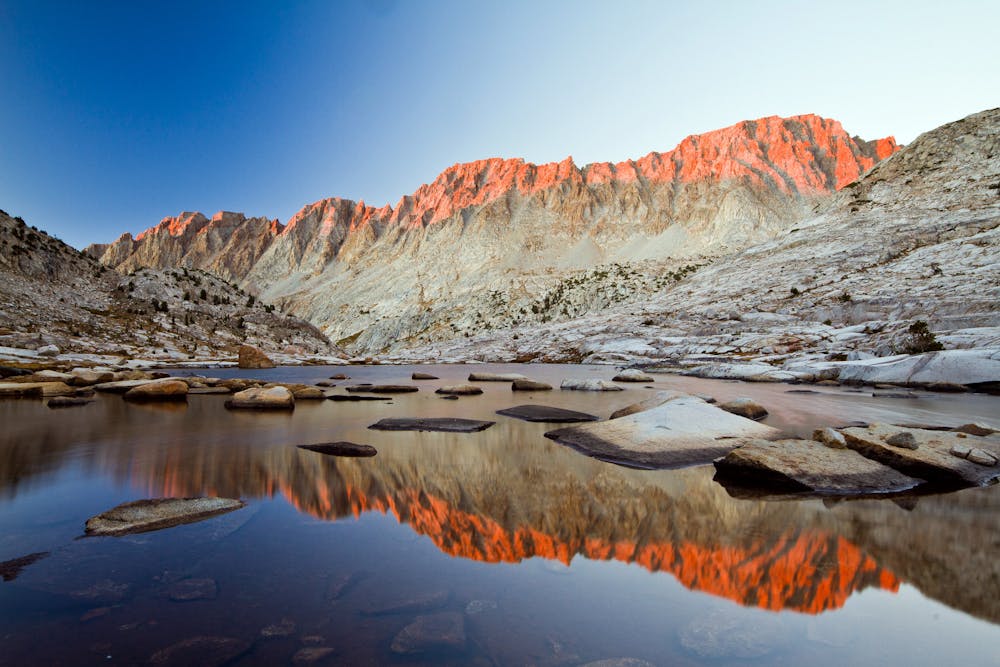
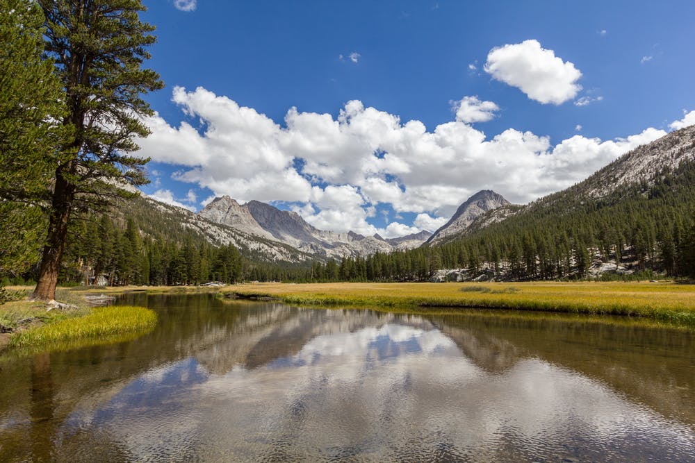
Evolution Lake (NB mile 843.5) is a wonderful place to spend the night. It’s located near the timberline with grassy shores and scattered trees, amid a panorama of sky-scraping peaks and weathered domes. Below this lake the trail drops into Evolution Valley, making a return to tall forest with sporadic rock gardens and meadows. Small campsites are scattered along the trail, but a particularly popular camp is McClure Meadow (NB mile 484.1), an idyllic spot where Evolution Creek slides lazily between green banks.
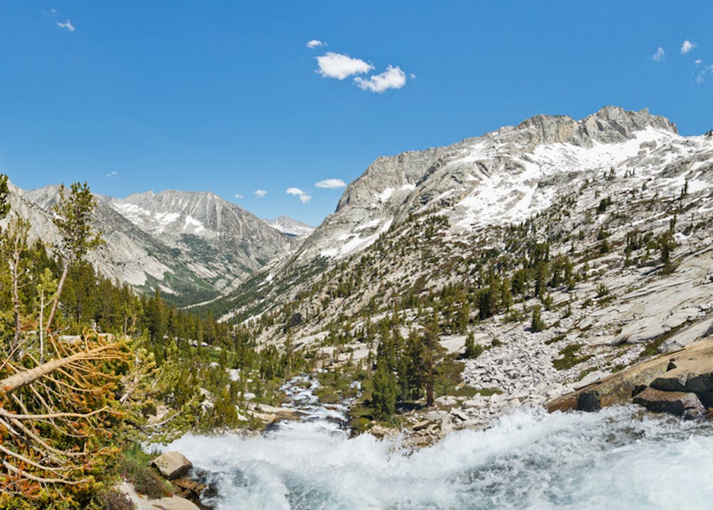
Farther down the valley the PCT fords the creek (NB mile 850.9), but it’s a spot known for dangerous flows in early season. An alternate high-water crossing can be found less than mile east (NB mile 850.1). Later on the trail emerges to a view into a huge gorge, with Evolution Creek thundering in waterfalls nearby. Switchbacks descend an open slope to reach the bottom, and meet the South Fork San Joaquin River at a sturdy bridge. (NB mile 852.4). On the other side Goddard Canyon trail heads south as the PCT turns north to trace the river downstream.
Another bridge crosses back to the river’s east side (NB mile 853.3), then continues down a narrowing gorge with fewer trees, more rocks, and frequent views of falls on the river. At the mouth this canyon, Piute Creek joins the South Fork San Joaquin among sunny, spacious forest with good campsites nearby. There’s another bridge crossing and a trail junction (NB mile 855.9) which makes a possible entry/exit point via Piute Pass and North Lake.
Here also is where the PCT leaves Kings Canyon National Park and enters the John Muir Wilderness of Sierra National Forest. Muir Trail Ranch is a guest resort located within the wilderness area, reached by short detour from the PCT on Florence Lake trail (NB mile 857.7). The ranch accepts resupply packages, but has few other services available for hikers except those who book a stay.
Permits: This segment is almost entirely within Kings Canyon National Park, which requires a permit for backcountry travel. The PCT long-distance Permit is recommended. If you don’t have that, you must arrange permits through the agency in charge of the land from which you enter the national park. For example, if you access the PCT from Inyo National Forest to the east (North Lake or South Lake trailheads) you’ll need an Inyo wilderness permit, but if you come from Sierra National Forest in the north you’ll need a Sierra wilderness permit instead. The number of permits may be subject to quotas, so it’s best to reserve well in advance. Note also that each permit is only good for continuous wilderness travel, meaning that if you exit the permit area you will need a separate permit to legally re-enter. This restriction applies to the PCT long-distance permit as well. Also, bear-proof food storage is required for camping within the national park. Some backcountry sites have bear lockers provided, but it’s recommended that all hikers carry approved canisters in order to be more flexible on where to camp.
Sources: https://www.halfwayanywhere.com/trails/pacific-crest-trail/muir-pass-guide/ https://pctmap.net/trail-notes/ https://pctwater.com/
Difficult
Hiking trails where obstacles such as rocks or roots are prevalent. Some obstacles can require care to step over or around. At times, the trail can be worn and eroded. The grade of the trail is generally quite steep, and can often lead to strenuous hiking.

Some trail sections have exposed ledges or steep ascents/descents where falling could cause serious injury.
Little chance of being seen or helped in case of an accident.
8.7 km away
A linkup of lakes around a multicolored mountain, requiring mild scrambling and some route finding.
Moderate Hiking

72 routes · Hiking