
72 routes · Hiking
Miles 1267.9-1287 of the northbound PCT: Up and over a lofty plateau, then abruptly down into a river gorge, within the burn scar of the Dixie Fire.
Hiking Difficult

<i>Notice: As of 2021, this portion of the PCT is closed due to wildfire damage. Check the PCTA Closures page for updates.</i>

Here the PCT traverses the Bucks Lake Wilderness on a topographic arc that climbs to nearly 7000 feet, then plummets to 2000 feet in the Feather River Canyon. Near the highpoint of the arc, you’ll enjoy views into granite lake basins and across a horizon of mountains. On the slopes, some stands of fragrant fir remain, but much was burned in the Dixie Fire of 2021.
This leg starts at Bucks Summit (NB mile 1267.9) and immediately enters the wilderness area upon crossing the road. The trail makes a steady climb, back and forth from subalpine scrub to stands of conifer, and crossing Bucks Creek twice (NB miles 1269.1 and 1269.5). Campsites with a view can be found near the head of this drainage (NB mile 1270), before the trail crests the plateau.
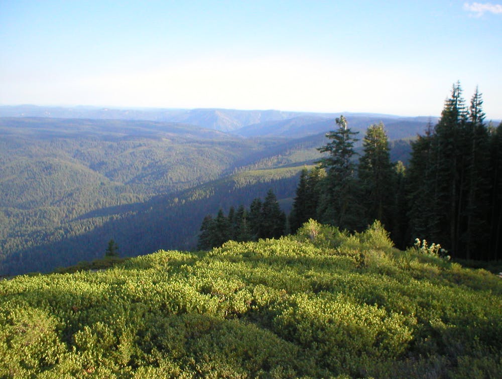
Soon the incline lessens, and the trail traces a string of wet meadows among thicker forest. Next, it emerges on a meadowy mountainside, with vantage to the east of endless mountains. A short side trip to Spanish Peak can reveal even more (junction at NB mile 1272), but the PCT soon finds an altogether different view.
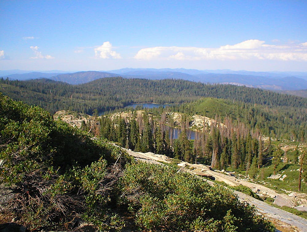
Less than a mile past the Spanish Peak junction, at the rim of this high plateau, the trail enters the scar of the Dixie Fire (NB mile 1272.7). But where singed trees line the trail, they reveal a stunning view to the north. You’ll peer over a granite escarpment pocked with small lakes, tumbling into valleys below. What was once a green sea of forest is now mostly burned, but the landscape is impressive nonetheless.
From this point on, water, campsites, and the trail itself are in unknown condition. Even after the trail reopens, damage and hazards are certain to persist. Clear Creek Springs (NB mile 1276.2) and the main stem of the creek (NB mile 1277.7) were formerly good campsites, but you should be prepared with alternate plans.
The descent to the Feather River begins along Clear Creek, but almost imperceptibly at first. Eventually, the trail contours onto open slopes, this time with views to the south, and a glimpse into the gaping gorge below. As the decline steepens, more of the canyon unfolds. Two broad switchbacks take the trail past Canyon View Spring (NB mile 1281.7), which could be a welcome source for southbound hikers near the top of their climb. Those going north will soon find the meat of the descent, where the trail plummets in repeated switchbacks, through badly burned forest on the shoulder of the mountain.
When it’s finally over, you’ll exit the wilderness area and emerge at a railroad track. Cross this to join Belden road (NB mile 1286.4), which leads into the resort village. Luckily the town was spared from severe fire damage, and operations have resumed. Belden Town Resort has a small store that caters to hikers, plus a lodge with a restaurant and bar. After crossing the road bridge over the North Fork Feather River, you’ll reach Highway 70 and the end of CA Section M on the PCT. Trailhead parking is just to the west along the highway (NB mile 1287).
Permits: This segment of trail is within Bucks Lake Wilderness on Plumas National Forest. No permit is needed for hiking or camping, but you should sign into the trail register upon entry. The California Fire Permit is generally required for campfires or use of a camp stove. Also, section hikers may need to pay a fee or present a recreation pass for parking at trailheads.
Sources: https://www.pcta.org/discover-the-trail/closures/northern-california/dixie-fire-in-feather-river-canyon-region/ https://www.fs.usda.gov/recarea/plumas/recarea/?recid=32329 https://www.pcta.org/discover-the-trail/maps/ https://pctmap.net/trail-notes/
Difficult
Hiking trails where obstacles such as rocks or roots are prevalent. Some obstacles can require care to step over or around. At times, the trail can be worn and eroded. The grade of the trail is generally quite steep, and can often lead to strenuous hiking.

The trail contains some obstacles such as outcroppings and rock which could cause injury.

Little chance of being seen or helped in case of an accident.
72 routes · Hiking