
72 routes · Hiking
Miles 767-788.9 of the northbound PCT: Cresting the highest elevation anywhere on the 2,650-mile trail, at the 13,200-foot Forester Pass.
Hiking Difficult

This begins California Section H of the PCT, continuing northward from Crabtree Meadow and crossing the highest point on the entire trail, at Forester Pass. Views are nonstop along this stretch, and include some of the highest peaks of the Sierra. Much of the distance is on treeless plateaus and windswept ridges, where marmots scurry among the rocks and snowmelt trickles underfoot. Snow-streaked slopes rise to granite pinnacles on every horizon, and azure lakes dot the stony expanses between.

Near Crabtree Meadow the PCT joins the John Muir Trail (JMT) going northward. The convergence of these two long-distance trails, plus the general popularity of hiking in Sequoia and Kings Canyon national parks, could mean a lot more hikers than what northbound PCTers are used to, and more competition for campsites. Therefore extra planning is required going forward, and always with consideration for park regulations as well as potentially difficult conditions in the mountains.
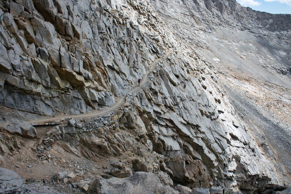
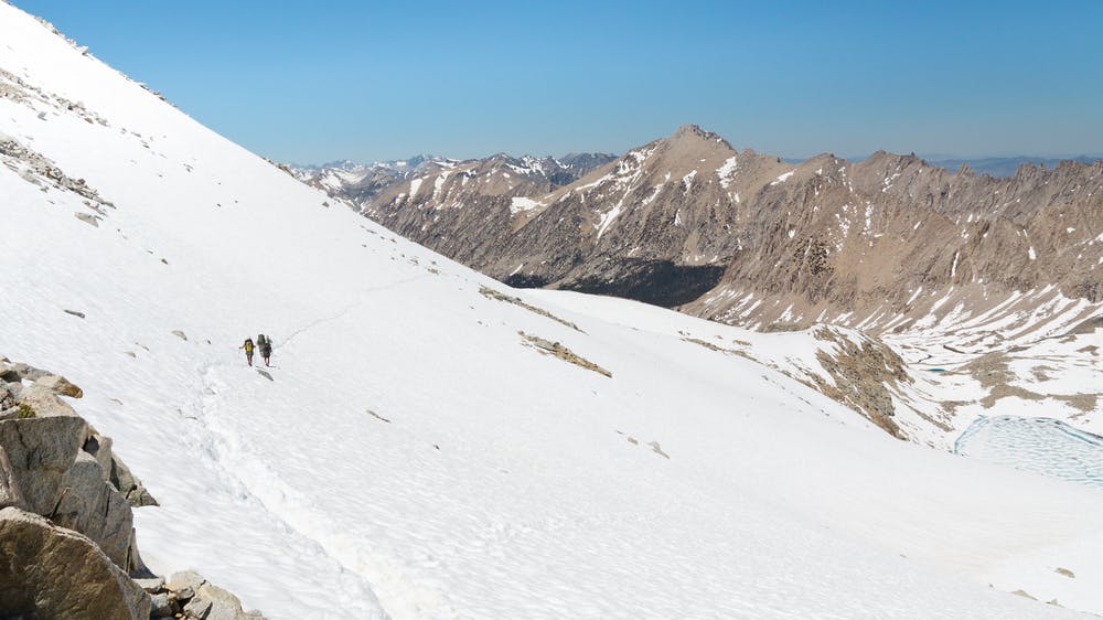
For hikers who don’t make the detour to Mount Whitney, Forester Pass could be the introduction to alpine conditions of the High Sierra. Surmounting the pass requires rocky and potentially icy switchbacks, plus crossing a chute which can hold snow all summer, and is steep enough that a fall could end on the rocks below. That said, Forester is typically not the most dangerous of passes on the PCT, so northbound hikers can test their mettle here before progressing to the others.
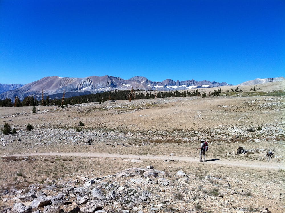
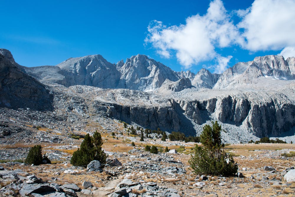
From the JMT merger (NB mile 767) the PCT rolls northward over forested slopes, dipping in and out of little valleys with flowing water and grassy meadows, passing several good campsites. Soon the trail rises to the Bighorn Plateau (NB mile 772.5), and the first taste of truly alpine habitat along this segment. The trees are left behind, with only tiny plants and lichen speckling a barren plain, and a little lake collecting at the center of the lunar expanse.
After dropping through bouldery meadows and back into the trees, the trail meets a junction near Tyndall Creek (NB mile 774.7). From there, another trail goes east to Shepherd Pass and eventually down to a trailhead near the town of Independence. This makes the closest road access south of Forester, though it’s still several miles and several thousand feet of elevation away.
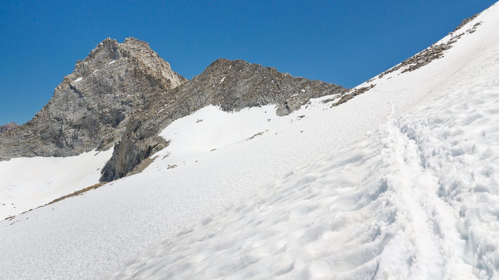
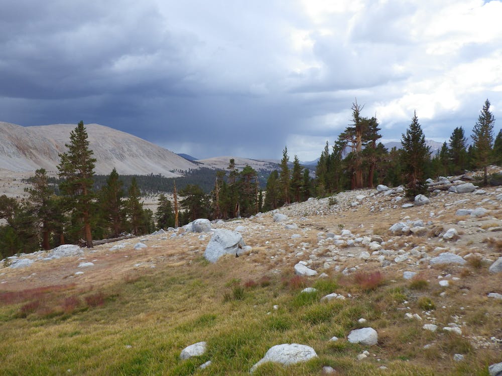
The PCT crosses Tyndall Creek, which can be a challenging ford in early season. You may have to move up or downstream to find a safer crossing. Just west of the creek is a campsite with a bear box (NB mile 774.7), making the final chance to camp among the trees before rising toward Forester Pass. From Tyndall Creek the trail turns uphill, and weaves through a final few stands of timber before returning to the moonscape and ascending beside a series of alpine lakes, with the pass looming in sight up ahead. In this stretch are some decent spots for wild camping, though they’re rather exposed and cold. You should choose your camp with a strategy for the pass in mind, based on expected snow conditions.
Early season or high-snow years can make the pass a bit treacherous. Firm snow of the early morning can make the quickest ascent, but only if you have crampons and poles, and even better to have an ice axe. You must be prepared to self arrest in case you slide. For those not prepared for icy conditions, hitting the pass later in the day is recommended. It could become a slushy slog, but the soft snow is safer.
On top of Forester Pass you’ll stand at the highest point anywhere on the PCT, just shy of 13,200 feet elevation. The north side of the pass is more mellow than the south, with potentially more snow but lesser gradient. You might even enjoy a glissade to expedite the descent, though fall hazard does still exist in places.
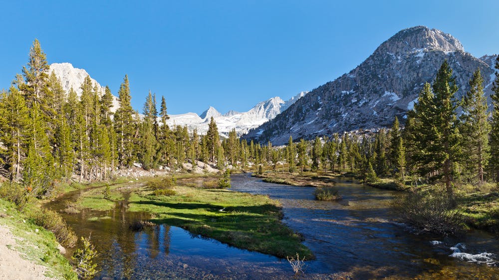
Continuing northward, the PCT takes tight switchbacks to drop from the pass, then traverses a ridge to more switchbacks and loses elevation quickly. A broad, U-shaped valley stretches ahead, crowned by imposing stone of the Kearsarge Pinnacles. Descending into this panorama, the trail soon re-enters the forest and comes to Bubbs Creek (NB mile 784), which is another potentially tricky crossing. On the other side are some good campsites, one of which has a bear box (NB mile 784.3). More good campsites with bear boxes come at Upper Vidette Meadow (NB mile 786.1) and Middle Vidette Meadow (NB mile 787).
Soon after these camps, the trail makes a stiff ascent to a minor pass where there are a couple of trail junctions. This is where many hikers enter or exit the PCT via Kearsarge Pass and the Independence. The Bullfrog Lake trail (NB mile 788.5) and Kearsarge Pass trail (NB mile 788.9) each lead to the pass, and on to Onion Valley from there. A paved road goes from Onion Valley to Independence, which is a small town with supplies, a post office, and motels. Some hikers continue from there to the city of Bishop for better resupply and a zero day.
Permits: This segment is entirely within Sequoia & Kings Canyon national parks, which require a permit for backcountry travel. The PCT Long-distance Permit permit is recommended because it simplifies the logistics of securing permits through various agencies. If you don’t have the long-distance permit, you’ll have to arrange a permit through the agency in charge of the land from which you enter the national park. For example, hikers who enter the park northbound from Inyo National Forest will need an Inyo wilderness permit. The number of permits may be subject to quotas, so it’s best to reserve well in advance. Note also that each permit is only good for continuous wilderness travel, meaning that if you exit the permit area (such as leaving the trail for Independence or Bishop), you will need a separate permit to legally re-enter. This restriction applies to the PCT Long-distance permit as well. Also, bear-proof food storage is required within the national parks. Some backcountry sites have bear lockers provided, but it’s recommended that all hikers carry approved canisters in order to be more flexible on where to camp.
Sources: https://pctmap.net/trail-notes/ https://pctwater.com/ https://www.recreation.gov/permits/445857 https://www.halfwayanywhere.com/trails/pacific-crest-trail/forester-pass-guide/
Difficult
Hiking trails where obstacles such as rocks or roots are prevalent. Some obstacles can require care to step over or around. At times, the trail can be worn and eroded. The grade of the trail is generally quite steep, and can often lead to strenuous hiking.

Some trail sections have exposed ledges or steep ascents/descents where falling could cause serious injury.
Little chance of being seen or helped in case of an accident.
72 routes · Hiking