
72 routes · Hiking
Miles 517.6-566.5 of the northbound PCT: Following "The Aqueduct" and rows of windmills through the Mojave Desert.
Hiking Moderate

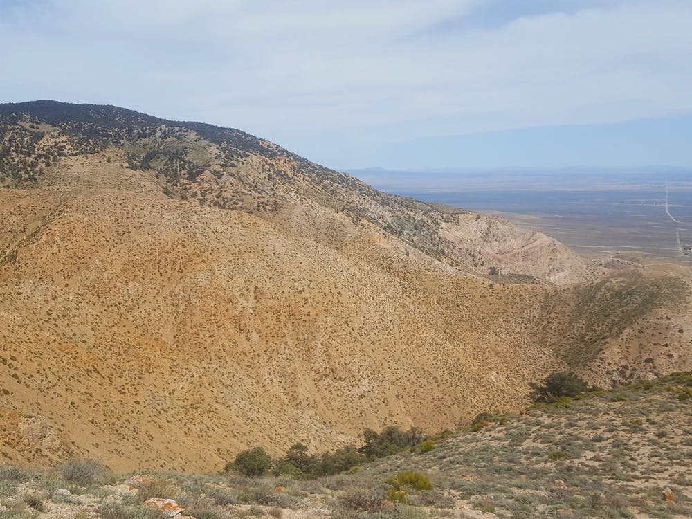
This is a notorious section of the PCT which crosses a valley in the Mojave Desert, brutally exposed to sun and wind, amongst a rather industrial setting. There’s a long stretch beside an aqueduct and many miles through wind farms. The company of Joshua trees is one condolence, however, and in early season the desert may be quite colorful, but for the most part the scenery is unremarkable. Harsh conditions and lack of water can make this section physically difficult as well as logistically troublesome. Luckily the terrain is mostly flat and the miles can be quick, monotonous though they are.

From Hikertown hostel at Highway 138 (NB mile 517.6) the PCT heads across arid grassland and irrigated fields, following straight-line dirt roads for some distance, and crossing an open canal (NB mile 518.5) where water can be drawn with care. Farther on, the trail follows a dirt road that parallels an enclosed aqueduct, and another possible water source is a spigot from this pipe (NB mile 520.9). It’s not always turned on, but there may be a water cache next to it. Check the PCT Water Report for updates. The next water may not be until Cottonwood Creek (NB mile 534.9) at another spigot. This one is not always on either, but a water cache is normally maintained at the site.
North of Cottonwood Creek are the miles of wind turbines, but here the trail becomes a footpath once more and begins to gain elevation steadily, heading for the Tehachapi Mountains. Tylerhorse Canyon (NB mile 541.6) provides nice campsites and a creek that normally has at least a trickle. From there the trail meanders higher into the hills. The turbines disappear for a while and the vegetation thickens, but there is still little shelter from the elements.
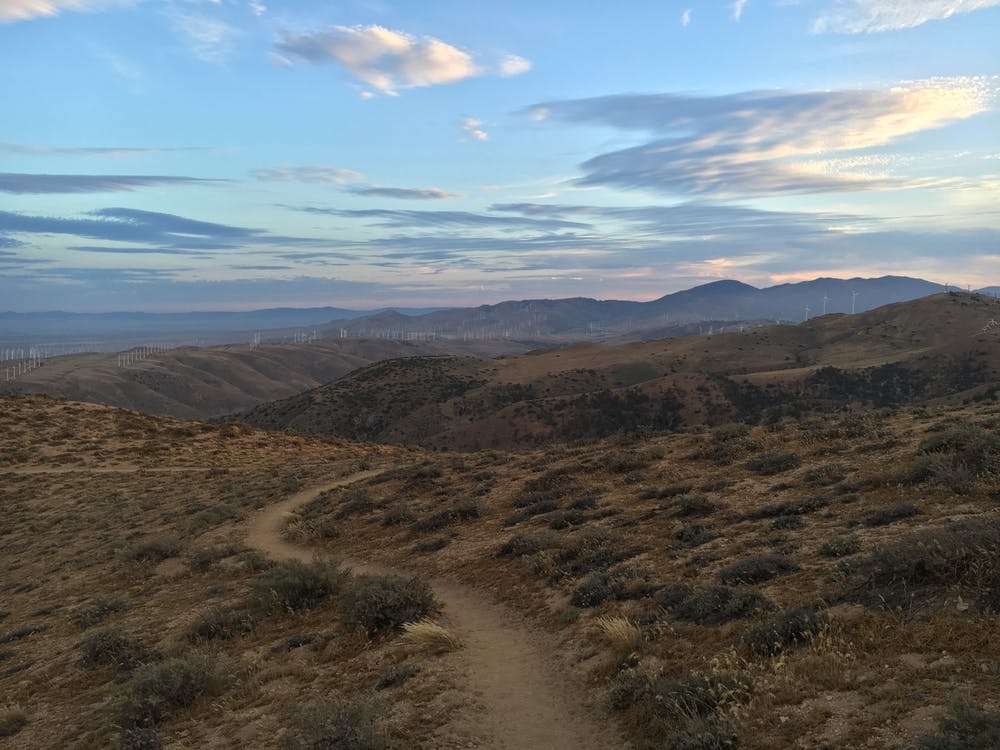
Later on, the trail intersects more dirt roads and returns to rows of turbines on its way down to Oak Creek (NB mile 558.2). The creek sometimes has water or sometimes has a cache, but neither should be considered reliable. Next the trail crosses a paved road, where hikers may hitch to nearby towns. Some may choose to end the section here rather than trying to park or hitch at Highway 58, which is more like a freeway. The remaining miles cross more of the wind farm to reach the highway (NB mile 566.4). From there the well-supplied town of Tehachapi is about 10 miles west.
Permits: Permits are not required for hiking or for backcountry camping on this segment. Campfires are not generally allowed, but anyone camping overnight may still need the California Fire Permit for use of a camp stove.
Sources: https://pctmap.net/trail-notes/ https://pctwater.com/
Moderate
Hiking along trails with some uneven terrain and small hills. Small rocks and roots may be present.

The path is on completely flat land and potential injury is limited to falling over.

Away from help but easily accessed.
72 routes · Hiking