
72 routes · Hiking
Miles 788.9-831 of the northbound PCT: Crossing over three high passes and through deep gorges between, surrounded by grandiose peaks of the High Sierra.
Hiking Severe

Here on California Section H, the PCT continues along the route of the John Muir Trail (JMT) through the Sequoia-Kings Canyon Wilderness. This terrain is deep within the High Sierra with nothing but soaring peaks on every horizon. Though water is not typically an issue here, other difficulties come with high altitude, steep terrain, thunderstorms, and lingering snow. Three of the nine major passes on the JMT are within this segment, including Mather Pass which is known for dangerous conditions in early season. Between the passes are some of the Sierra’s finest scenery: deep river gorges and spectacular waterfalls, along with proud conifer forests and tundra basins filled with lakes. It’s truly a highlight section of the PCT, with the perfect formula of scenery, difficulty, and isolation.
Access from either Kearsarge Pass in the south or Bishop Pass in the north requires several miles of extra hiking off the PCT, plus the logistics involved with these remote trailheads. Most thru hikers will link this segment continuously with those north and south, but it’s somewhat common to enter or exit the PCT via Kearsarge Pass and the city of Bishop. Section hikers may choose Kearsarge or Bishop Pass as an endpoint. Thus the segment is mapped here, as the expanse of the PCT between the junctions to those two passes.
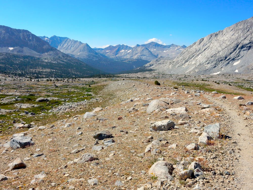
Glen Pass
Onion Valley is a common place to enter or exit the PCT/JMT, via the trail over Kearsarge Pass. Long-distance hikers should know, however, that two separate permits are needed if you decide to exit and re-enter the trail here (See permits section below).
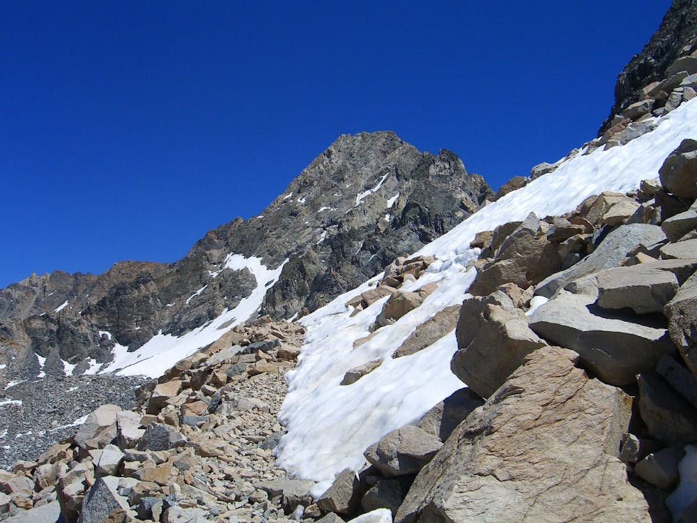
If hiking northbound, Glen Pass (NB mile 791.1) comes shortly after the Kearsarge junction. At 11,926 feet, it’s one of the higher passes on the PCT and can make a significant obstacle in snowy or stormy conditions. Both the south and north sides of the pass are quite steep, with many switchbacks in the trail and cliff bands on the slope. When the trail is buried in early season, shoe traction and ideally, an ice axe should be used for safety.
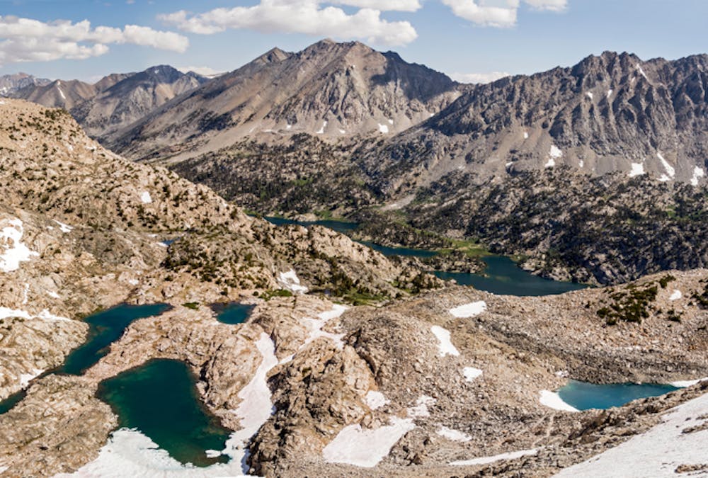
North of Glen Pass are the Rae Lakes (NB mile 793.5), which make a very popular camp spot for PCTers as well as backpackers on other routes in the national park. Northbound from Rae the PCT descends along a string of smaller lakes, through a valley with plenty of timber but even more granite––from boulders beside the trail to megalithic domes overhead. Soon the trail crosses Baxter Creek (NB mile 797.1), which can be a tricky ford in early season.
Continuing down the valley, the trail eventually crosses Woods Creek on an elaborate suspension bridge (NB mile 799.8), where there’s a campsite and bear box nearby. At mile 800 of the PCT, it turns uphill into the gorge of Woods Creek and immediately finds a spectacular view of a huge granite slide––where the water careens over carved-out bedrock. Waterfall views keep on coming, as the trail slants above the creek for the next few miles. Also in this stretch is the crossing of White Fork (NB mile 801.1), which is a small but swift stream that can present difficulty.
Pinchot Pass
Continuing upward, past several small streams and decent campsites, the PCT breaks above timberline, into tundra meadows laced with streams and ponds. A gentle incline leads soon enough to some switchbacks and a traverse to get over Pinchot Pass (NB mile 807.1) at about 12,100 ft. It’s a straightforward hike when snow-free, and in early season when the passes are snowbound, hikers generally find this one to be easier than either of the passes immediately north and south.
A less-steep trail leads down the north side of Pinchot, through a broad tundra basin with the welcoming sight of Lake Marjorie below. This rather large, circular lake settles beneath huge, tilted cliffs. The lakeshore (NB mile 808.9) makes a beautiful but rather exposed place to camp. Continuing down to Bench Lake (NB mile 810) or lower may yield better campsites in the trees.
After passing Bench Lake the trail drops sharply into a gorge and meets the South Fork Kings River (NB mile 811.4). This presents a difficult ford that has claimed lives, so many hikers choose to bypass it. If the crossing does not look safe, you can simply turn and look for a use trail continuing along the east side of the river. This trail rejoins the PCT in 2.3 miles, saving the river crossing for another spot (NB mile 814.5) that’s tamer. In this stretch along the South Fork Kings are several small campsites, and it’s common to spend the night in this zone to set up for crossing Mather Pass.
Mather Pass
Mather Pass (NB mile 816.9) has a reputation as one of the more intimidating passes to cross in early season. That’s because its south side is not only steep, but tends to collect a cornice which can collapse. You should expect to do some route finding if hiking early season, perhaps moving toward bare rock rather than committing to steep snow beneath the pass. The north side of Mather is just as steep, and tends to hold snow well into the summer. When snow-free, however, both sides of the pass have a well-maintained, switchbacking trail.
On the descent from Mather Pass, the ragged peaks of the Palisades rise ahead, and the trail continues to the bedrock terraces above Palisade Lakes. Good water sources and decent campsites can be found near the lower lake (NB mile 820.5). Beyond these lakes the trail follows the stream through a bouldery canyon, and then the terrain falls away in spectacular fashion at a section known as the Golden Staircase (NB mile 821.4). Here the water plummets over a granite headwall as the trail drops in rugged switchbacks, and peaks crown every side of a yawning valley ahead.
As the trail descends this drainage of Palisade Creek it reenters thicker forest, and the “staircase” soon gives way to a gentler decline. Campsites and water sources are frequent, and especially good camps can be found near the confluence with the Middle Fork Kings River (NB mile 827.5), in the vicinity of some impressive cascades.
From there the PCT turns into the canyon of the Middle Kings, meandering steadily upward among tall conifers and grassy meadows, never far from the tumbling water. An opportunity to enter/exit the trail comes at the Bishop Pass junction (NB mile 831) where a trail leads 12 miles eastward, over the pass and to a paved road at South Lake trailhead.
Permits: This segment is entirely within Kings Canyon National Park, which requires a permit for backcountry travel. The PCT long-distance Permit is recommended. If you don’t have that, you’ll have to arrange permits through the agency in charge of the land from which you enter the national park. Kearsarge Pass and Bishop Pass trailheads are both inside Inyo National Forest, so hikers who enter from either of those will need an Inyo wilderness permit. The number of permits may be subject to quotas, so it’s best to reserve well in advance. Note also that each permit is only good for continuous wilderness travel, meaning that if you exit the permit area (such as leaving the trail for Bishop), you will need a separate permit to legally re-enter. This restriction applies to the PCT long-distance permit as well. Also, bear-proof food storage is required within the national parks. Some backcountry sites have bear lockers provided, but it’s recommended that all hikers carry approved canisters in order to be more flexible on where to camp.
Sources: https://www.halfwayanywhere.com/trails/pacific-crest-trail/glen-pass-guide/ https://www.halfwayanywhere.com/trails/pacific-crest-trail/pinchot-pass-guide/ https://www.halfwayanywhere.com/trails/pacific-crest-trail/mather-pass-guide/ https://pctmap.net/trail-notes/ https://pctwater.com/
Severe
Hiking challenging trails where simple scrambling, with the occasional use of the hands, is a distinct possibility. The trails are often filled with all manner of obstacles both small and large, and the hills are very steep. Obstacles and challenges are often unexpected and can be unpredictable.

Some trail sections have exposed ledges or steep ascents/descents where falling could cause serious injury.
Little chance of being seen or helped in case of an accident.
72 routes · Hiking