
72 routes · Hiking
Miles 1234.8-1267.9 of the northbound PCT: Through the burn zone of a 2020 wildfire, on a rolling ridgewalk punctuated by a sharp dip into a river gorge.
Hiking Moderate

<i>Notice: This segment of the PCT was burned by wildfire in 2020. As of 2021, the trail has reopened, but repairs have not been completed, and various hazards remain. See the PCTA Closures page for more information.</i>
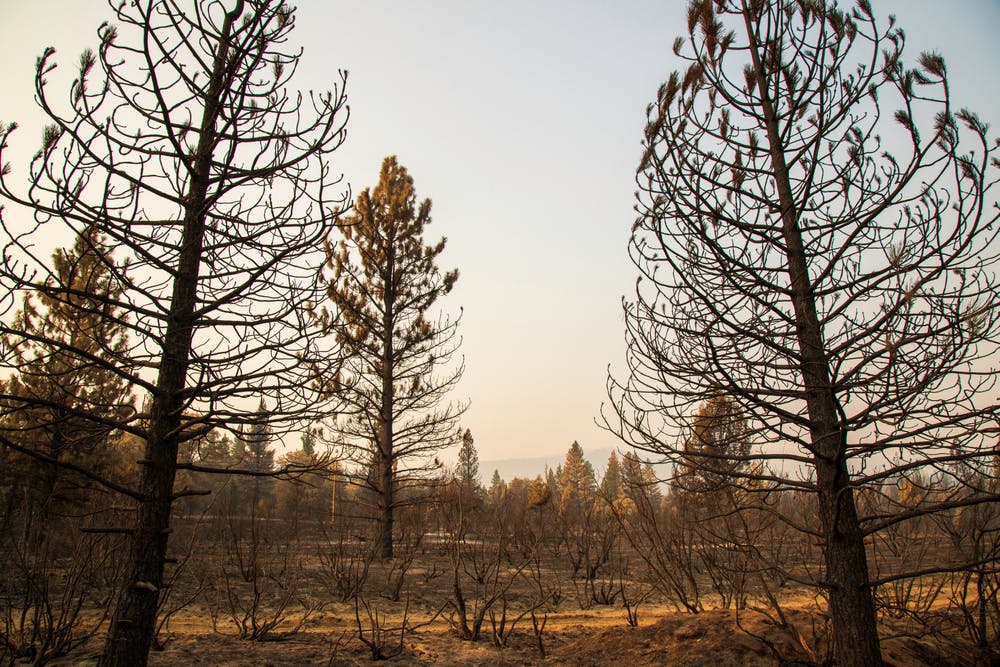
This leg of the PCT used to be known as a long green tunnel, with little for scenery outside of conifer forest. That changed in summer 2020, however, when the North Complex Fire burned over roughly 25 miles of trail from Quincy La Porte Road (NB mile 1234.8) to Lookout Rock (NB mile 1260). The severity varies by location, but most trees were killed, and parts of the trail were damaged. Though the PCT still follows its original course through the burn area, you can expect to maneuver around logs, holes, rocks, new growth, and the like until repairs are complete. Also, beware of skeleton trunks that are prone to falling down. It’s never safe to camp under dead trees, nor is it recommended to hike this section during windy or wet weather.
Water sources may be in jeopardy through the burn area as well. Water can be obtained at the start of this segment from the South Fork Feather River, which is less than half a mile south by road. In the first few miles of the section, there are some springs in unknown condition. Fowler Creek likely has water, reached by a short side trail (NB mile 1244.5). Next is the Middle Fork Feather River (NB mile 1249.7), which the trail crosses on a bridge after making a sharp descent into the canyon. However, as of 2021, the river itself was closed to all access. Check the PCTA closures page for updates.
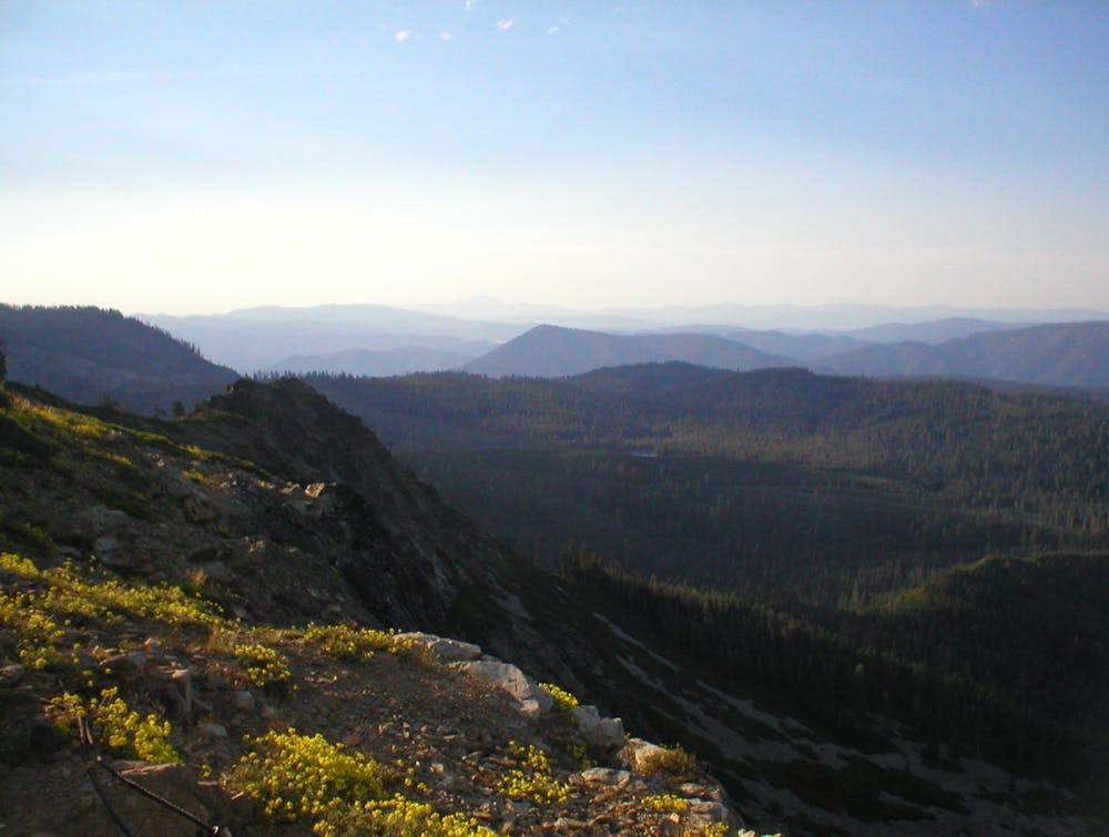
Once across the Middle Fork Feather, the trail begins to wind upward out of the gorge. The PCTA reports that fire damage is even worse on this north side of the river, so hikers should use extreme caution when traveling through. Another footbridge later crosses Bear Creek (NB mile 1253), which should also have water. After finishing the rather intense climb up Mount Ararat, the trail traverses the canyon rim and comes to Lookout Rock (NB mile 1260). Even before the fire cleared so many trees, the view from this spot was fantastic. The vantage is just as extensive now, though the scenery is altered.
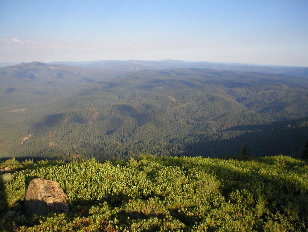
Lookout Rock is near the northern perimeter of the burn area, however. Shortly afterward, the trail tips downhill into a more intact forest, and crosses some dirt roads to reach the paved Big Creek Road (NB mile 1263.5). Bucks Lake is a recreation area 2.5 miles to the west, where you’ll find campgrounds, lodging, restaurants, and a small store. The PCT continues north and steadily uphill to Bucks Summit, which is an overlook and trailhead along Bucks Lake Road (NB mile 1267.9). Quincy is about 12 miles east, offering typical town amenities as well as a bus service.
Permits: This segment is in Plumas National Forest, which does not require a permit for hiking or backcountry camping. However, the California Fire Permit is generally required for campfires or use of a camp stove. Also, section hikers may need to pay fees or present a recreation pass for parking at certain trailheads.
Sources: https://inciweb.nwcg.gov/incident/6997/ https://www.pcta.org/discover-the-trail/closures/northern-california/bear-fire-plumas/ https://www.pcta.org/discover-the-trail/maps/ https://pctmap.net/trail-notes/
Moderate
Hiking along trails with some uneven terrain and small hills. Small rocks and roots may be present.

The trail contains some obstacles such as outcroppings and rock which could cause injury.
Away from help but easily accessed.
72 routes · Hiking