235 m away
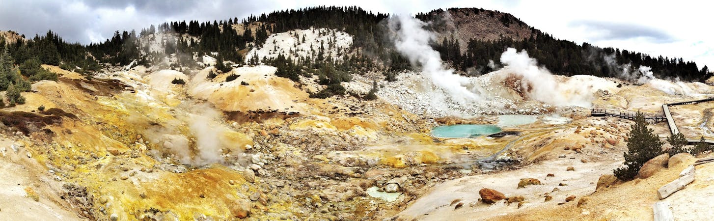
Devils Kitchen
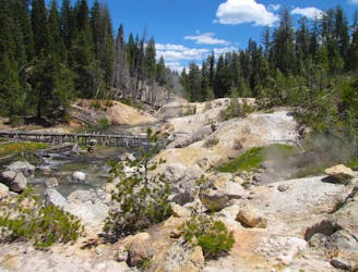
Witness a highly active hydrothermal area in Lassen's peaceful Warner Valley.
Moderate Hiking
- Distance
- 7.5 km
- Ascent
- 178 m
- Descent
- 178 m
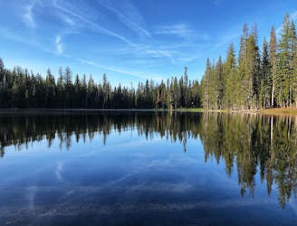
Miles 1350.1-1377.4 of the northbound PCT: Continuing through Lassen National Park, past backcountry lakes and views of volcanic peaks.
Hiking Moderate

<i>Notice: This segment of the PCT closed due to the Dixie Fire of 2021, with no date for reopening yet announced. Check the PCTA Closures page for updates.</i>
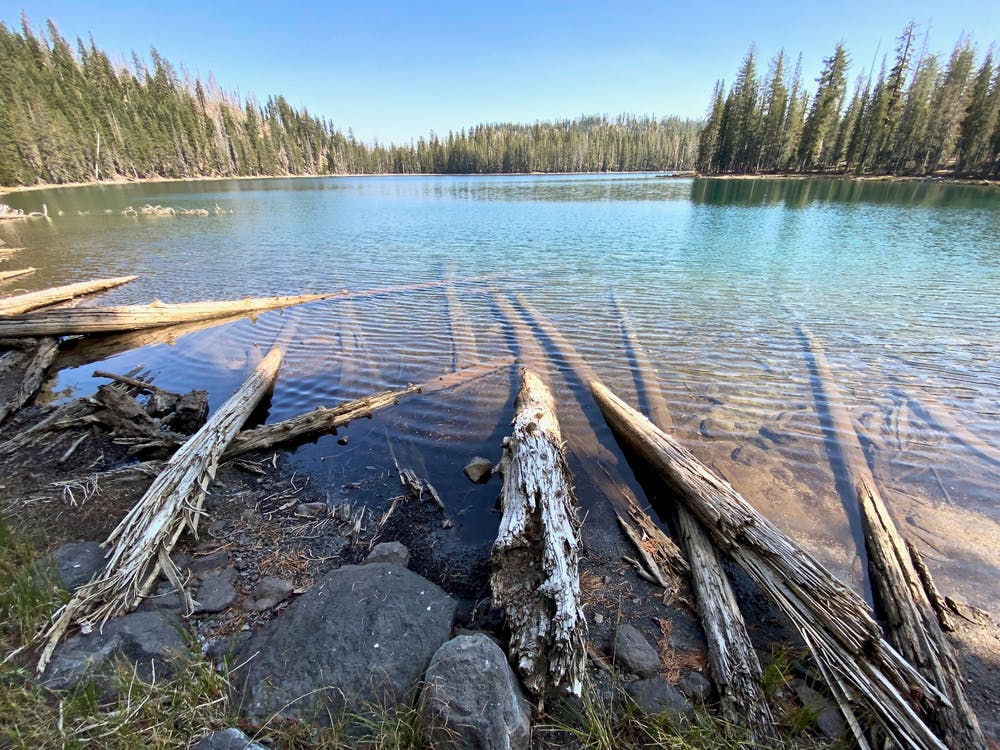
North of Warner Valley, the PCT goes through a remote area of Lassen National Park. Though Lassen Peak and other summits at times appear on the horizon, the trail misses many of the park’s best highlights. Distance hikers will likely push on through, but those with more time could conceivably make a loop with other destinations in the Lassen backcountry, like additional wilderness lakes. However, the condition of all these trails in the wake of the Dixie Fire remains to be seen.
This segment begins from the Warner Valley trailhead in Lassen. There should be water, a toilet, and picnic tables here, plus a campground nearby––assuming everything reopens as before the fire closure. From this trailhead, the northbound PCT goes uphill, taking a couple of switchbacks on its way over a low ridge.
After descending the other side of the ridge, the trail comes to Summit Creek (NB mile 1352.9), which used to be a good water source with campsites nearby. Conditions post-fire are unknown, however. The trail then follows the course of Grassy Swale Creek and crosses the stream a couple of times in the next few miles. After turning from the creek and crossing a meadowy area, the trail passes Swan Lake (NB mile 1357) and Lower Twin Lake (NB mile 1357.6). These lakes are likely to have safe campsites away from burned trees, as the forest here was rather open before the fire.
A trail junction leads to additional backcountry lakes (NB mile 1357.8), but the PCT continues through dry, charred forest in a broad valley. The forest later becomes a mosaic of burned and unburned trees as the trail proceeds slightly uphill and crosses out of the national park (NB mile 1365.5). It then drops downhill and goes through an area of logged forest before coming to Hat Creek (NB mile 1369.7), which likely has water and good campsites nearby.
Continuing on, the PCT crosses several forest roads and nears the highway in the small community of Old Station. A short detour west from the trail can get to a Forest Service campground and a trailhead at the Spatter Cones (NB mile 1375.3). A couple miles farther, the PCT crosses Highway 44 (NB mile 1377.4), where the town center of Old Station is just to the west. A cafe and a mini-mart can be found there, but not a great deal else.
Note: Distance hikers will want to load up on water for the ~30-mile northbound stretch to Crystal Lake. Water can be obtained in Old Station or at the Subway Cave trailhead to the north.
Permits: Lassen Volcanic National Park requires permits for backcountry camping, but these are free and self-issued at trailheads and park boundaries. Special regulations apply within the park, including the use of approved bear canisters in the backcountry. See the park’s backcountry regulations for more information.
Sources: https://www.nps.gov/lavo/planyourvisit/wilderness-permit-information.htm https://www.pcta.org/discover-the-trail/maps/ https://pctmap.net/trail-notes/
Moderate
Hiking along trails with some uneven terrain and small hills. Small rocks and roots may be present.

The trail contains some obstacles such as outcroppings and rock which could cause injury.

Little chance of being seen or helped in case of an accident.
235 m away
Witness a highly active hydrothermal area in Lassen's peaceful Warner Valley.
Moderate Hiking
236 m away
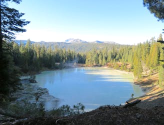
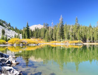
Hike along a portion of the Pacific Crest Trail to find a warm creek, a hot lake, and a steaming vent in a lesser-traveled corner of Lassen.
Moderate Hiking
5.9 km away
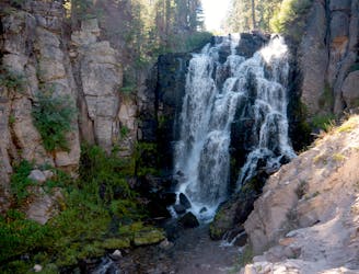
Ultra-popular hike to a cascading creek and waterfall in a verdant gorge.
Difficult Hiking
6.3 km away
An extended stroll through Lassen’s backcountry interior, packed with pristine lakes in subalpine forest.
Moderate Hiking
8.1 km away
Three exquisite alpine lakes, linked by a path through sunny and colorful woodland.
Moderate Hiking
11 routes · Hiking

72 routes · Hiking