


+ 76
Runyon Canyon Highpoint Loop (East Ridge-West Ridge Loop)
Hiking Trail
Hard
3.31 mi
883 ft
Linkup of all the major viewpoints in one of the best parks near Hollywood.
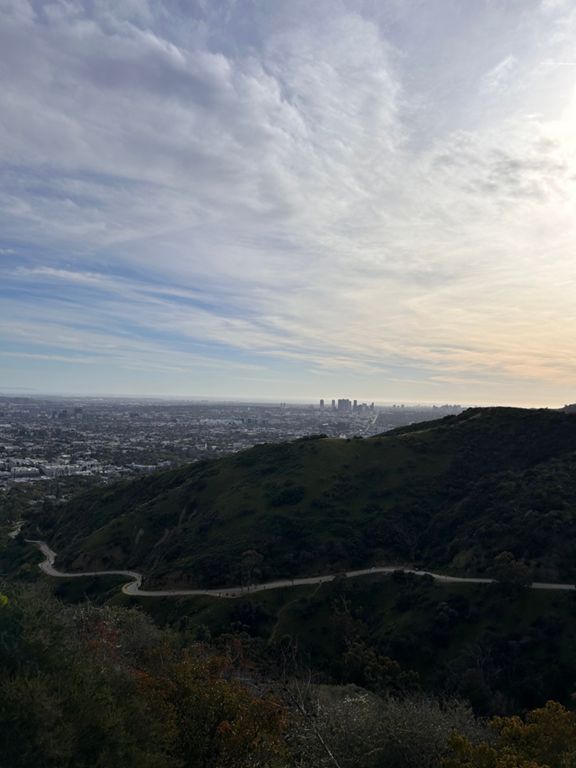
Runyon Canyon is a very popular urban park near Hollywood Hills. It’s loved by locals and visitors alike for its panoramic viewpoints over Hollywood and Central LA, as well as considerable elevation gain for aerobic workouts. The network of trails makes many hike variations possible. The one described here is a longer loop connecting all the park’s major viewpoints, including the highest-elevation spot in the park. For a shorter trip, skip one arm of the route or do an out and back along one or two of the trails.
In the park, you will find steep hillsides covered in dense chaparral vegetation and taller trees like eucalyptus in the shady canyons. Most of the trails follow ridge crests or canyon bottoms. This loop combines the two major ridgelines in the park, East Ridge and West Ridge, both with expansive views over surrounding hillsides and distant skylines of both city and mountains. The park’s highpoint is a hilltop near the north entrance that reaches roughly 1,300 feet elevation. Views all along the way make the climb to the highpoint well worth it. Once there, it is mostly downhill along an equally panoramic ridgeline to return to the bottom.
The trails are mostly of gentle gradient, wide, and free of obstacles, but in places, you will find rougher sections as well as staircases. Please stay on official trails and do not take cutoffs. Help preserve this pocket of nature in the city which grows on easily erodible soils.
The loop begins from the park’s south entrance at N Fuller Ave. There is no lot at this entrance, only street parking, and it is very limited. There is a parking area at the north entrance on Mulholland Drive, but it is often full. Consider biking or taking public transportation to reach Runyon Canyon.
Sources:
Written by Jesse Weber
Created By
Strava Routes

Route and Elevation
Segments
| Name | Distance | Elev. Diff. | Avg. Grade |
|---|---|---|---|
| Up to Clouds Rest | 0.30 mi | 344 ft | 21.5% |
| N Fuller Ave Climb | 0.25 mi | 200 ft | 14.9% |
| Mulholland Drive Climb | 0.43 mi | 157 ft | 6.8% |
| Hit the Road to the top | 0.84 mi | 259 ft | 5.8% |
| Mulholland Drive Climb | 0.25 mi | 148 ft | 10.7% |