17 routes · Hiking
Swimming holes, sandy shores, and uncommon nature along one of Southern California's last free-flowing rivers.
Hiking Moderate

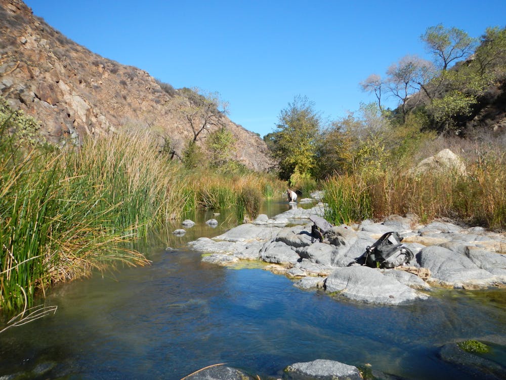
The Santa Margarita River is a true gem of Southern California, as one of the last free-flowing (free of dams) rivers in the region. This means that its flow fluctuates naturally with the seasons, but because it’s fed by springs and a large, mountainous watershed, it rarely runs dry. Even in the heat of summer, you can find swimming holes with sandy beaches along the Santa Margarita River.
The trail goes through a nature preserve, protecting the river and its unique riparian habitat. Access is allowed to hikers, bikes, and horses, and dogs on leash, but you should take extra care to avoid trampling vegetation, littering, and other negative impacts on this fragile environment. Seventy species of special concern under the Endangered Species Act are known to live here. These are mostly plants but also birds like the western willow flycatcher and amphibians like the arroyo toad. Rare species survive here because of the river’s natural flow cycle and relatively good water quality.
As you hike the trails and splash in the water, notice all the types of plants that surround you. In summer you’ll enjoy the shade of cottonwoods, sycamores, and oaks. Come back in the fall to see their leaves turn color. Hike in spring and early summer for wildflowers like California poppies, golden yarrow, and Mexican elderberry.
In places, the network of paths can feel maze-like, and the trails aren’t always marked. They do all interconnect, though, and the area is not huge, so just pay attention to your bearings, and soon you will find the trail you mean to be on.
The loop mapped here is just one of many possible versions. You can make it shorter by crossing the creek sooner, or longer by crossing farther upstream. Other trails climb the surrounding hills, which you can add for a more strenuous hike and elevated views.
The creek crossings are not bridged, so you may have to get your feet wet to wade across. In times of high flow, do not attempt to cross the creek. If you can’t or don’t want to cross, simply hike an out and back on the south side, or a loop with trails on the south hillsides.
Sources: http://www.fallbrooksource.com/smtrail.htm https://www.wildlandsconservancy.org/preservesantamargarita.html https://www.wildlandsconservancy.org/pdf/SantaMargaritaRiverTrailPreserveMaptemporary.pdf https://modernhiker.com/hike/hike-the-santa-margarita-river/ https://en.wikipedia.org/wiki/SantaMargaritaRiver
Moderate
Hiking along trails with some uneven terrain and small hills. Small rocks and roots may be present.

The trail contains some obstacles such as outcroppings and rock which could cause injury.

Close to help in case of emergency.
17 routes · Hiking