2.3 km away
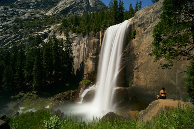
Wapama Falls
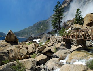
Uncrowded waterfall trail along the cliff-lined lakeshore in Hetch Hetchy Valley.
Moderate Hiking
- Distance
- 7.8 km
- Ascent
- 332 m
- Descent
- 333 m
Backcountry hike to an impressive but little-known view over Hetch Hetchy Valley.
Hiking Difficult

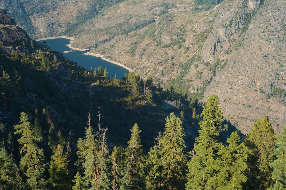
Hetch Hetchy is Yosemite National Park’s other valley, not nearly as well known or as popular as the namesake Yosemite Valley. That’s because Hetch Hetchy is partially filled by a reservoir, drowning what could have been an equal bounty of hiking trails. Many granite walls still rise above the water, however, and tall summits crown the rim. The tallest of these is Smith Peak, though it’s not actually visible from anywhere along the Hetch Hetchy Road. You have to hike to it.
It’s a true backcountry trail that leads to the top—lightly traveled, strenuous, and long. The area burned extensively in a 2013 wildfire, so most of the way is sun-exposed and strewn with downed trees. You’ll have to step over logs, plus trudge through tall grass and brush, in addition to ascending the rocky trail. Pay close attention to avoid losing the path. The grade briefly flattens at intermittent small meadows, but these may be swampy with snowmelt in the early season (April-June). Finally comes Smith Meadow, a large clearing with a trail junction. Take a rest here, then follow the steep trail that leads through a large burn area to the top of the peak. This is the toughest part of the hike, but the end is in sight.
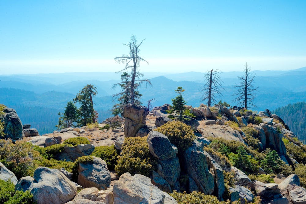
On the broad summit, you can find a few different viewpoints of the valley and reservoir below, and burned trees do little to obstruct the 360-degree, mountainous horizon. A handful of excellent campsites exist near the summit, which you can utilize with a wilderness permit. If you’re willing to lug your gear to the top of Smith Peak, the journey can be even more rewarding when split into two days.
Because Hetch Hetchy Road is open year-round, Smith Peak can be done as a winter summit with snowshoes or skis and hiked in the spring when other trails in the high country are still snowbound. Even into early summer, however, you should expect to encounter some snow on Smith Peak. The upper reaches of the trail can remain covered well into June.
Sources: https://www.nps.gov/yose/planyourvisit/upload/hetchhetchy-sitebull.pdf https://www.summitpost.org/smith-peak/150426
Difficult
Hiking trails where obstacles such as rocks or roots are prevalent. Some obstacles can require care to step over or around. At times, the trail can be worn and eroded. The grade of the trail is generally quite steep, and can often lead to strenuous hiking.

The trail contains some obstacles such as outcroppings and rock which could cause injury.

Little chance of being seen or helped in case of an accident.
2.3 km away
Uncrowded waterfall trail along the cliff-lined lakeshore in Hetch Hetchy Valley.
Moderate Hiking
7 routes · Hiking
9 routes · Hiking