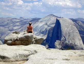
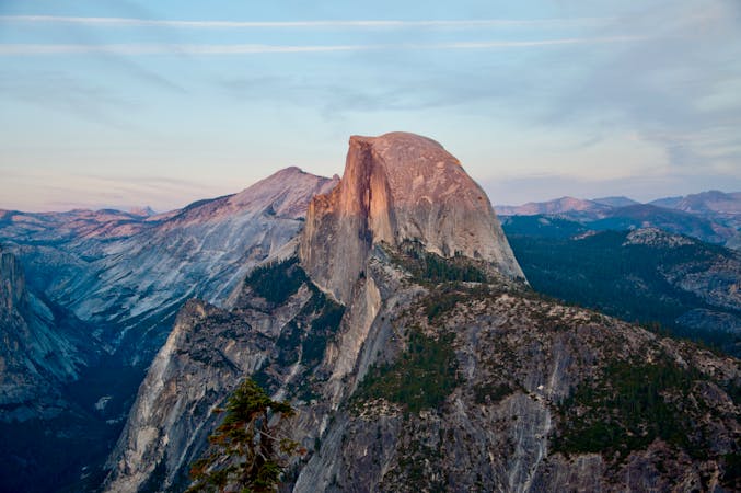
Half Dome
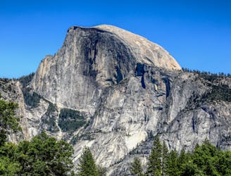
An exciting hike to the summit of one of North America's most iconic peaks.
Extreme Hiking
- Distance
- 24 km
- Ascent
- 1.7 km
- Descent
- 1.7 km
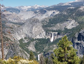
Connect two of Yosemite's great waterfalls in a concise but strenuous loop
Hiking Difficult

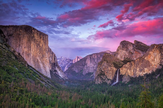
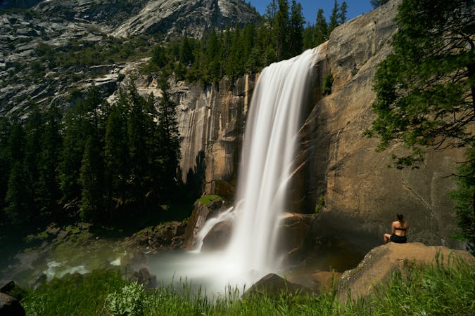
This astonishingly-scenic loop features two impressive waterfalls on the Merced River, and offers different options for distance and difficulty. The full hike mapped here is to the top of Nevada Fall via the Mist Trail and back via the John Muir Trail, but shorter variations are mentioned in the description below.
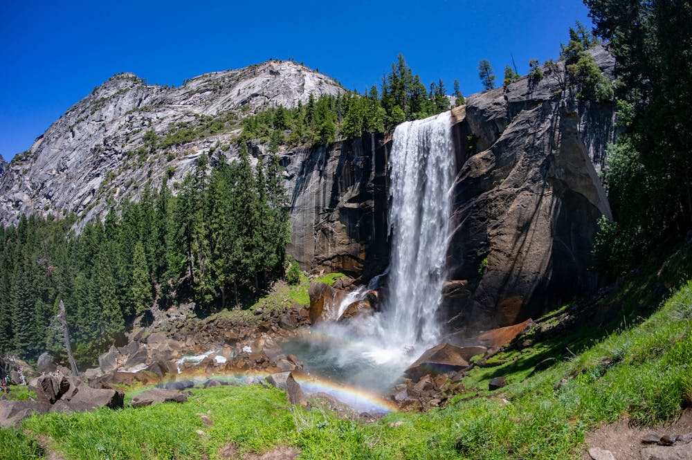
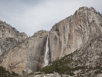
Begin at Happy Isles Trailhead and follow the paved trail to Vernal Fall Footbridge for your first great view of a waterfall. Vernal Fall is more than 300 feet tall and drops in a broad, continuous curtain for much of the year. In the drier months, it can thin into separate streams, but it always has water. The bridge is a popular turnaround point for casual hikers, but the Mist Trail continues as a rock and dirt path to climb past Vernal Fall and toward Nevada Fall. It takes many stairs cut into granite to ascend quite close to Vernal Fall. During times of high flow, the trail is in the spray zone and the rock becomes quite slick.
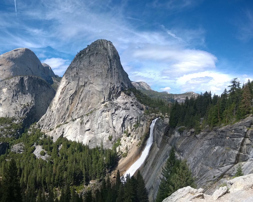
Pause at an overlook near the lip of Vernal Fall, then proceed to the next waterfall. After crossing the cascading river once more on a bridge, the trail continues on relatively mellow terrain through groves of oak trees. Through gaps in the canopy, you can see the towering summits of Mount Broderick and Liberty Cap overhead.
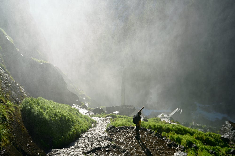
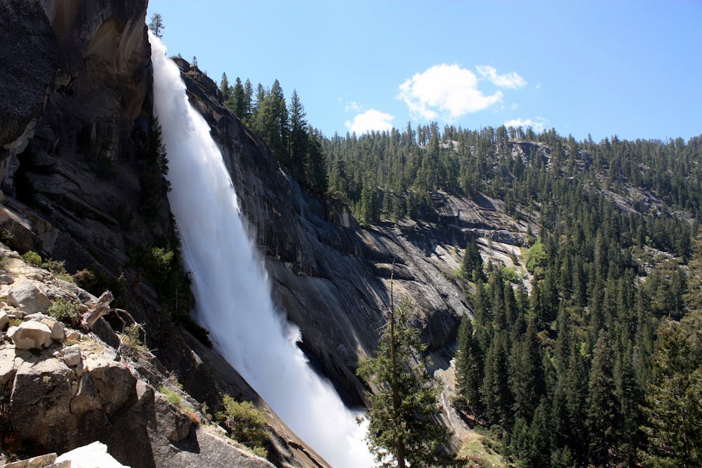
Instead of continuing to Nevada Fall, you can turn right on a connector trail that climbs steeply to a view at Clark Point and joins the John Muir Trail there. This is a shorter alternative to the full loop. If you stay on the Mist Trail, you’ll soon reach another steep stair climb, this time in the spray of Nevada Fall. This waterfall is twice as tall as the first, and even more dynamic. Its water column rockets outward in freefall for a few hundred feet before crashing down on the angled cliff face, making an especially broad mist zone.
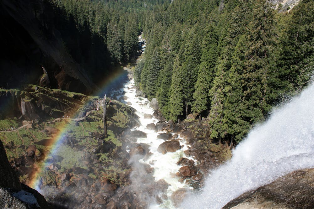
The trail takes aggressive switchbacks in a rocky gully to climb past Nevada Fall. At the top, join the John Muir Trail and cross a bridge poised proudly at the lip. From there, returning the way you came is slightly shorter than completing the loop on the John Muir Trail, but the loop is only slightly longer and immensely rewarding. The John Muir Trail continues downhill along the south side of the gorge, reaching many zoomed-out viewpoints of both waterfalls and granite summits that surround. It is very different scenery than on the first half of the loop. You will rejoin the Mist Trail below Vernal Fall, then retrace the paved path back to the trailhead.
Note that in winter, you can still hike to both waterfalls, but only as an out-and-back using the connector trail to Clark Point. A portion of both the Mist Trail and the John Muir Trail close in the winter due to icy conditions, so the loop is not an option.
Sources: https://www.nps.gov/yose/planyourvisit/vernalnevadatrail.htm https://en.wikipedia.org/wiki/NevadaFall https://en.wikipedia.org/wiki/VernalFall
Difficult
Hiking trails where obstacles such as rocks or roots are prevalent. Some obstacles can require care to step over or around. At times, the trail can be worn and eroded. The grade of the trail is generally quite steep, and can often lead to strenuous hiking.

The trail contains some obstacles such as outcroppings and rock which could cause injury.

Close to help in case of emergency.
An exciting hike to the summit of one of North America's most iconic peaks.
Extreme Hiking
2 m away
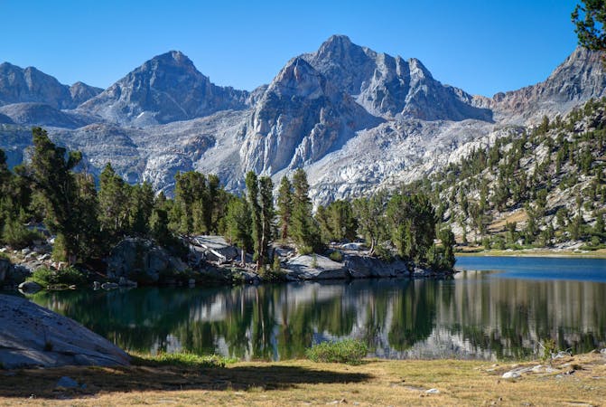
Thru hike of the California’s Sierra Nevada, linking the most impressive alpine scenery from Yosemite National Park to Mount Whitney.
Difficult Hiking
28 m away
A stunning hike up steep climbs, passing close to Vernal and Nevada Falls.
Difficult Hiking
1.1 km away
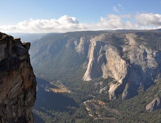
Hike at the brink of a huge waterfall and along the precipitous rim of Yosemite Valley.
Difficult Hiking
3.1 km away
A hike through the forest to a panoramic viewpoint over Yosemite Valley.
Easy Hiking
3.1 km away
Birds-eye view of the Valley atop one of Yosemite's higher granite domes.
Moderate Hiking
3.2 km away
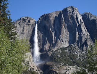
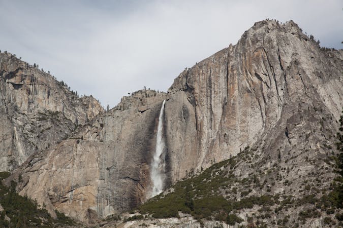
Steep hike to the top of North America's tallest waterfall.
Difficult Hiking
3.2 km away
Make the arduous climb to Upper Yosemite Falls, then go even farther to find the highest point on this side of Yosemite Valley.
Difficult Hiking
7.7 km away
Paved trail to the base of a 620-foot waterfall.
Easy Hiking
8.1 km away
Forest hike to the rim of Yosemite Valley at one of its greatest viewpoints
Moderate Hiking
13 routes · Hiking
6 routes · Hiking · Road Biking
7 routes · Hiking
9 routes · Hiking

25 routes · Alpine Climbing · Hiking

5 routes · Alpine Climbing · Hiking
7 routes · Hiking

63 routes · Alpine Climbing · Hiking