
10 routes · Mountain Biking
One of the most epic shuttles in California, if not the entire USA!
Mountain Biking Difficult

The Cannell Trail, followed by The Plunge, is easily one of the most epic shuttle rides in California, if not the entire USA! This incredible 25-mile shuttle with just 2,000 feet of climbing drops a whopping 8,400 over the course of the entire ride!
"The flow and speed on Cannell Plunge is unreal... I'm blown away every time I ride this trail,” said Eric Carter, Pro BMX racer, Mountain X, and Downhill Legend, according to KernRiverSierra.com. And he’s not the only one to realize how epic this ride is. In fact, IMBA has assigned the Cannell Trail their coveted “Epic” designation.
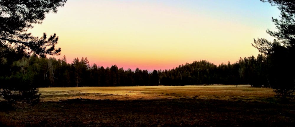
The Cannell Trail proper, or "Cannell Meadow Trail," passes through a verdant alpine meadow that leaves many riders astonished by its beauty. But as the trail begins to descend, the scenery returns to the dry, rocky, arid California mountains that dominate the landscape. The further you descend, the drier the terrain gets, until you’re swooping through classic So Cal desert terrain.
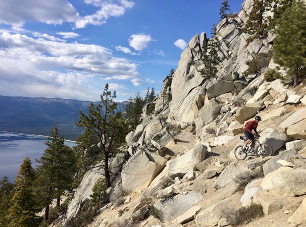
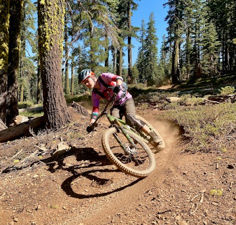
Despite the beautiful alpine meadows up high, the vast majority of this trail remains dry and dusty in true So Cal style. Many sections of the trail tread are smooth and flowy, with an old school XC flow flavor. Many of the corners are bermed naturally into the hillside, with unexpectedly tight, off-camber, and exposed corners forcing you to ride ultra-alert. Other portions of the trail are challenging and rocky, with some big, blocky rock features to test your skills.
Sources: http://kernriversierra.com/bike/cannell.html https://www.imba.com/ride/where-to-ride/imba-epics https://www.youtube.com/watch?v=ECqhR-Lem2o
Difficult
Mostly stable trail tread with some variability featuring larger and more unavoidable obstacles that may include, but not be limited to: bigger stones, roots, steps, and narrow curves. Compared to lower intermediate, technical difficulty is more advanced and grades of slopes are steeper. Ideal for upper intermediate riders.

Some trail sections have exposed ledges or steep ascents/descents where falling could cause serious injury.
Little chance of being seen or helped in case of an accident.
10 routes · Mountain Biking
4 routes · Mountain Biking
5 routes · Mountain Biking