Little Bear Peak
One of the most technical and coveted 14er summits.
Extreme Hiking
- Distance
- 4.6 km
- Ascent
- 715 m
- Descent
- 715 m
Tag two lofty summits on the Blanca Massif.
Hiking Extreme

Note: this route warrants a "Moderate" Mountaineering difficulty rating.
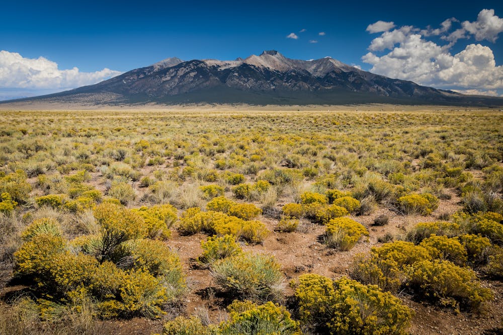
Blanca Peak and Ellingwood Point are often combined into a two-summit hike, deep in the Sangre de Cristo Range. These two 14ers form just one small part of the Sierra Blanca Massif. "Blanca is the highest of the massif which includes Little Bear (14,037), California Peak (13,849), Mt. Lindsey (14,042) Iron Nipple (13,480), Hamilton Peak (13,658) Peak 13,828, and of course Ellingwood Point (14,042) as well as all the ridges connecting them," according to Sunnysummit on SummitPost.org.
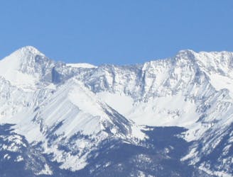
While climbing either Blanca or Ellingwood Point on its own would only be a Class 2 climb, adding in the traverse between the two mountains makes it a Class 3 effort. It is also possible to traverse between Blanca and nearby Little Bear Peak, but this exposed, rocky ridgeline requires 2-5 hours of class 4 climbing and traversing (if you forgo ropes and protection). While coveted by Colorado climbers, this traverse is not mapped as a part of this adventure.
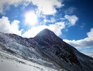
To simply summit Blanca and Ellingwood Point, hike up the Lake Como/Blanca Peak Road past Lake Como. Once you reach Blue Lakes, you get to leave the unpleasant road hiking behind. Continue on a trail to Crater Lake, pass a series of ledges, and "follow cairns and a defined trail up the steep terrain," according to 14ers.com. Once you reach the ridge, you'll eventually go both directions to tag both summits.
Traversing the ridge in both directions requires Class 3 rock scrambling with significant exposure. Some of the scrambling takes place on loose and rotten rock, so be prepared for uncertain footing, and consider bringing a helmet. The traverse does feature some small cairns and faint trails to follow, but being able to spot your own ideal route through the obstacles is still advantageous.
Sources: https://www.summitpost.org/blanca-peak/150450 https://www.14ers.com/route.php?route=blan1&peak=Blanca%2C+Ellingwood+and+Little+Bear
Extreme
Scrambling up mountains and along technical trails with moderate fall exposure. Handholds are necessary to navigate the trail in its entirety, although they are not necessary at all times. Some obstacles can be very large and difficult to navigate, and the grades can often be near-vertical. The challenge of the trail and the steepness of the grade results in very strenuous hiking. Hikes of this difficulty blur the lines between "hiking" and "climbing".

Some trail sections have exposed ledges or steep ascents/descents where falling could cause serious injury.

In the high mountains or remote conditions, all individuals must be completely autonomous in every situation.
One of the most technical and coveted 14er summits.
Extreme Hiking
6.9 km away
A secluded alpine lake trek.
Moderate Hiking
7 km away
One of the four 14er summits in the Sierra Blanca Massif.
Extreme Hiking