6.3 km away
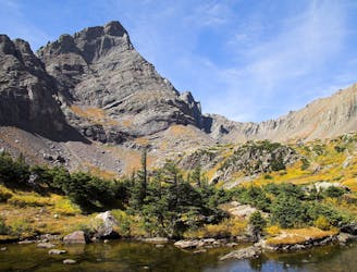
Crestone Peak
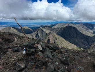
Climb one of the most beautiful and most challenging of Colorado's 14ers
Extreme Hiking
- Distance
- 17 km
- Ascent
- 1.8 km
- Descent
- 1.8 km
Standard route up the Challenger Point and Kit Carson 14ers outside of Crestone, CO.
Hiking Extreme

Note: this route warrants a "Moderate" Mountaineering difficulty rating.
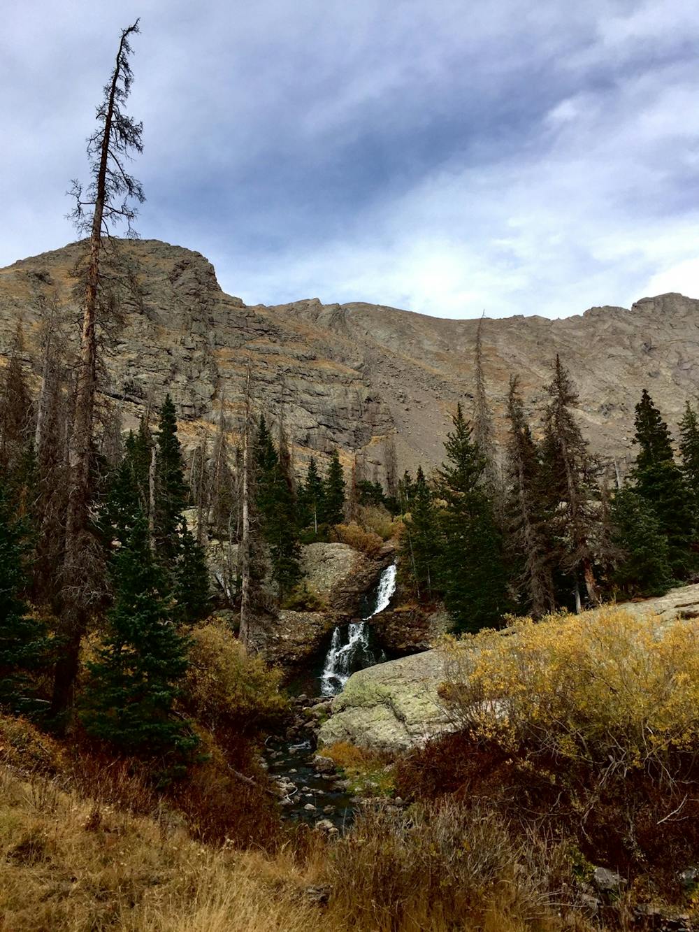
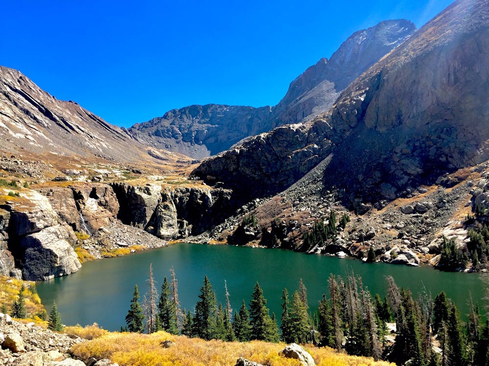
This is a great overnight backpacking trip into the high alpine of the Sangre De Cristo Mountains! Willow Lake, the halfway point of the climb, is surrounded by 200-foot cliffs with waterfalls and is the ideal spot to set up camp.
The surrounding mountains are some of the most spectacular in the state, since they rise abruptly on both sides from relatively flat and low elevation valleys—as opposed to most mountains in Colorado that are surrounded by foothills. This also means that the mountains rise quickly! This hike gains over 6,000 feet in about 7 miles, so don't underestimate how long this will take you—start early.
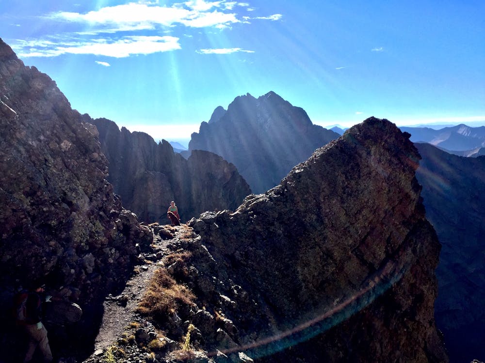
On your way to Kit Carson Peak you will pass over Challenger Point. There is a cool plaque in memory of the Space Shuttle Challenger crew who died traveling to space and which the mountain is named in memory of.
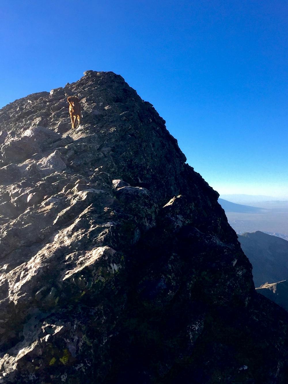
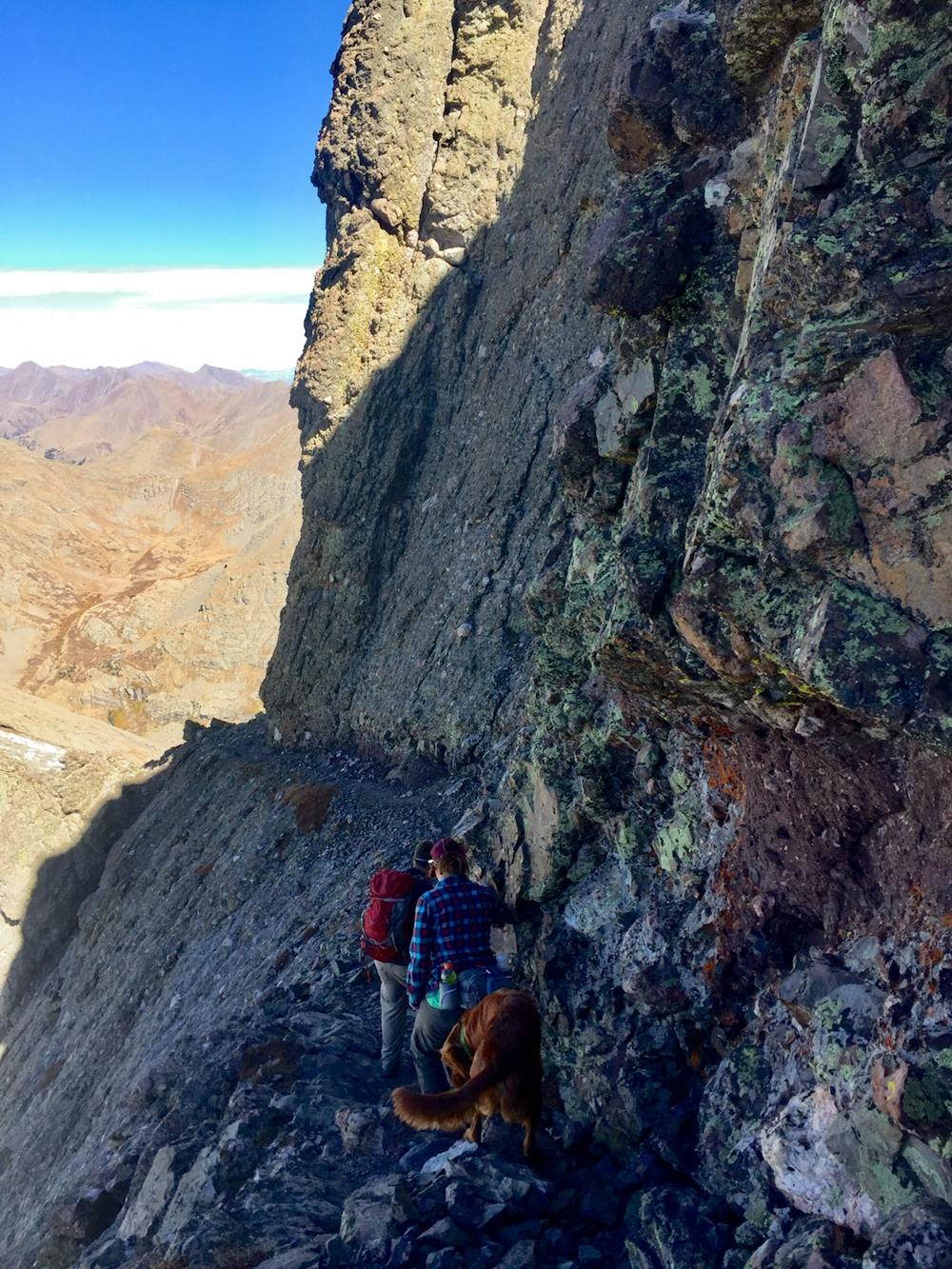
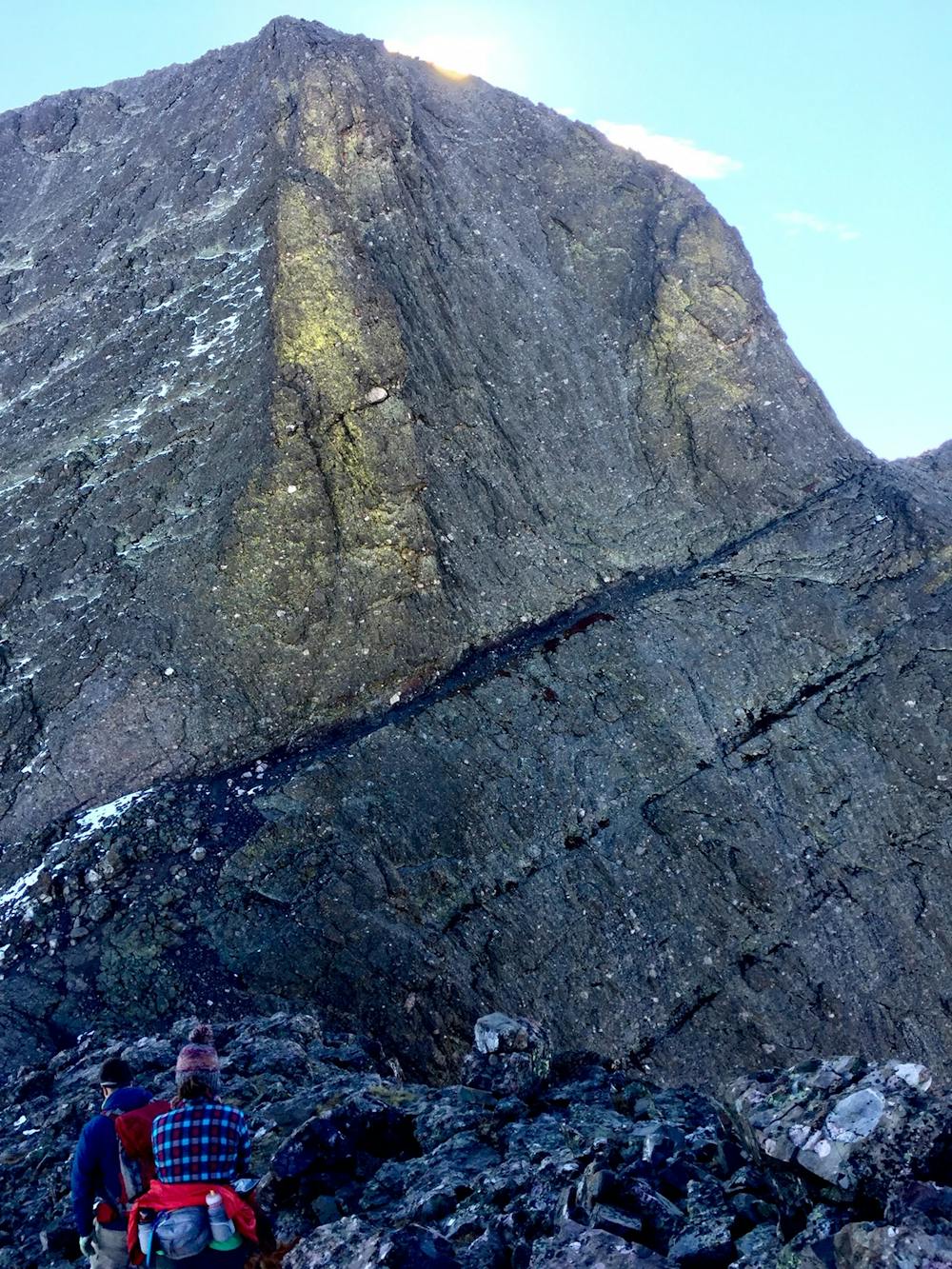
My favorite part of the trail is traversing Kit Carson Avenue, a ledge cut out of the west face of Kit Carson. There is some exposure, but overall the hike is class 2 with a few class 3 moves.
The trailhead is only two miles outside of the town of Crestone: a true hippie/spiritual hideout that is full of interesting people, funky shops, organic restaurants, and the occasional commune. The trail is popular like most other 14ers, but due to Crestone's isolated location, you will see fewer people than any of the mountains off of I-70 or near Aspen.
If you are deciding on only one 14er to climb, I don't recommend this trail. If you have a couple 14ers under your belt and you're looking for something with a little more challenge and fewer people, this is a good place to keep exploring! Once you're done, stop by the Crestone Brewery for a post-hike burger and beer.
Extreme
Scrambling up mountains and along technical trails with moderate fall exposure. Handholds are necessary to navigate the trail in its entirety, although they are not necessary at all times. Some obstacles can be very large and difficult to navigate, and the grades can often be near-vertical. The challenge of the trail and the steepness of the grade results in very strenuous hiking. Hikes of this difficulty blur the lines between "hiking" and "climbing".

The trail contains some obstacles such as outcroppings and rock which could cause injury.

Little chance of being seen or helped in case of an accident.
6.3 km away
Climb one of the most beautiful and most challenging of Colorado's 14ers
Extreme Hiking
6.3 km away
One of the most aesthetic and challenging Colorado 14ers.
Extreme Hiking