5.4 km away
Alpine Ridge Trail
High-altitude stair climb to an alpine vista.
Moderate Hiking
- Distance
- 993 m
- Ascent
- 61 m
- Descent
- 61 m
An eye-popping hike above the treeline, to a panoramic summit on the Continental Divide.
Hiking Difficult

This hike is perfect training for Colorado 14ers, but it’s also spectacular in its own right and is among the best summit hikes in Rocky Mountain National Park. The entire trail is more or less along the Continental Divide, tracing it from Milner Pass to Ida’s summit. Most park maps do not show the full trail up the mountain, but it’s a designated and well-worn path. It’s all very easy to follow, except maybe after recent snow, most of the way to the summit of Mount Ida.
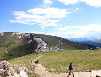
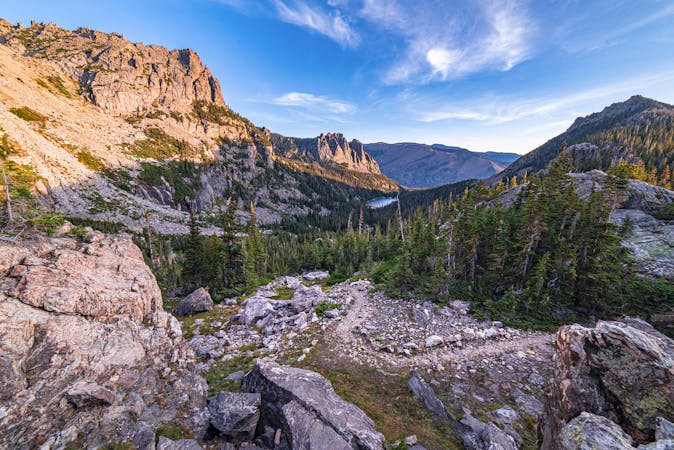
The trail starts by curving around Poudre Lake, then zigzags upward through conifer forest. In only about a mile, it emerges at the treeline and strikes out across the alpine tundra, with a broad view over the Colorado River Valley and the Never Summer Mountains to the west. Look for elk and deer, which sometimes graze at this altitude, and for marmots and pika which live here year-round.
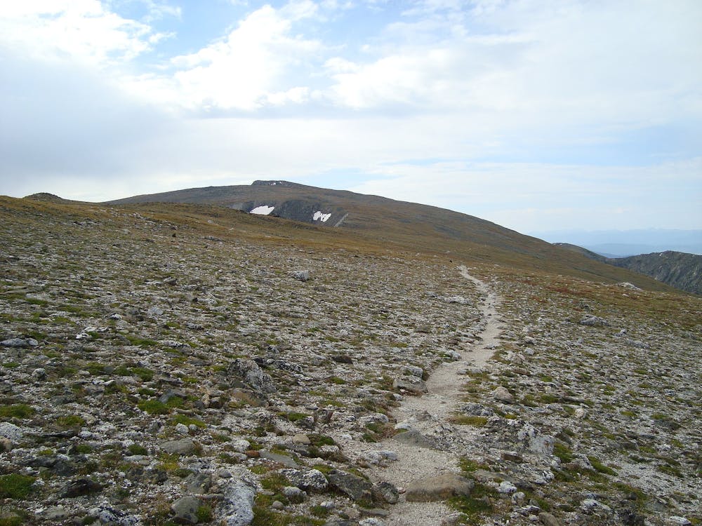
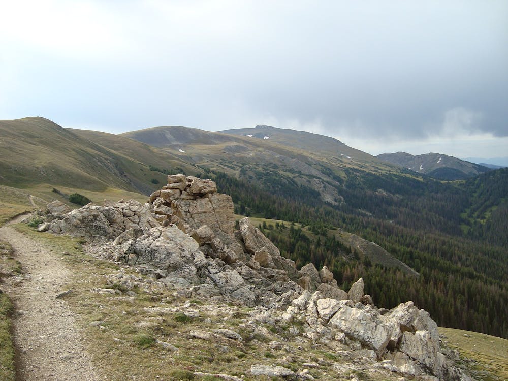
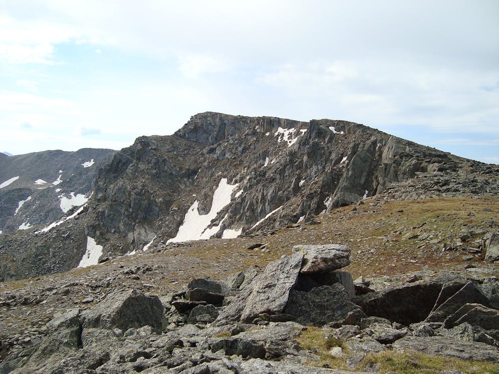
For the most part, the trail traverses beneath the ridge crest, moving gradually higher in elevation. It’s all pretty easy going until the trail dips down to a pronounced saddle. From there, the rest of the way up Mount Ida is more rugged. The trail soon fades into a sea of talus, and attention to routefinding becomes necessary.
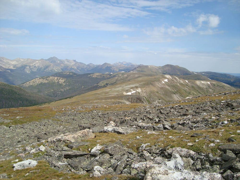
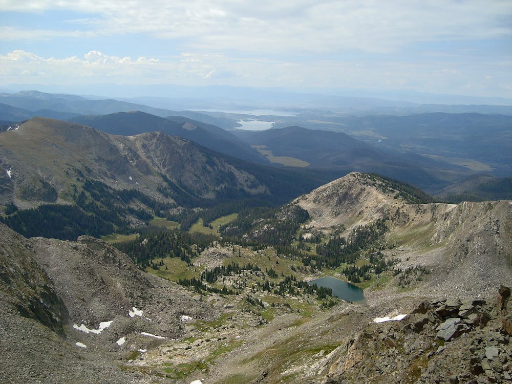
There are easier and harder ways to proceed. Simply tracing the ridgeline may be tempting, but large boulders make it slower going. Contouring slightly west is generally easier. Look for cairns that suggest the path of least resistance, but keep in mind that multiple variations might be marked. No matter how you choose to go, the summit is within reach. Once there, you’ll find the reward of a 360-degree panorama––up and down the Continental Divide, over mountain ranges on either side, down to blue lakes below, and across to Longs Peak.
Because this hike is such high elevation and so exposed, you’ll need to be particularly attentive to the weather. A very early start is recommended in order to avoid afternoon storms in the summer. Once above the treeline, there is zero shelter from the elements. Come prepared with layers of clothing and sun protection, and keep an eye on the clouds.
Sources: http://www.rockymountainhikingtrails.com/mount-ida.htm https://www.summitpost.org/mt-ida-timber-lake-loop/158988
Difficult
Hiking trails where obstacles such as rocks or roots are prevalent. Some obstacles can require care to step over or around. At times, the trail can be worn and eroded. The grade of the trail is generally quite steep, and can often lead to strenuous hiking.

The trail contains some obstacles such as outcroppings and rock which could cause injury.

Little chance of being seen or helped in case of an accident.
5.4 km away
High-altitude stair climb to an alpine vista.
Moderate Hiking
10 routes · Alpine Climbing · Hiking