1 km away
Knife Edge
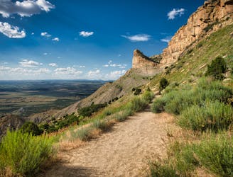
A mellow hike with stunning views!
Easy Hiking
- Distance
- 5.1 km
- Ascent
- 102 m
- Descent
- 102 m
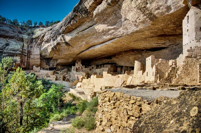
Far and away the longest hike in Mesa Verde National Park
Hiking Moderate

The Prater Ridge Trail is far and away the longest hike in Mesa Verde National Park. As mapped, the lollipop loop covers 7.2 miles round-trip. However, a short connector trail bisects the loop on top of the mesa, providing the option to shorten the hike to five miles.
Most of the 1,100 feet of elevation gain come in the first mile, as you climb steeply to gain the top of the mesa. Once on top, the gradient mellows out dramatically.
"According to the park rangers, the best place to view wildlife is the Prater Ridge Trail," writes Abbie Mood on RootsRated.com. "The farther out from the road, the more likely visitors are to see big mammals, such as coyote or deer," she continues."
From the top of the mesa, you'll enjoy 360-degree views, with only some scrubby juniper trees obscuring the vistas. At points, the trail on top of the mesa can be faint, so look for rock cairns to help you navigate. "However, if you lose the trail, stay near the rim and you will pick up the trail again," writes Jeremy Small on OutdoorProject.com.
Moderate
Hiking along trails with some uneven terrain and small hills. Small rocks and roots may be present.

The trail contains some obstacles such as outcroppings and rock which could cause injury.

Little chance of being seen or helped in case of an accident.
1 km away
A mellow hike with stunning views!
Easy Hiking
6 routes · Hiking