489 m away
Bear Lake to Fern Lake
One-way hike using the park's free shuttle, connecting multiple alpine lakes and vistas.
Difficult Hiking
- Distance
- 14 km
- Ascent
- 409 m
- Descent
- 819 m
Begin on the popular trail to Alberta Falls, then ascend along creeks and lakes to one of the park's most dramatic alpine basins.
Hiking Severe

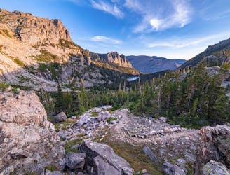
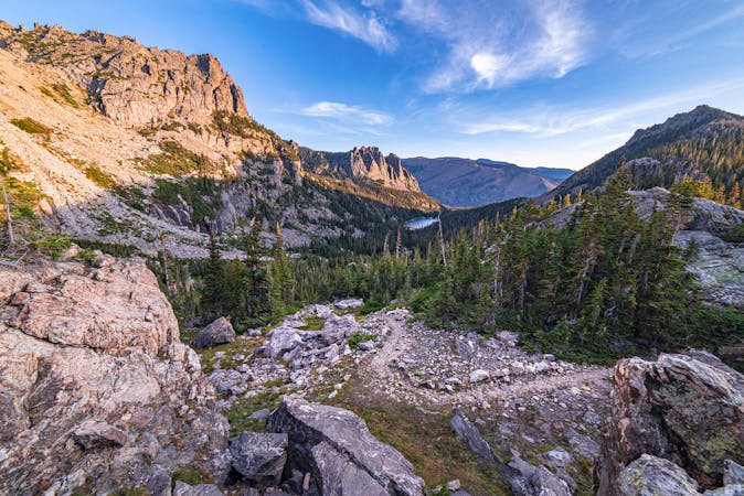
The full trip to Sky Pond is a rather serious hike, requiring rock scrambling and potentially snow travel, depending on the season. But the hike serves many highlights along its length, thus offering many logical turnaround points. The trail begins as one of the park’s most popular at the Glacier Gorge Trailhead, and it ends as a rugged path in alpine wilderness.
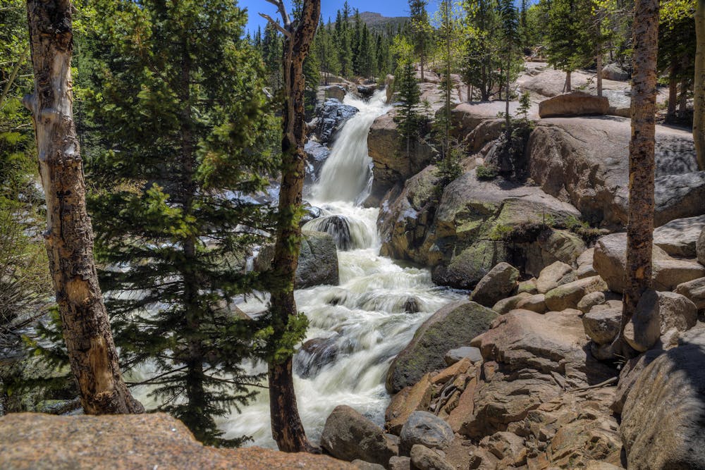
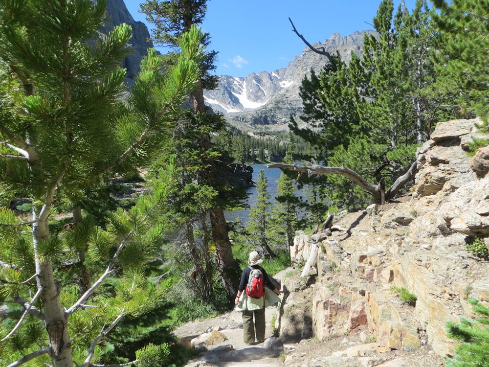
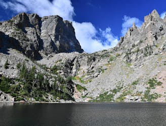
Less than a mile in is Alberta Falls, one of the park’s finest waterfalls, set among lush pine and aspen forest. From there, the trail goes steadily uphill, with frequent views to the mountains over the trees and into the cliff-lined gorge called Loch Vale. It steepens in a section of switchbacks, then comes to The Loch and traces the shore, granting views across the water to rock walls and glaciated slopes.
Beyond this lake, the trail is less traveled. It leads along a tumbling creek called Icy Brook, crossing on several small bridges. The gradient is mellow until just before Timberline Falls. A very steep section leads its base, then no easy way exists around the waterfall. The route is up a natural stone staircase that streams with water, requiring hand-and-foot scrambling on slippery rock. Proceed with caution, and turn back if the flow is too strong.
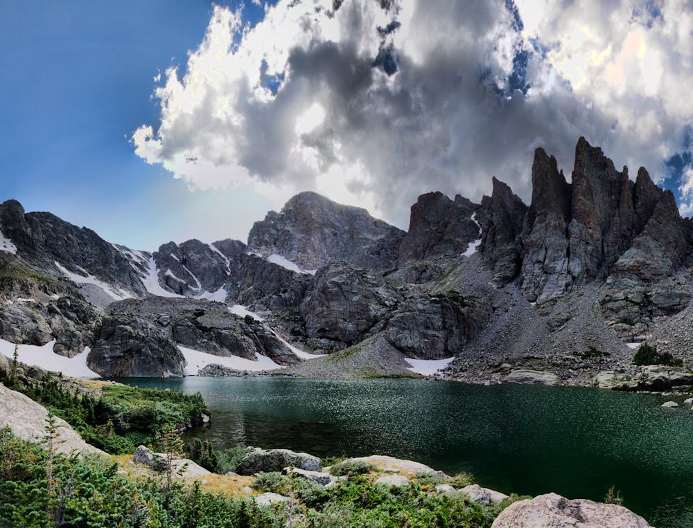
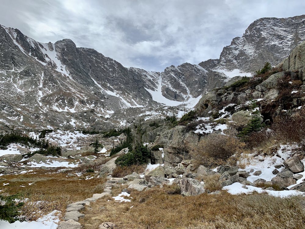
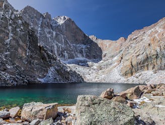
Triumphant climbers are greeted by the Lake of Glass, surrounded by stone and snow and only patches of stunted trees. The trail continues, but becomes tougher to distinguish among the boulders. The last half mile is slow going, but worth the effort, as long as the weather holds. Sky Pond is above the treeline, with rubble slopes and snowfields and granite walls encircling it. A row of giant spires rises on one side, and glaciers cling to 13,000-foot peaks on the other. With this dramatic backdrop, and at this elevation, the lake truly earns its moniker of Sky Pond.
Sources: https://www.nps.gov/thingstodo/romotheloch.htm https://www.earthtrekkers.com/sky-pond-hike-rocky-mountain/
Severe
Hiking challenging trails where simple scrambling, with the occasional use of the hands, is a distinct possibility. The trails are often filled with all manner of obstacles both small and large, and the hills are very steep. Obstacles and challenges are often unexpected and can be unpredictable.

Some trail sections have exposed ledges or steep ascents/descents where falling could cause serious injury.
Little chance of being seen or helped in case of an accident.
489 m away
One-way hike using the park's free shuttle, connecting multiple alpine lakes and vistas.
Difficult Hiking
496 m away
See four idyllic alpine lakes in one moderate hike.
Moderate Hiking
8.3 km away
Hike up into the treeless tundra, to a glacial lake tucked beneath a 14-thousand-foot peak.
Difficult Hiking
8.9 km away
Warm up the legs and take in the view, on this rewarding hike near the entrance to Rocky Mountain National Park.
Difficult Hiking
9.3 km away
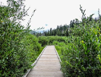
This short, easy walk offers a quick dose of nature in Rocky Mountain National Park.
Easy Hiking
10 routes · Alpine Climbing · Hiking