2.3 km away
Graneros -> Greenhorn Loop
An easy but scenic hike through the lower Hogbacks area.
Easy Hiking
- Distance
- 5.7 km
- Ascent
- 101 m
- Descent
- 101 m
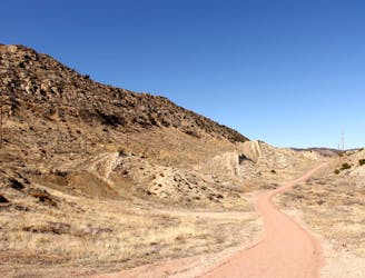
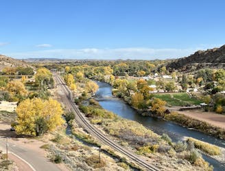
The Hogbacks trails can be accessed easily from downtown Canon City, providing incredible views over the city and the mountains beyond.
Hiking Severe

The singletrack in the Hogbacks area is easily accessible from the west side of Canon City, making these trails popular for local dog walkers, hikers, and trail runners looking to get a quick dose of nature.
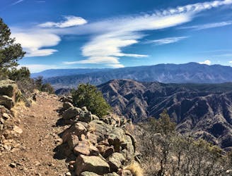
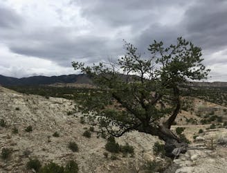
One of the most interesting things about this network is the radical diversity of the trails. The lower Graneros trail is very flowy, mellow, non-technical, mostly-flat singletrack. But as you climb up the ridge to access the higher trails, the singletrack quickly gets much rockier and more difficult.
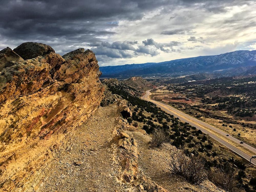
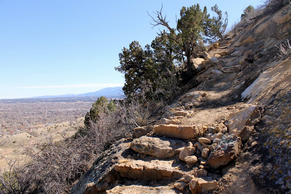
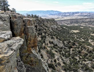
The main ascent to the ridge is filled with natural rock steps, rock gardens, rock slabs, and rock ledges. In some places, you may need to use a hand or two to gain upward access. While most hikers won't have too much of a problem with these trails, they do earn a FATMAP "Severe" technicality rating, although the truly "Severe" sections are fairly few and far between.
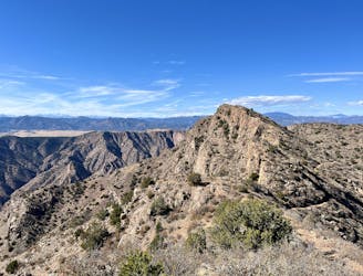
Soon you'll reach the upper Dakota Ridge trail running along the hogback spine, which is an absolute must-do! However, note that some sections are exposed, rocky, and could cause some hikers a sense of vertigo. There's nothing extremely technical here, but do expect to clamber up and over some sections of the rock spine and to climb and descend some natural rock steps. Be sure to slow down and savor these surreal views!
This route descends the Old Skyline Trail for a bit before, taking a right turn onto the rocky Stone Quarry trail to finish the descent. If you've had enough of rocks and technical trails, it's best to skip Stone Quarry and descend Old Skyline back down to Graneros. But if you're up for a few more beautiful views and cool rocks, follow Stone Quarry back down to Graneros instead.
Severe
Hiking challenging trails where simple scrambling, with the occasional use of the hands, is a distinct possibility. The trails are often filled with all manner of obstacles both small and large, and the hills are very steep. Obstacles and challenges are often unexpected and can be unpredictable.

Some trail sections have exposed ledges or steep ascents/descents where falling could cause serious injury.

Close to help in case of emergency.
2.3 km away
An easy but scenic hike through the lower Hogbacks area.
Easy Hiking
3.9 km away

The easiest way to the top of Fremont Peak.
Difficult Hiking
4.2 km away
Fremont Peak: the hard way.
Difficult Hiking
4.2 km away
An easy but beautiful hike into the Royal Gorge.
Easy Hiking
5.3 km away
Hike along the rim of the 1,250-foot-deep Royal Gorge.
Moderate Hiking
7.7 km away
A beautiful hike to one of the most productive fossil quarries in Colorado.
Moderate Hiking
7.9 km away
Hike to a stunning overlook from the Island in the Sky.
Difficult Hiking

9 routes · Hiking