3.5 km away
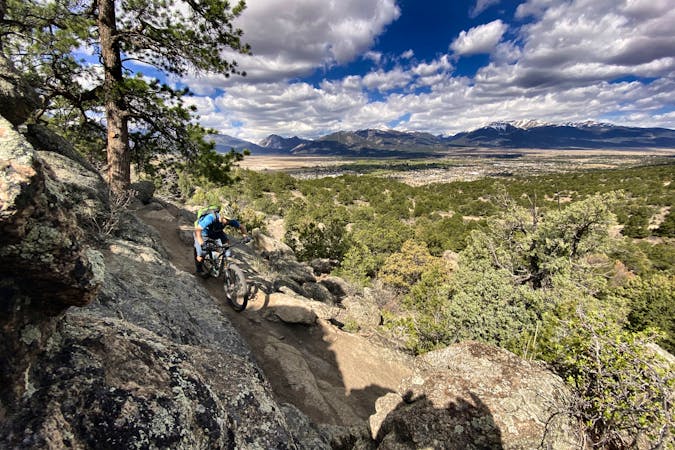
Mount Antero
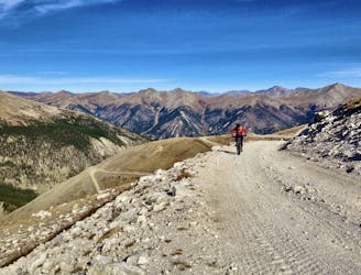
Ride one of Colorado's few bike-legal 14ers with this massive loop ride.
Extreme Mountain Biking
- Distance
- 40 km
- Ascent
- 2 km
- Descent
- 2 km
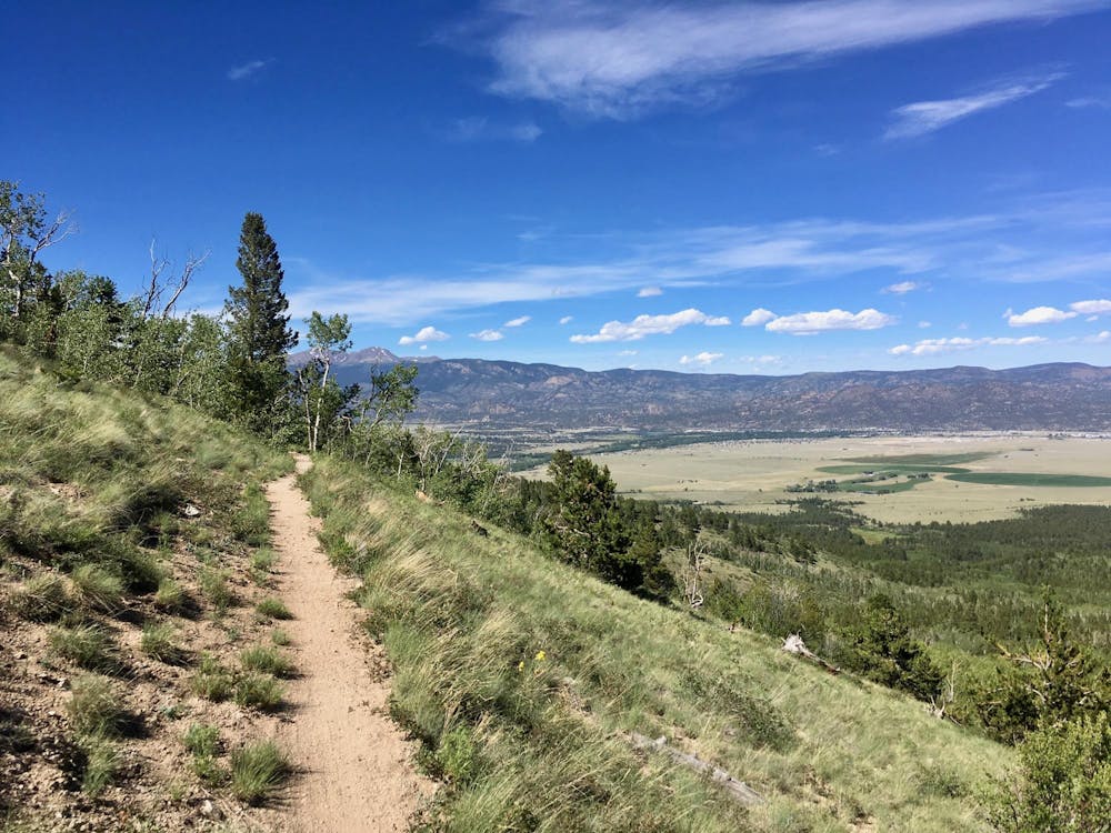
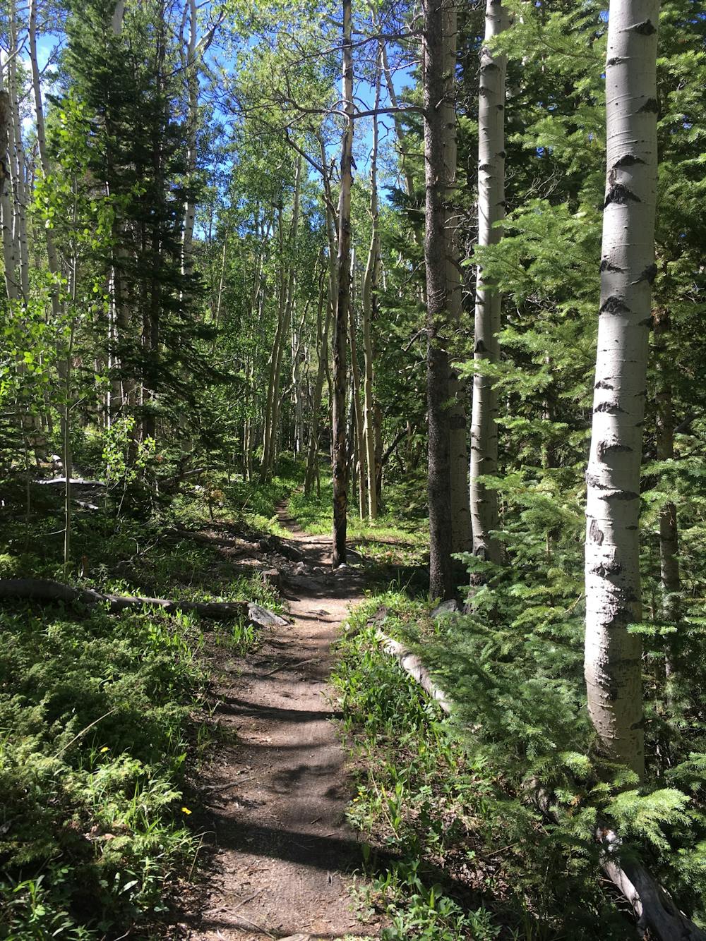
A sublime stretch of largely nontechnical cross country singletrack.
Mountain Biking Moderate

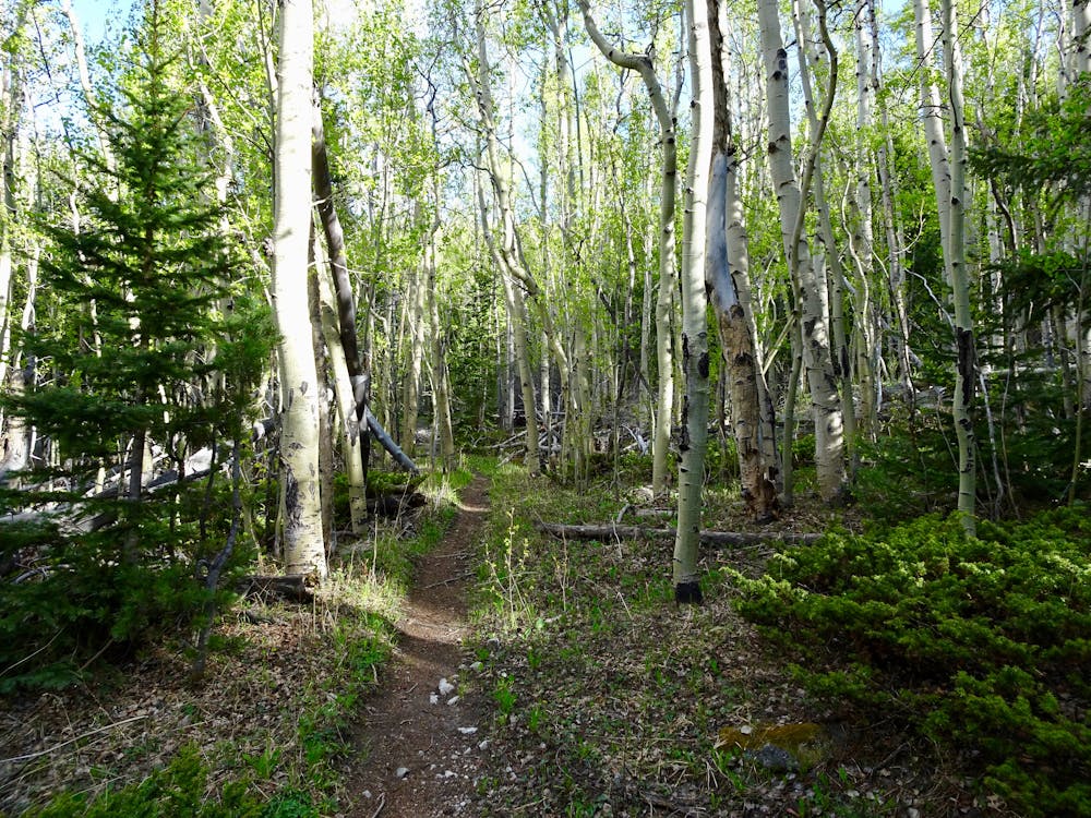
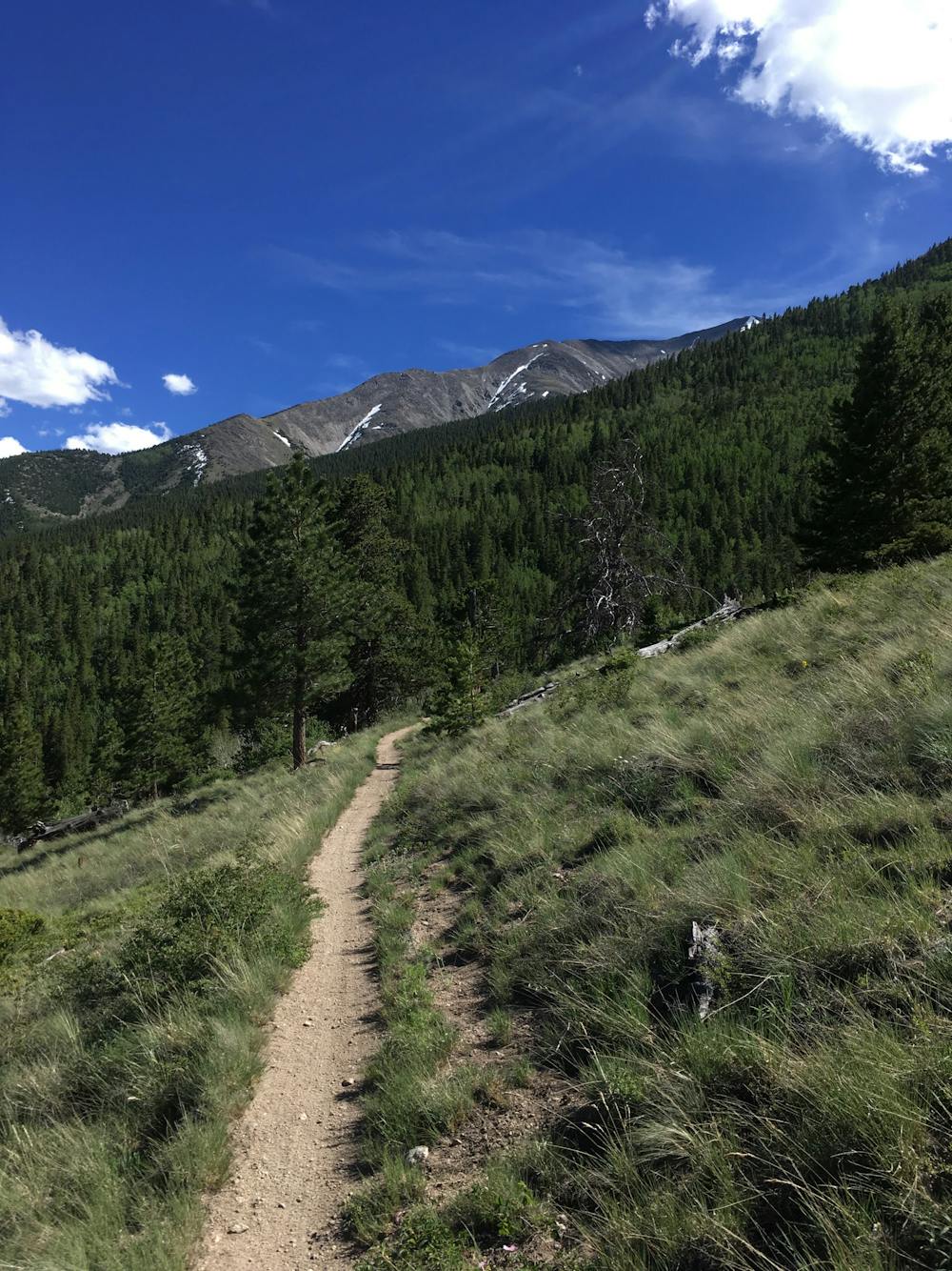
While the entire section of the Colorado Trail running from Highway 50 to Cottonwood Pass offers great mountain biking, this short segment on the flanks of Mount Princeton provides a very achievable out-and-back ride from an easily-accessible parking lot. The ride is topped off by gorgeous views of the valley from mountainside meadows.
Begin this out-and-back pedal from the Mount Princeton trailhead at Frontier Ranch. Unfortunately, the route begins with a steep climb up the dirt road to reach the singletrack portion of the Colorado Trail. While some riders may be tempted to try to drive up the road to park at the singletrack trailhead, be warned that there’s no parking allowed at the trailhead, no parking possible along the road, and that even attempting to turn a vehicle around on this steep mountain road may be difficult or impossible. Skip this problem and just park at the lower trailhead and suffer through the steep climb.
Once on the trail, the climbing continues, but at a mellower grade, slowly gaining elevation through the trees. The trail drops steeply into and climbs back out of a few mountain stream valleys along the way. After a few stream crossings, the singletrack breaks out into a series of mountainside meadows, providing stunning vistas across the Arkansas Valley, and even of the peak of Mount Princeton above you.
The key to this out-and-back route is to turn around before the steep descent to Cottonwood Pass. If you drop down that steep descent, you’ll be forced to hike-a-bike straight back up the mountainside to get back to your car.
While some portions of the singletrack where the trail drops into the creek bottoms can be technical and challenging, overall, this ride is quite non-technical and achievable for most mountain bikers. This long, flowy stretch of benchcut singletrack provides a delightful cross country ride, yet for some reason, it remains largely unknown and little-ridden. Become one of the wise few and enjoy this sublime stretch of singletrack on this ideal out-and-back route!
Moderate
Mostly stable trail tread with some variability, with unavoidable obstacles 8in/20cm tall or less. Other obstacles such as rock gullies and steep sections may exist. Ideal for lower intermediate riders.

The trail contains some obstacles such as outcroppings and rock which could cause injury.

Little chance of being seen or helped in case of an accident.
3.5 km away
Ride one of Colorado's few bike-legal 14ers with this massive loop ride.
Extreme Mountain Biking
5 routes · Mountain Biking