9.2 km away
Cub Lake Loop
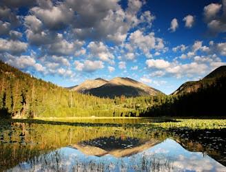
Run alongside meadows, creeks, and a subalpine lake on this nicely-varied loop.
Moderate Trail Running
- Distance
- 9.7 km
- Ascent
- 243 m
- Descent
- 243 m
Estes Park’s must-run mountain, for the slightly masochistic.
Trail Running Difficult

The trail up Twin Sisters Peak is a well-known testpiece near Estes Park. It’s tough, but an all-around great trail, with a rhythm of steep and less-steep that makes a crusher workout. The first half is shrouded in pine forest, where you can keep your head down and plod through most of the climbing. Just when you might need some extra motivation, you’ll break through the treeline to tantalizing views that draw you on. One brief scramble guards the summit, and you’re there––at a panorama of the Rockies with Longs Peak front and center.
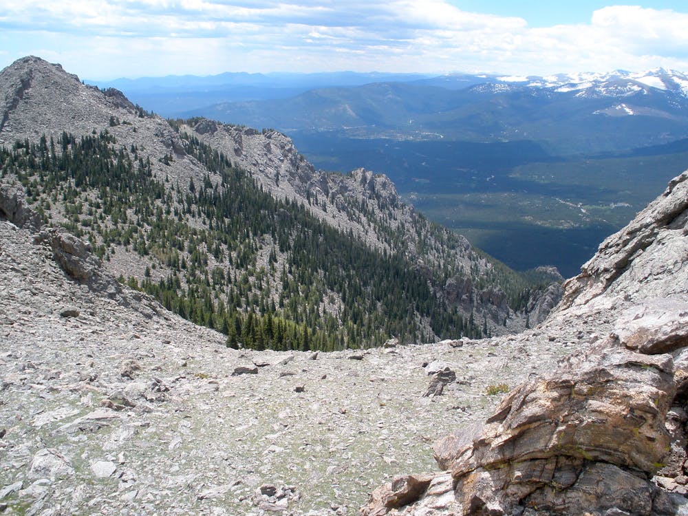
From the often-busy trailhead near Lily Lake, you’ll jog a short dirt road before the trail begins. It gets steep and rugged right away, but you’ll have to consider it a warm up. The gradient soon eases a bit, continuing steadily uphill, and later reaches a massive washout from a landslide. The trail cuts straight across, granting a nice view to Longs Peak, and preview of the incline ahead.
Next come the brutal switchbacks, with even bigger rocks in the trail. Press on through, and you’ll find a brief reprieve at a mellow section before another set of switchbacks finally gets you to timberline and the views. From there, an inclined traverse on a bouldery slope inches you closer to the goal. A final set of tight, air-sucking switchbacks gains the saddle between the two peaks. The peak to the right, Twin Sisters West, is the closer and easier of the two, by a little bit. After tagging one or both of the peaks, turn around and take on the rocky descent, all the way back the same trail.
Sources: https://www.fs.usda.gov/recarea/arp/recarea/?recid=36857 https://www.earthtrekkers.com/twin-sisters-peak-hike/
Difficult

Some trail sections have exposed ledges or steep ascents/descents where falling could cause serious injury.

Away from help but easily accessed.
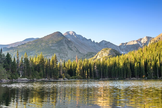
9.2 km away
Run alongside meadows, creeks, and a subalpine lake on this nicely-varied loop.
Moderate Trail Running
8 routes · Trail Running