


+ 17
Bartram Trail
Hiking Trail
Details
105.75 mi
25,407 ft
An epic long-distance hike through the Appalachian Mountains in North Georgia and North Carolina.
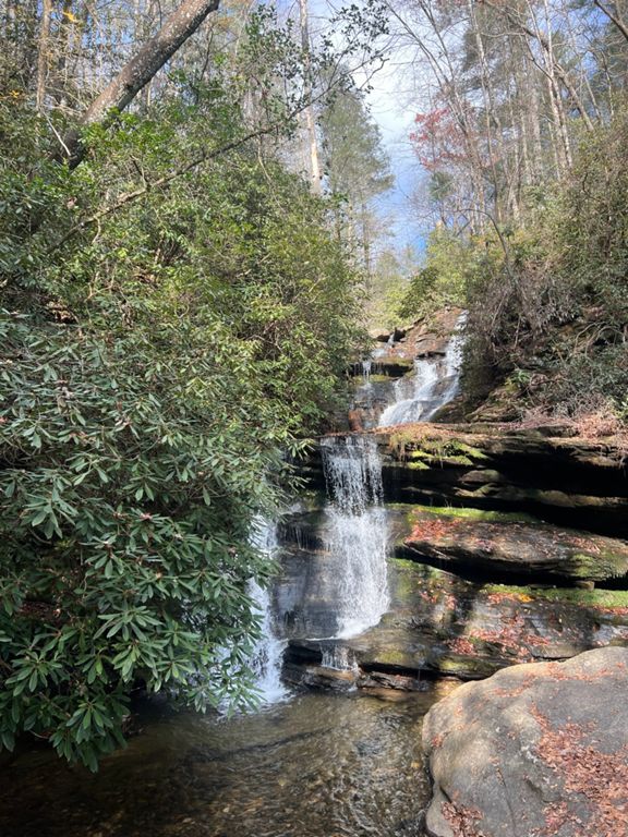
The Bartram Trail is an epic long-distance backpacking (or fastpacking) route through the Appalachian Mountains of North Georgia and North Carolina. If you're not feeling up for a thru-hike, many sections of this trail can be used for day hikes or trail runs.
While some short sections of this trail overlap the famous Appalachian Trail, the vast majority of the Bartram Trail is unique. It traverses through the far northeastern corner of North Georgia before crossing the state border into North Carolina, working its way northwest.
This trail is beautiful, rugged, and remote, providing a superb Appalachian hiking experience!
Sources:
Written by Greg Heil
Created By
Strava Routes

Route and Elevation
Segments
| Name | Distance | Elev. Diff. | Avg. Grade |
|---|---|---|---|
| Bartram - Warwoman to Becky Branch Falls | 0.15 mi | 148 ft | 18.0% |
| Bartram - Warwoman to Martin Creek Camping Area | 1.83 mi | 220 ft | 0.9% |
| Jeff Davis Ln Climb | 0.69 mi | 863 ft | 23.6% |
| Hickory Knut Gap Road Climb | 1.47 mi | 935 ft | 12.0% |
| Bartram to Scaly Mountain | 1.95 mi | 1,037 ft | 10.0% |
| Crawford Road Climb | 0.34 mi | 197 ft | 10.8% |
| Tessentee Road Climb | 0.57 mi | 289 ft | 9.6% |
| Retreat Lane Climb | 0.74 mi | 581 ft | 14.8% |
| Carson Cove Road Climb | 0.52 mi | 233 ft | 8.4% |
| Paulie Bleeker | 1.23 mi | 112 ft | 1.6% |
| Science Class Beaker | 1.21 mi | -102 ft | -1.2% |
| Switchbacks of Doom | 1.12 mi | 1,007 ft | 17.0% |
| Nantahala River Gorge to Cheoah Summit | Bartram Trail | 5.03 mi | 3,025 ft | 11.4% |
| Final push to Cheoah Bald | 0.95 mi | 692 ft | 13.7% |