2.1 km away
Halema'uma'u Trail
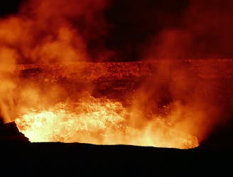
One of the best hikes for viewing lava in Volcanos National Park.
Difficult Hiking
- Distance
- 10 km
- Ascent
- 193 m
- Descent
- 193 m
Get up close and personal with the results of a recent 1959 volcanic eruption.
Hiking Moderate

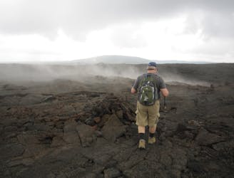
This loop formed by the Kilauea Iki Trail and Crater Rim Trail is one of the most popular and most beautiful in Hawaii Volcanoes National Park. The main draw is the ability to cross a now-dried lava flow in a volcanic crater. As you hike across the fractured black rock surface, you'll spot steam vents hissing along the trail, indicating just how active the volcano still is beneath your feet. The most recent eruption was in 1959—who knows when the next one will be?!
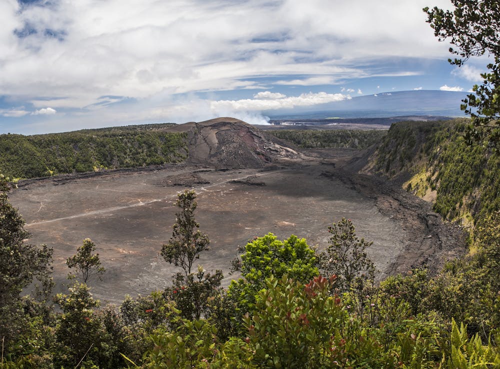
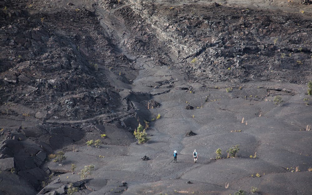
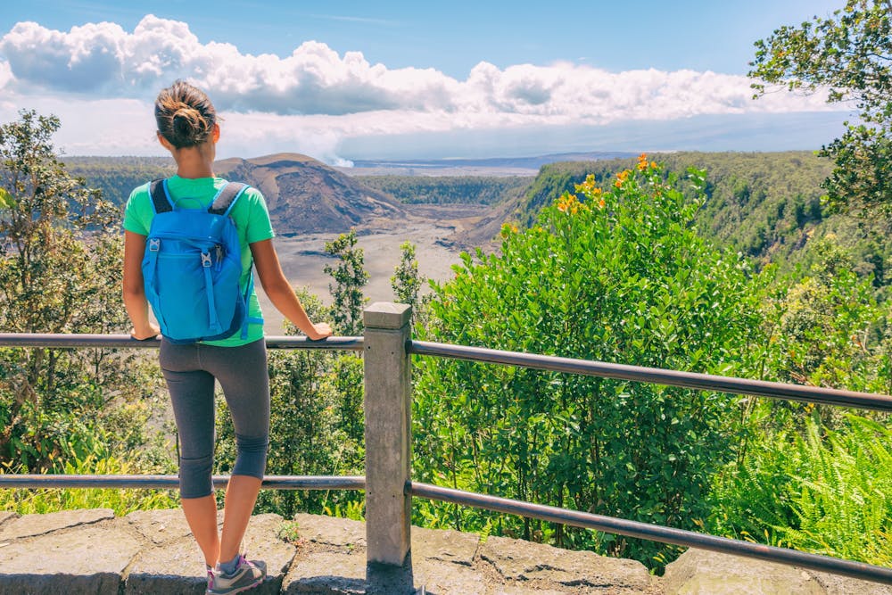
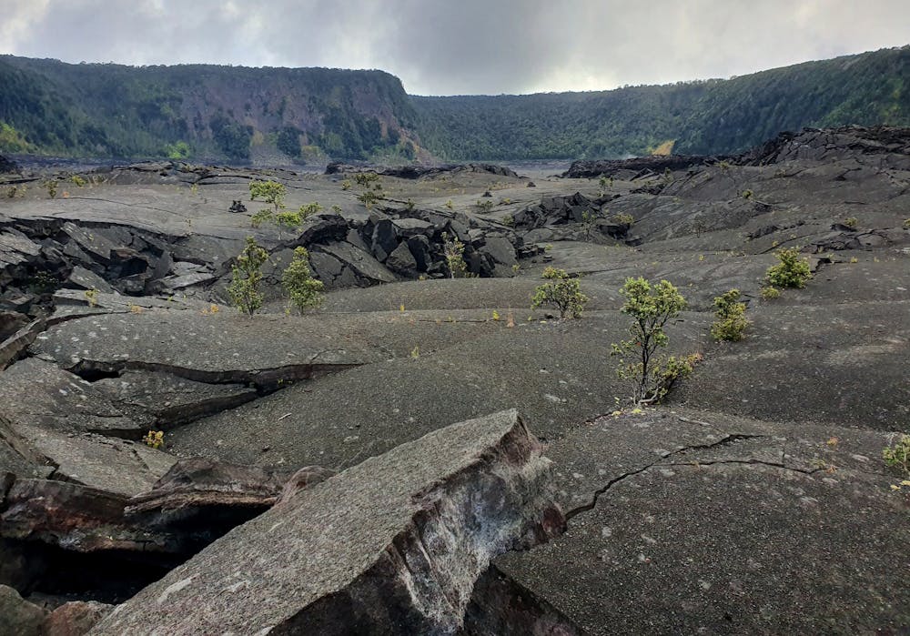
From the crater's rim, you'll enjoy expansive views of the lava rock below. This perspective will help drive home the immense forces of nature lurking just below the surface.
Sources: https://www.nps.gov/havo/planyourvisit/hikedaykilaueaiki.htm
Moderate
Hiking along trails with some uneven terrain and small hills. Small rocks and roots may be present.

The trail contains some obstacles such as outcroppings and rock which could cause injury.
Away from help but easily accessed.
2.1 km away
One of the best hikes for viewing lava in Volcanos National Park.
Difficult Hiking
6.4 km away
Visit several stunning sites in one long hike.
Difficult Hiking
6 routes · Hiking

63 routes · Alpine Climbing · Hiking