Kepros Mountain
A high-quality ridge run to a notable summit, best in early and mid spring conditions.
Trail Running Difficult
- Distance
- 15 km
- Ascent
- 608 m
- Descent
- 608 m
- Duration
- 2-3 hrs
- Low Point
- 1.5 km
- High Point
- 1.6 km
- Gradient
- 10˚

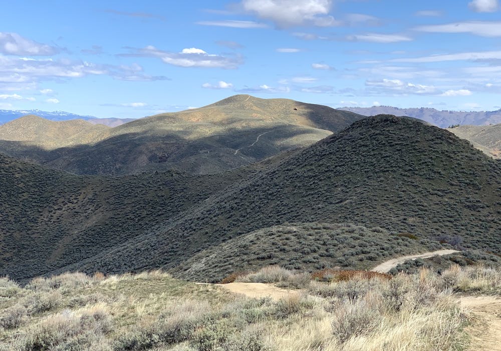
Kepros Mountain is one of the taller summits near Boise, and it may be one of the best for running. The route is an undulating ridge with bypass trails in key places, keeping the total elevation gain much less than what it could be. There’s still plenty of up and down though, all among a wide-open vista of snowy Idaho mountains. You’ll likely contend with some lingering snow on these hills as well, if you get it in early season. Spring is the time, because that’s when the trails are drying out, but it’s not yet hot. Zero shade makes this one pretty much unbearable in summer, unless you go very early morning. Fall would be good, except that it’s hunting season and this is a popular zone, so it’s wise to stay away.
Description
The trail begins at a pullout on Blacks Creek Road (a good dirt road). There’s nothing in the way of a warmup, as the trail goes right into one of its steepest sections here at the start. It’s short, though––less than half a mile to gain the ridge. From there, turn right and begin the scenic traverse toward Kepros. Note: The path to the left goes up Three Point Mountain, a popular short hike/run to a trio of summits.
On the way to Kepros there are many peaks along the ridge. Some of these have bypass trails around them, which you’ll definitely want to take unless you’re trying to make the run tougher. The bypasses save some elevation gain, and for the most part they have good tread, as opposed to the steeper and looser trails going straight over the humps. After two distinct bypass routes and at about 2 miles from the start, a third bypass branches off to the right. The bypass is what’s mapped here, but if you want to tag a bonus summit you should continue straight up the hill instead. Just a bit farther is the top of an unnamed peak that’s only 50 feet shorter than Kepros. Whether summitting this or skipping it, you’ll next have a long and perhaps demoralizing descent between this peak and the final climb up Kepros.
The singletrack you’ve been on thus far soon meets a jeep road (closed to vehicles except in the fall), and you’ll follow this the rest of the way. It’s steep in short sections, but for the most part it’s easy running. Try to enjoy the downhill, even with the knowledge you’ll have to regain it on the way back. The final push to Kepros is quite steep, knocking out about 500 feet of elevation in only half a mile. But after that, you’re there! Enjoy the 360-degree panorama that includes the city, the reservoirs, and endless mountains. You might also find a summit register, in case you’re inclined to add your name. On the return trip, if you still have energy, you might hit the summits you missed along the ridge.
Sources: https://www.idahoaclimbingguide.com/bookupdates/kepros-5428/ https://idahosummits.com/kepros/kepros.htm
Difficulty
Difficult
Medium Exposure

The trail contains some obstacles such as outcroppings and rock which could cause injury.
Remoteness

Little chance of being seen or helped in case of an accident.