8 routes · Hiking
Wander pedestrian paths through a grassy urban park at the feet of the Gateway Arch.
Hiking Easy

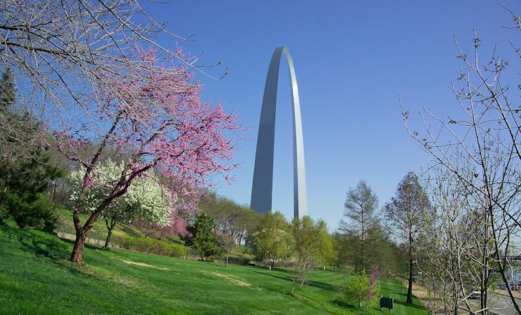
Set in the heart of downtown St. Louis near the riverfront, the Gateway Arch Trail encircles the base of the famous monument. The “trail” is not one particular route; rather it blends into the network of paved paths in Gateway Arch National Park and connects to the greenway trail along the river. So there’s no reason to exactly follow the route mapped here. You can simply wander the grounds and find different perspectives of the architecture, including standing directly beneath it and gazing at the dizzying span across the sky.


The park has a wealth of tree-lined pathways and grassy lawns, sprawled at the feet of the Arch and surrounded by the sparkling cityscape. As in any good urban park, you’ll find other attractions like wall murals, scenic benches, informative signs, and duck ponds as well. The main activity in the national park is, of course, riding the tram to the top of the Arch, but a stretch of the legs on these paths should not be missed. A walk or jog in the park and along the riverfront makes a soothing addition to any itinerary in downtown St. Louis.
Source: https://www.nps.gov/jeff/planyourvisit/basicinfo.htm
Easy
Walking along a well-kept trail that’s mostly flat. No obstacles are present.

The path is on completely flat land and potential injury is limited to falling over.
Close to help in case of emergency.
8 routes · Hiking

63 routes · Alpine Climbing · Hiking