9.8 km away
River Scene Trail
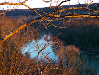
The #1 hike in Castlewood State Park, featuring clifftop views and riverside woodland.
Moderate Hiking
- Distance
- 5.6 km
- Ascent
- 110 m
- Descent
- 110 m
A hilly nature trail where you may see wildlife surprisingly close to the city.
Hiking Moderate

Powder Valley offers a much-needed escape to nature in the St. Louis metro area. It’s a pocket of hilly forest tucked between neighborhoods and two busy interstates. So while you can’t fully lose the sound of the highway, you can find more greenery and tranquility than you might expect this close to the city.
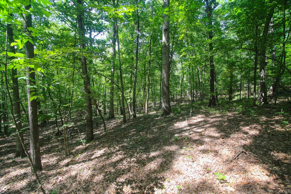
The conservation area has three trails, and Hickory Ridge is the longest of them. It is paved and suitable for strollers, but that doesn’t mean it’s easy. There are some steep hills! The trail rolls between two wooded ridges and crosses small streams on footbridges. You may see deer in the forest, and if you watch closely, you can spot many kinds of birds, butterflies, and other small wildlife.
The trail is good all year, even in wet conditions thanks to the paved surface, but in winter, it can be icy for days after a snowfall. Powder Valley has a number of other attractions for families as well, including picnic areas, a nature center, aquarium, and guided tours. Note that pets are not allowed on the trails, however.
Source: https://nature.mdc.mo.gov/discover-nature/places/powder-valley-conservation-nature-center
Moderate
Hiking along trails with some uneven terrain and small hills. Small rocks and roots may be present.

The path is on completely flat land and potential injury is limited to falling over.
Close to help in case of emergency.
9.8 km away
The #1 hike in Castlewood State Park, featuring clifftop views and riverside woodland.
Moderate Hiking
8 routes · Hiking